Property Record
Broad St, Bridgewater, MA 02324

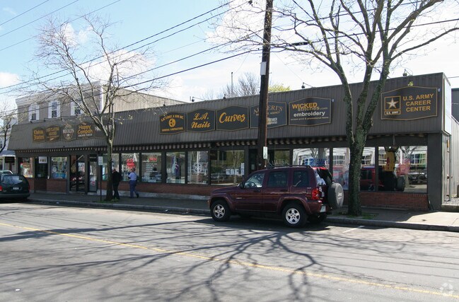
Property Detail
Broad St
Boston-Cambridge-Newton, MA-NH
PLYMOUTH
BRID-000034-000000-000198
Massachusetts
Governmentalpublicusegeneral
196
B and X Area of moderate flood hazard, usually the area between the limits of the 100-year and 500-year floods.
69 AC
2025
Route 3 South
2025
Boston
525101
NEARBY LISTINGS FOR SALE OR LEASE
DEMOGRAPHICS near Broad St
1 mile
3 mile
5 mile
2025 Total Population
9,827
30,954
64,041
2030 Population
9,910
31,364
65,020
Pop Growth 2025-2030
+ 0.84%
+ 1.32%
+ 1.53%
Average Age
34
40
41
2025 Total Households
2,904
9,945
21,820
HH Growth 2025-2030
+ 0.86%
+ 1.34%
+ 1.54%
Median Household Inc
$93,712
$115,447
$114,631
Avg Household Size
2.40
2.70
2.70
2025 Avg HH Vehicles
2.00
2.00
2.00
Median Home Value
$540,039
$556,662
$542,823
Median Year Built
1971
1977
1978
Nearby Places
Map Layers
Map Styles
 Street
 Aerial
Transit
 Traffic
 Biking
Places
Listings with unknown addresses are not visible on the map
- Restaurants
- Banks
- Shops
- Fitness
- Groceries
PUBLIC TRANSPORTATION
COMMUTER RAIL
Bridgewater (Middleborough/Lakeville Line - Massachusetts Bay Transportation Authority Commuter Rail (Purple Line))
Drive
Walk
Distance
Bridgewater (Middleborough/Lakeville Line - Massachusetts Bay Transportation Authority Commuter Rail (Purple Line))
6 min
1.8 mi
Campello (Middleborough/Lakeville Line - Massachusetts Bay Transportation Authority Commuter Rail (Purple Line))
Drive
Walk
Distance
Campello (Middleborough/Lakeville Line - Massachusetts Bay Transportation Authority Commuter Rail (Purple Line))
12 min
6.5 mi
AIRPORT
General Edward Lawrence Logan International
Drive
Walk
Distance
General Edward Lawrence Logan International
50 min
34.5 mi
Freight Ports
Port of Boston
Drive
Walk
Distance
Port of Boston
48 min
32.4 mi
Nearby Properties
Address
Land Use
TOTAL SIZE
Lot Size
Zoning
Address
Land Use
TOTAL SIZE
Lot Size
Zoning
22,788 SF
116.37 AC
Address
Land Use
TOTAL SIZE
Lot Size
Zoning
43.60 AC
Address
Land Use
TOTAL SIZE
Lot Size
Zoning
Address
Land Use
TOTAL SIZE
Lot Size
Zoning
349,800 SF
30.82 AC
Address
Land Use
TOTAL SIZE
Lot Size
Zoning
47.64 AC
100
Address
Land Use
TOTAL SIZE
Lot Size
Zoning
Address
Land Use
TOTAL SIZE
Lot Size
Zoning
187,637 SF
20 AC
Address
Land Use
TOTAL SIZE
Lot Size
Zoning
23.60 AC
Address
Land Use
TOTAL SIZE
Lot Size
Zoning
251.33 AC
Address
Land Use
TOTAL SIZE
Lot Size
Zoning
21.12 AC
Address
Land Use
TOTAL SIZE
Lot Size
Zoning
219,000 SF
45.62 AC
Address
Land Use
TOTAL SIZE
Lot Size
Zoning
10.98 AC
Address
Land Use
TOTAL SIZE
Lot Size
Zoning
117,950 SF
26 AC
100
Address
Land Use
TOTAL SIZE
Lot Size
Zoning
463,305 SF
116.22 AC
100
Address
Land Use
TOTAL SIZE
Lot Size
Zoning
12.73 AC
Address
Land Use
TOTAL SIZE
Lot Size
Zoning
5.69 AC
Address
Land Use
TOTAL SIZE
Lot Size
Zoning
90,920 SF
6.27 AC
Address
Land Use
TOTAL SIZE
Lot Size
Zoning
49,295 SF
6.02 AC
100
Address
Land Use
TOTAL SIZE
Lot Size
Zoning
70,692 SF
2 AC
Address
Land Use
TOTAL SIZE
Lot Size
Zoning
4.80 AC
Address
Land Use
TOTAL SIZE
Lot Size
Zoning
80,225 SF
8.07 AC
Address
Land Use
TOTAL SIZE
Lot Size
Zoning
Address
Land Use
TOTAL SIZE
Lot Size
Zoning
15.90 AC
Address
Land Use
TOTAL SIZE
Lot Size
Zoning
14,690 SF
2.15 AC
Address
Land Use
TOTAL SIZE
Lot Size
Zoning
4.60 AC
Address
Land Use
TOTAL SIZE
Lot Size
Zoning
12,396 SF
4.66 AC
Address
Land Use
TOTAL SIZE
Lot Size
Zoning
56,384 SF
10.11 AC
Address
Land Use
TOTAL SIZE
Lot Size
Zoning
2,400 SF
8.17 AC
100
Address
Land Use
TOTAL SIZE
Lot Size
Zoning
56,354 SF
7.26 AC
Address
Land Use
TOTAL SIZE
Lot Size
Zoning
43.52 AC
The World's #1 Commercial Real Estate Marketplace
Connect with us
© 2026 CoStar Group
The information above has been obtained from sources believed reliable. While we do not doubt its accuracy we have not verified it and make no guarantee, warranty or representation about it. It is your responsibility to independently confirm its accuracy and completeness. Any projections, opinions, assumptions, or estimates used are for example only and do not represent the current or future performance of the property. The value of this transaction to you depends on tax and other factors which should be evaluated by your tax, financial, and legal advisors. You and your advisors should conduct a careful, independent investigation of the property to determine to your satisfaction the suitability of the property for your needs.