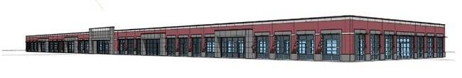
Property Record
401 Brookfield Pky, Greenville, SC 29607


Property Detail
401 Brookfield Pky
Greenville-Anderson-Greer, SC
MAP 0547.03
0547.03-01-050.00
Greenville
Commercialnec
South Carolina
RS
050.00
AE The base floodplain where base flood elevations are provided. AE Zones are now used on new format FIRMs instead of A1-A30 Zones.
6.01 AC
2025
Woodruff/I-385 Corridor
2025
Greenville/Spartanburg
002812
NEARBY LISTINGS FOR SALE OR LEASE
DEMOGRAPHICS near 401 Brookfield Pky
1 mile
3 mile
5 mile
2025 Total Population
6,450
56,047
142,172
2030 Population
6,965
60,480
153,011
Pop Growth 2025-2030
+ 7.98%
+ 7.91%
+ 7.62%
Average Age
38
41
40
2025 Total Households
2,815
24,089
59,097
HH Growth 2025-2030
+ 8.21%
+ 8.24%
+ 7.94%
Median Household Inc
$87,472
$94,397
$93,661
Avg Household Size
2.20
2.30
2.40
2025 Avg HH Vehicles
2.00
2.00
2.00
Median Home Value
$305,957
$367,097
$377,717
Median Year Built
2001
1997
1995
Nearby Places
Map Layers
Map Styles
 Street
 Aerial
Layers
 Traffic
 Biking
Places
Listings with unknown addresses are not visible on the map
- Restaurants
- Banks
- Shops
- Fitness
- Groceries
PUBLIC TRANSPORTATION
AIRPORT
Greenville Spartanburg International
Drive
Walk
Distance
Greenville Spartanburg International
16 min
9.9 mi
SALE & LEASE HISTORY
LISTING DATE
SALE/LEASE

Sep 24, 2016
For Sale
Nearby Properties
Address
Land Use
TOTAL SIZE
Lot Size
Zoning
Address
Land Use
TOTAL SIZE
Lot Size
Zoning
17.56 AC
C3
Address
Land Use
TOTAL SIZE
Lot Size
Zoning
223.09 AC
I1
Address
Land Use
TOTAL SIZE
Lot Size
Zoning
181.61 AC
C-2,I1
Address
Land Use
TOTAL SIZE
Lot Size
Zoning
22.50 AC
S1
Address
Land Use
TOTAL SIZE
Lot Size
Zoning
2,355 SF
10.21 AC
RS
Address
Land Use
TOTAL SIZE
Lot Size
Zoning
10.20 AC
R12
Address
Land Use
TOTAL SIZE
Lot Size
Zoning
10.07 AC
S1
Address
Land Use
TOTAL SIZE
Lot Size
Zoning
Address
Land Use
TOTAL SIZE
Lot Size
Zoning
10.29 AC
S1
Address
Land Use
TOTAL SIZE
Lot Size
Zoning
3.38 AC
S1
Address
Land Use
TOTAL SIZE
Lot Size
Zoning
9.10 AC
RM,C2
Address
Land Use
TOTAL SIZE
Lot Size
Zoning
5.83 AC
S1
Address
Land Use
TOTAL SIZE
Lot Size
Zoning
11.05 AC
S1
Address
Land Use
TOTAL SIZE
Lot Size
Zoning
6.27 AC
UVD
Address
Land Use
TOTAL SIZE
Lot Size
Zoning
10.36 AC
R12
Address
Land Use
TOTAL SIZE
Lot Size
Zoning
3.24 AC
S1
Address
Land Use
TOTAL SIZE
Lot Size
Zoning
37.35 AC
S1
Address
Land Use
TOTAL SIZE
Lot Size
Zoning
39.85 AC
C3
Address
Land Use
TOTAL SIZE
Lot Size
Zoning
26.75 AC
S1
Address
Land Use
TOTAL SIZE
Lot Size
Zoning
Address
Land Use
TOTAL SIZE
Lot Size
Zoning
7.53 AC
S1
Address
Land Use
TOTAL SIZE
Lot Size
Zoning
38.86 AC
C2
Address
Land Use
TOTAL SIZE
Lot Size
Zoning
0.66 AC
PD
Address
Land Use
TOTAL SIZE
Lot Size
Zoning
19.33 AC
S1
Address
Land Use
TOTAL SIZE
Lot Size
Zoning
24.12 AC
S1
Address
Land Use
TOTAL SIZE
Lot Size
Zoning
5 AC
R12
Address
Land Use
TOTAL SIZE
Lot Size
Zoning
Address
Land Use
TOTAL SIZE
Lot Size
Zoning
0.33 AC
C3
Address
Land Use
TOTAL SIZE
Lot Size
Zoning
25.70 AC
I1
Address
Land Use
TOTAL SIZE
Lot Size
Zoning
5.47 AC
C3
The World's #1 Commercial Real Estate Marketplace
Connect with us
© 2026 CoStar Group
The information above has been obtained from sources believed reliable. While we do not doubt its accuracy we have not verified it and make no guarantee, warranty or representation about it. It is your responsibility to independently confirm its accuracy and completeness. Any projections, opinions, assumptions, or estimates used are for example only and do not represent the current or future performance of the property. The value of this transaction to you depends on tax and other factors which should be evaluated by your tax, financial, and legal advisors. You and your advisors should conduct a careful, independent investigation of the property to determine to your satisfaction the suitability of the property for your needs.