Property Record
Brown Bridge Rd, Covington, GA 30016

Save to a Folder
{{folder.Name}}
{{folder.ListingIds.length}} Properties
{{folder.ListingIds.length}} Property
Create a New Folder
Property Detail
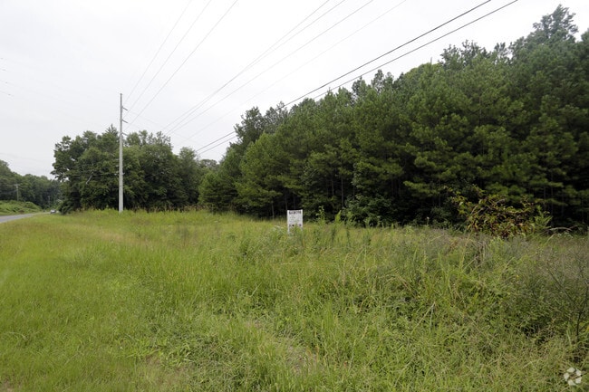
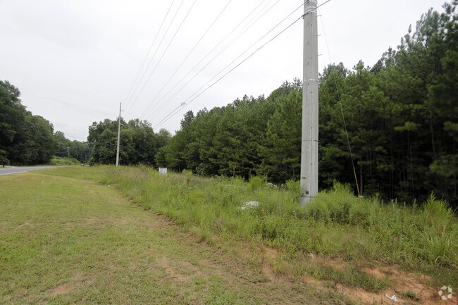
Brown Bridge Rd
Atlanta-Sandy Springs-Roswell, GA
2.03AC OUT TRACT
0006000000318000
NEWTON
Residentialacreage
Georgia
OI
85
B and X Area of moderate flood hazard, usually the area between the limits of the 100-year and 500-year floods.
2.03 AC
2025
Newton County
2025
Atlanta
100902
NEARBY LISTINGS FOR SALE OR LEASE
DEMOGRAPHICS near Brown Bridge Rd
1 mile
3 mile
5 mile
2025 Total Population
2,225
31,715
86,308
2030 Population
2,381
33,611
91,970
Pop Growth 2025-2030
+ 7.01%
+ 5.98%
+ 6.56%
Average Age
40
39
39
2025 Total Households
793
10,978
29,781
HH Growth 2025-2030
+ 7.19%
+ 6.11%
+ 6.70%
Median Household Inc
$79,665
$89,633
$85,872
Avg Household Size
2.80
2.80
2.90
2025 Avg HH Vehicles
2.00
2.00
2.00
Median Home Value
$257,575
$274,078
$285,258
Median Year Built
1991
1992
1996
Nearby Places
Map Layers
Map Styles
 Street
 Aerial
Layers
 Traffic
 Biking
Places
Listings with unknown addresses are not visible on the map
- Restaurants
- Banks
- Shops
- Fitness
- Groceries
PUBLIC TRANSPORTATION
AIRPORT
Hartsfield - Jackson Atlanta International
Drive
Walk
Distance
Hartsfield - Jackson Atlanta International
51 min
33.1 mi
SALE & LEASE HISTORY
LISTING DATE
SALE/LEASE

Aug 31, 2017
For Sale
Nearby Properties
Address
Land Use
TOTAL SIZE
Lot Size
Zoning
Address
Land Use
TOTAL SIZE
Lot Size
Zoning
1,158,095 SF
161.26 AC
Address
Land Use
TOTAL SIZE
Lot Size
Zoning
1,158,095 SF
0.01 AC
Address
Land Use
TOTAL SIZE
Lot Size
Zoning
175,605 SF
39.99 AC
AR
Address
Land Use
TOTAL SIZE
Lot Size
Zoning
65,360 SF
75.51 AC
E6
Address
Land Use
TOTAL SIZE
Lot Size
Zoning
151,955 SF
26.17 AC
R1
Address
Land Use
TOTAL SIZE
Lot Size
Zoning
18,648 SF
2.48 AC
C1
Address
Land Use
TOTAL SIZE
Lot Size
Zoning
81,591 SF
12.80 AC
C2
Address
Land Use
TOTAL SIZE
Lot Size
Zoning
66,660 SF
12.80 AC
C1
Address
Land Use
TOTAL SIZE
Lot Size
Zoning
81,730 SF
17.98 AC
C1
Address
Land Use
TOTAL SIZE
Lot Size
Zoning
181,858 SF
6.92 AC
I1
Address
Land Use
TOTAL SIZE
Lot Size
Zoning
38,250 SF
26.56 AC
AR
Address
Land Use
TOTAL SIZE
Lot Size
Zoning
65,360 SF
30.63 AC
E6
Address
Land Use
TOTAL SIZE
Lot Size
Zoning
27.26 AC
R1
Address
Land Use
TOTAL SIZE
Lot Size
Zoning
50,096 SF
4.19 AC
C1
Address
Land Use
TOTAL SIZE
Lot Size
Zoning
9,779 SF
1.41 AC
C1
Address
Land Use
TOTAL SIZE
Lot Size
Zoning
17,700 SF
1.69 AC
C2
Address
Land Use
TOTAL SIZE
Lot Size
Zoning
63,328 SF
10.67 AC
C2
Address
Land Use
TOTAL SIZE
Lot Size
Zoning
7,440 SF
48.60 AC
C1
Address
Land Use
TOTAL SIZE
Lot Size
Zoning
64,800 SF
16.19 AC
AR
Address
Land Use
TOTAL SIZE
Lot Size
Zoning
18,751 SF
4.14 AC
C2/OI
Address
Land Use
TOTAL SIZE
Lot Size
Zoning
6,000 SF
2.61 AC
C1
Address
Land Use
TOTAL SIZE
Lot Size
Zoning
19,363 SF
4 AC
AR
Address
Land Use
TOTAL SIZE
Lot Size
Zoning
30,000 SF
11.06 AC
E2
Address
Land Use
TOTAL SIZE
Lot Size
Zoning
1,790 SF
79.74 AC
E2
Address
Land Use
TOTAL SIZE
Lot Size
Zoning
13,332 SF
1.17 AC
C1
Address
Land Use
TOTAL SIZE
Lot Size
Zoning
17,558 SF
5.08 AC
AR/C1
Address
Land Use
TOTAL SIZE
Lot Size
Zoning
15,953 SF
1.94 AC
C1
Address
Land Use
TOTAL SIZE
Lot Size
Zoning
4,576 SF
1.46 AC
Address
Land Use
TOTAL SIZE
Lot Size
Zoning
25.71 AC
R2
Address
Land Use
TOTAL SIZE
Lot Size
Zoning
11,862 SF
1.76 AC
C1
The World's #1 Commercial Real Estate Marketplace
Connect with us
© 2026 CoStar Group
The information above has been obtained from sources believed reliable. While we do not doubt its accuracy we have not verified it and make no guarantee, warranty or representation about it. It is your responsibility to independently confirm its accuracy and completeness. Any projections, opinions, assumptions, or estimates used are for example only and do not represent the current or future performance of the property. The value of this transaction to you depends on tax and other factors which should be evaluated by your tax, financial, and legal advisors. You and your advisors should conduct a careful, independent investigation of the property to determine to your satisfaction the suitability of the property for your needs.