Property Record
Browns Bridge Rd, Cumming, GA 30028

Save to a Folder
{{folder.Name}}
{{folder.ListingIds.length}} Properties
{{folder.ListingIds.length}} Property
Create a New Folder
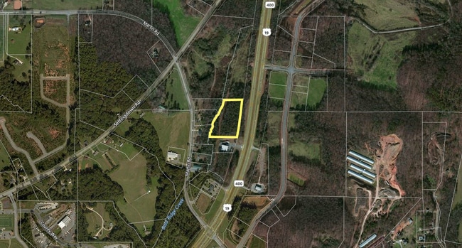
Property Detail
Browns Bridge Rd
217-809
14-1 100-137 PONDS A & B WAL-MART EAST
Commercialnec
FORSYTH
CBD
Georgia
AE The base floodplain where base flood elevations are provided. AE Zones are now used on new format FIRMs instead of A1-A30 Zones.
5.17 AC
2025
N Fulton/Forsyth County
2025
Atlanta
130203
Atlanta-Sandy Springs-Roswell, GA
NEARBY LISTINGS FOR SALE OR LEASE
DEMOGRAPHICS near Browns Bridge Rd
1 mile
3 mile
5 mile
2025 Total Population
3,440
26,944
64,080
2030 Population
3,732
29,393
70,303
Pop Growth 2025-2030
+ 8.49%
+ 9.09%
+ 9.71%
Average Age
35
38
40
2025 Total Households
1,087
9,217
22,150
HH Growth 2025-2030
+ 8.46%
+ 9.07%
+ 9.70%
Median Household Inc
$135,110
$108,682
$113,366
Avg Household Size
3.10
2.90
2.80
2025 Avg HH Vehicles
2.00
2.00
2.00
Median Home Value
$587,059
$482,812
$535,194
Median Year Built
2010
2005
2001
Nearby Places
Map Layers
Map Styles
 Street
 Aerial
Layers
 Traffic
 Biking
Places
Listings with unknown addresses are not visible on the map
- Restaurants
- Banks
- Shops
- Fitness
- Groceries
SALE & LEASE HISTORY
LISTING DATE
SALE/LEASE

Feb 25, 2021
For Sale
Nearby Properties
Address
Land Use
TOTAL SIZE
Lot Size
Zoning
Address
Land Use
TOTAL SIZE
Lot Size
Zoning
383,270 SF
61.71 AC
RES6
Address
Land Use
TOTAL SIZE
Lot Size
Zoning
351,995 SF
28.74 AC
MP
Address
Land Use
TOTAL SIZE
Lot Size
Zoning
305,332 SF
23.75 AC
CBD
Address
Land Use
TOTAL SIZE
Lot Size
Zoning
318,423 SF
127.99 AC
A1
Address
Land Use
TOTAL SIZE
Lot Size
Zoning
98,743 SF
12.61 AC
CBD
Address
Land Use
TOTAL SIZE
Lot Size
Zoning
101,319 SF
420.29 AC
A1
Address
Land Use
TOTAL SIZE
Lot Size
Zoning
142,605 SF
19.21 AC
M1
Address
Land Use
TOTAL SIZE
Lot Size
Zoning
152,668 SF
41.92 AC
CBD
Address
Land Use
TOTAL SIZE
Lot Size
Zoning
59,534 SF
16.93 AC
CBD
Address
Land Use
TOTAL SIZE
Lot Size
Zoning
74,796 SF
9.92 AC
CBD
Address
Land Use
TOTAL SIZE
Lot Size
Zoning
98,519 SF
121.31 AC
A1
Address
Land Use
TOTAL SIZE
Lot Size
Zoning
194,068 SF
21.11 AC
CBD
Address
Land Use
TOTAL SIZE
Lot Size
Zoning
17,657 SF
59.25 AC
A1
Address
Land Use
TOTAL SIZE
Lot Size
Zoning
80,956 SF
6.07 AC
CBD
Address
Land Use
TOTAL SIZE
Lot Size
Zoning
375 SF
154 AC
LR
Address
Land Use
TOTAL SIZE
Lot Size
Zoning
229.24 AC
M1
Address
Land Use
TOTAL SIZE
Lot Size
Zoning
65,238 SF
9.22 AC
CBD
Address
Land Use
TOTAL SIZE
Lot Size
Zoning
39,693 SF
5.65 AC
CBD
Address
Land Use
TOTAL SIZE
Lot Size
Zoning
24,052 SF
3.85 AC
CBD
Address
Land Use
TOTAL SIZE
Lot Size
Zoning
109,522 SF
20 AC
LR
Address
Land Use
TOTAL SIZE
Lot Size
Zoning
54,186 SF
26.64 AC
CBD
Address
Land Use
TOTAL SIZE
Lot Size
Zoning
76,508 SF
5.61 AC
CBD
Address
Land Use
TOTAL SIZE
Lot Size
Zoning
42.36 AC
CBD
Address
Land Use
TOTAL SIZE
Lot Size
Zoning
33,370 SF
5.88 AC
NS
Address
Land Use
TOTAL SIZE
Lot Size
Zoning
138.66 AC
A1
Address
Land Use
TOTAL SIZE
Lot Size
Zoning
33,608 SF
3.34 AC
HB
Address
Land Use
TOTAL SIZE
Lot Size
Zoning
40,092 SF
3.35 AC
M1
Address
Land Use
TOTAL SIZE
Lot Size
Zoning
3,060 SF
8.47 AC
M1
Address
Land Use
TOTAL SIZE
Lot Size
Zoning
58,869 SF
16.76 AC
CBD
Address
Land Use
TOTAL SIZE
Lot Size
Zoning
41,486 SF
6.11 AC
M1
The World's #1 Commercial Real Estate Marketplace
Connect with us
© 2026 CoStar Group
The information above has been obtained from sources believed reliable. While we do not doubt its accuracy we have not verified it and make no guarantee, warranty or representation about it. It is your responsibility to independently confirm its accuracy and completeness. Any projections, opinions, assumptions, or estimates used are for example only and do not represent the current or future performance of the property. The value of this transaction to you depends on tax and other factors which should be evaluated by your tax, financial, and legal advisors. You and your advisors should conduct a careful, independent investigation of the property to determine to your satisfaction the suitability of the property for your needs.