Property Record
Buchanan Rd, Panama City Beach, FL 32413


Save to a Folder
{{folder.Name}}
{{folder.ListingIds.length}} Properties
{{folder.ListingIds.length}} Property
Create a New Folder
Property Detail
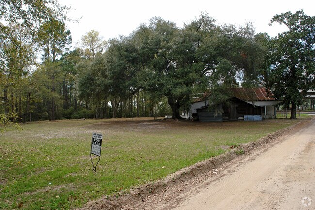
Buchanan Rd
32565-000-000
21 2S 16W 1A -15.4- 34C BEG AT SE COR OF SW1/4 W 178 TO CL OF CO RD NWLY 1182.40 SW 240.29 SE 160 FOR POB NW 185 SW 350 TO BAY SELY 140 NE 3 43 TO POB ORB 3207 P 553
Vacantlandnec
BAY
BC16
Florida
AE The base floodplain where base flood elevations are provided. AE Zones are now used on new format FIRMs instead of A1-A30 Zones.
1.28 AC
2024
Panama City
2025
Other Market Areas
002706
Panama City-Panama City Beach, FL
NEARBY LISTINGS FOR SALE OR LEASE
-
-
View all Panama City Beach listings for sale on LoopNet.com
DEMOGRAPHICS near Buchanan Rd
1 mile
3 mile
5 mile
2025 Total Population
757
4,032
5,964
2030 Population
889
4,764
6,944
Pop Growth 2025-2030
+ 17.44%
+ 18.15%
+ 16.43%
Average Age
41
40
41
2025 Total Households
274
1,435
2,234
HH Growth 2025-2030
+ 17.52%
+ 18.33%
+ 16.52%
Median Household Inc
$85,416
$72,067
$82,900
Avg Household Size
2.80
2.80
2.70
2025 Avg HH Vehicles
2.00
2.00
2.00
Median Home Value
$334,146
$277,812
$345,454
Median Year Built
2010
2010
2007
Nearby Places
Map Layers
Map Styles
 Street
 Aerial
Layers
 Traffic
 Biking
Places
Listings with unknown addresses are not visible on the map
- Restaurants
- Banks
- Shops
- Fitness
- Groceries
PUBLIC TRANSPORTATION
AIRPORT
Northwest Florida Beaches International
Drive
Walk
Distance
Northwest Florida Beaches International
11 min
6.9 mi
Freight Ports
Port of Panama City
Drive
Walk
Distance
Port of Panama City
26 min
15.9 mi
Nearby Properties
Address
Land Use
TOTAL SIZE
Lot Size
Zoning
Address
Land Use
TOTAL SIZE
Lot Size
Zoning
4,964 SF
84.18 AC
BC08
Address
Land Use
TOTAL SIZE
Lot Size
Zoning
66,556 SF
5 AC
BC14
Address
Land Use
TOTAL SIZE
Lot Size
Zoning
32,847 SF
53.07 AC
Address
Land Use
TOTAL SIZE
Lot Size
Zoning
9,554 SF
6 AC
Address
Land Use
TOTAL SIZE
Lot Size
Zoning
3,364 SF
21.97 AC
BC16
Address
Land Use
TOTAL SIZE
Lot Size
Zoning
320 SF
10.47 AC
BC05
Address
Land Use
TOTAL SIZE
Lot Size
Zoning
73.10 AC
BC08
Address
Land Use
TOTAL SIZE
Lot Size
Zoning
6,579 SF
5.60 AC
BC16
Address
Land Use
TOTAL SIZE
Lot Size
Zoning
8,940 SF
1.36 AC
BC08
Address
Land Use
TOTAL SIZE
Lot Size
Zoning
1,800 SF
95.85 AC
BC13
Address
Land Use
TOTAL SIZE
Lot Size
Zoning
4,094 SF
1.33 AC
BC08
Address
Land Use
TOTAL SIZE
Lot Size
Zoning
10,512 SF
1.37 AC
BC08
Address
Land Use
TOTAL SIZE
Lot Size
Zoning
8,188 SF
1.16 AC
BC17
Address
Land Use
TOTAL SIZE
Lot Size
Zoning
8,010 SF
1.55 AC
CSVH
Address
Land Use
TOTAL SIZE
Lot Size
Zoning
1,318 SF
12.72 AC
BC20
Address
Land Use
TOTAL SIZE
Lot Size
Zoning
6,254 SF
0.63 AC
CSVH
Address
Land Use
TOTAL SIZE
Lot Size
Zoning
3,398 SF
0.19 AC
Address
Land Use
TOTAL SIZE
Lot Size
Zoning
3,361 SF
0.18 AC
Address
Land Use
TOTAL SIZE
Lot Size
Zoning
4,187 SF
0.17 AC
BC02
Address
Land Use
TOTAL SIZE
Lot Size
Zoning
3,398 SF
0.18 AC
Address
Land Use
TOTAL SIZE
Lot Size
Zoning
3,415 SF
0.18 AC
Address
Land Use
TOTAL SIZE
Lot Size
Zoning
3,178 SF
0.20 AC
Address
Land Use
TOTAL SIZE
Lot Size
Zoning
3,398 SF
0.14 AC
Address
Land Use
TOTAL SIZE
Lot Size
Zoning
3,398 SF
0.18 AC
Address
Land Use
TOTAL SIZE
Lot Size
Zoning
3,398 SF
0.14 AC
Address
Land Use
TOTAL SIZE
Lot Size
Zoning
3,398 SF
0.21 AC
Address
Land Use
TOTAL SIZE
Lot Size
Zoning
3,361 SF
0.18 AC
Address
Land Use
TOTAL SIZE
Lot Size
Zoning
3,178 SF
0.19 AC
Address
Land Use
TOTAL SIZE
Lot Size
Zoning
3,415 SF
0.28 AC
Address
Land Use
TOTAL SIZE
Lot Size
Zoning
3,361 SF
0.19 AC
The World's #1 Commercial Real Estate Marketplace
Connect with us
© 2026 CoStar Group
The information above has been obtained from sources believed reliable. While we do not doubt its accuracy we have not verified it and make no guarantee, warranty or representation about it. It is your responsibility to independently confirm its accuracy and completeness. Any projections, opinions, assumptions, or estimates used are for example only and do not represent the current or future performance of the property. The value of this transaction to you depends on tax and other factors which should be evaluated by your tax, financial, and legal advisors. You and your advisors should conduct a careful, independent investigation of the property to determine to your satisfaction the suitability of the property for your needs.