Property Record
Buck Range Rd, Nashville, AR 71852
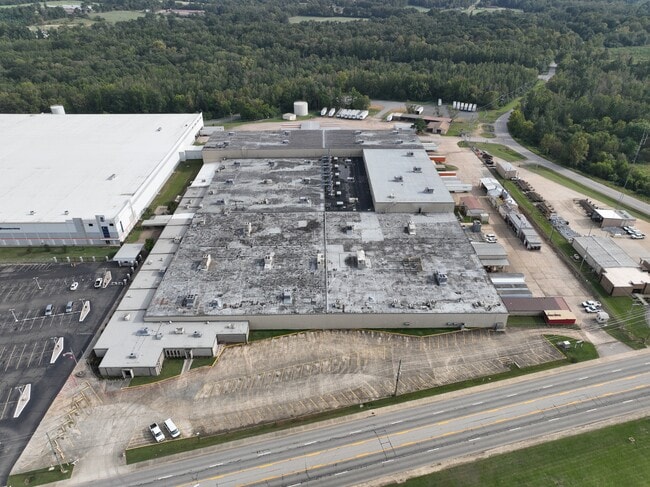

This Property Is For Sale
Current Lease Availabilities
Property Detail
Buck Range Rd
001-03159-000C
NW PT FRL NWNE N CRK (12.89AC) E PT FRL NENW (8.24AC) ***SEE ADMIN FOR SURVEY INFO***
Commercialacreage
HOWARD
B and X Area of moderate flood hazard, usually the area between the limits of the 100-year and 500-year floods.
Arkansas
2025
0.83 AC
2025
Arkansas South Area
950200
Other Market Areas
NEARBY LISTINGS FOR SALE OR LEASE
DEMOGRAPHICS near Buck Range Rd
1 mile
3 mile
5 mile
2025 Total Population
890
5,382
7,178
2030 Population
897
5,312
7,033
Pop Growth 2025-2030
+ 0.79%
(1.30%)
(2.02%)
Average Age
40
39
40
2025 Total Households
396
2,140
2,840
HH Growth 2025-2030
+ 0.76%
(1.36%)
(2.04%)
Median Household Inc
$27,300
$42,699
$46,216
Avg Household Size
2.20
2.50
2.50
2025 Avg HH Vehicles
2.00
2.00
2.00
Median Home Value
$99,999
$144,959
$147,259
Median Year Built
1972
1975
1978
Nearby Places
Map Layers
Map Styles
 Street
 Aerial
Layers
 Traffic
 Biking
Places
Listings with unknown addresses are not visible on the map
- Restaurants
- Banks
- Shops
- Fitness
- Groceries
Nearby Properties
Address
Land Use
TOTAL SIZE
Lot Size
Zoning
Address
Land Use
TOTAL SIZE
Lot Size
Zoning
264,991 SF
11.43 AC
Address
Land Use
TOTAL SIZE
Lot Size
Zoning
110,919 SF
17.68 AC
Address
Land Use
TOTAL SIZE
Lot Size
Zoning
3,774 SF
28.58 AC
Address
Land Use
TOTAL SIZE
Lot Size
Zoning
100,028 SF
12.46 AC
Address
Land Use
TOTAL SIZE
Lot Size
Zoning
106,408 SF
7.34 AC
Address
Land Use
TOTAL SIZE
Lot Size
Zoning
23,679 SF
4.22 AC
Address
Land Use
TOTAL SIZE
Lot Size
Zoning
9,864 SF
13.83 AC
Address
Land Use
TOTAL SIZE
Lot Size
Zoning
19,757 SF
3.98 AC
Address
Land Use
TOTAL SIZE
Lot Size
Zoning
6,772 SF
32.56 AC
Address
Land Use
TOTAL SIZE
Lot Size
Zoning
34,507 SF
8.14 AC
Address
Land Use
TOTAL SIZE
Lot Size
Zoning
19,376 SF
4.55 AC
Address
Land Use
TOTAL SIZE
Lot Size
Zoning
24,662 SF
3 AC
Address
Land Use
TOTAL SIZE
Lot Size
Zoning
58,152 SF
6.72 AC
Address
Land Use
TOTAL SIZE
Lot Size
Zoning
25,207 SF
3.38 AC
Address
Land Use
TOTAL SIZE
Lot Size
Zoning
84,308 SF
5.20 AC
Address
Land Use
TOTAL SIZE
Lot Size
Zoning
13,260 SF
1 AC
Address
Land Use
TOTAL SIZE
Lot Size
Zoning
11,278 SF
4 AC
Address
Land Use
TOTAL SIZE
Lot Size
Zoning
8,617 SF
1.57 AC
Address
Land Use
TOTAL SIZE
Lot Size
Zoning
38,241 SF
7.32 AC
Address
Land Use
TOTAL SIZE
Lot Size
Zoning
5,096 SF
1.05 AC
Address
Land Use
TOTAL SIZE
Lot Size
Zoning
7,196 SF
1.93 AC
Address
Land Use
TOTAL SIZE
Lot Size
Zoning
12,000 SF
1.03 AC
Address
Land Use
TOTAL SIZE
Lot Size
Zoning
5,715 SF
3.17 AC
Address
Land Use
TOTAL SIZE
Lot Size
Zoning
3,902 SF
0.95 AC
Address
Land Use
TOTAL SIZE
Lot Size
Zoning
20,296 SF
0.33 AC
Address
Land Use
TOTAL SIZE
Lot Size
Zoning
1,841 SF
0.89 AC
Address
Land Use
TOTAL SIZE
Lot Size
Zoning
6,300 SF
1.92 AC
Address
Land Use
TOTAL SIZE
Lot Size
Zoning
19,500 SF
1.59 AC
Address
Land Use
TOTAL SIZE
Lot Size
Zoning
17,500 SF
5.53 AC
Address
Land Use
TOTAL SIZE
Lot Size
Zoning
7,760 SF
1.77 AC
The World's #1 Commercial Real Estate Marketplace
Connect with us
© 2026 CoStar Group
The information above has been obtained from sources believed reliable. While we do not doubt its accuracy we have not verified it and make no guarantee, warranty or representation about it. It is your responsibility to independently confirm its accuracy and completeness. Any projections, opinions, assumptions, or estimates used are for example only and do not represent the current or future performance of the property. The value of this transaction to you depends on tax and other factors which should be evaluated by your tax, financial, and legal advisors. You and your advisors should conduct a careful, independent investigation of the property to determine to your satisfaction the suitability of the property for your needs.