Property Record
Buckeye Rd, Osceola, IN 46561

NEARBY LISTINGS FOR SALE OR LEASE
Property Detail
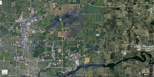
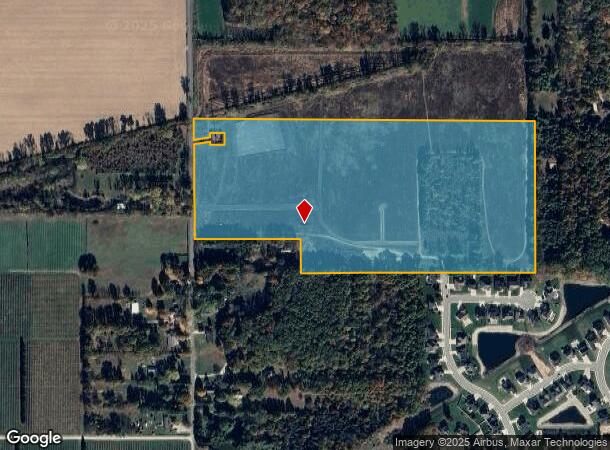
Buckeye Rd
South Bend-Mishawaka, IN-MI
Csapo Minor Sub
71-05-32-100-011.000-031
SE4 NW4 SEC32 T38N R04E
Farms
St Joseph
X
Indiana
18039C0125D
174 SF
2023
Outlying St Joseph County
2024
South Bend/Mishawaka
011602
DEMOGRAPHICS near Buckeye Rd
1 Mile
3 Mile
5 Mile
2024 Total Population
2,678
24,804
80,876
2029 Population
2,665
24,483
80,083
Pop Growth 2024-2029
(0.49%)
(1.29%)
(0.98%)
Average Age
39
40
39
2024 Total Households
931
9,091
30,848
HH Growth 2024-2029
(0.54%)
(1.36%)
(1.03%)
Median Household Inc
$104,524
$80,918
$73,800
Avg Household Size
2.80
2.70
2.60
2024 Avg HH Vehicles
2.00
2.00
2.00
Median Home Value
$188,925
$197,972
$198,069
Median Year Built
1989
1981
1981
Nearby Places
Map Layers
Map Styles
 Street
 Aerial
- Restaurants
- Banks
- Shops
- Fitness
- Groceries
PUBLIC TRANSPORTATION
COMMUTER RAIL
Elkhart Amtrak Station (Capitol Limited - Amtrak, Lake Shore Limited - Amtrak)
DRIVE
WALK
Distance
Elkhart Amtrak Station (Capitol Limited - Amtrak, Lake Shore Limited - Amtrak)
15 min
7.9 mi
AIRPORT
South Bend International
DRIVE
WALK
Distance
South Bend International
36 min
16.0 mi
Freight Ports
Port Milwaukee
DRIVE
WALK
Distance
Port Milwaukee
228 min
189.0 mi
SALE & LEASE HISTORY
LISTING DATE
SALE/LEASE

Feb 01, 2021
For Sale
Nearby Properties
Address
Land Use
TOTAL SIZE
Lot Size
Zoning
Address
Land Use
TOTAL SIZE
Lot Size
Zoning
2,584,820 SF
32.18 AC
Address
Land Use
TOTAL SIZE
Lot Size
Zoning
184,212 SF
23.71 AC
ZO01
Address
Land Use
TOTAL SIZE
Lot Size
Zoning
36,851 SF
22.72 AC
Address
Land Use
TOTAL SIZE
Lot Size
Zoning
83,856 SF
54.56 AC
ZO01
Address
Land Use
TOTAL SIZE
Lot Size
Zoning
3,692,640 SF
0.01 AC
Address
Land Use
TOTAL SIZE
Lot Size
Zoning
316,658 SF
27.46 AC
Address
Land Use
TOTAL SIZE
Lot Size
Zoning
144,550 SF
30.99 AC
ZO01
Address
Land Use
TOTAL SIZE
Lot Size
Zoning
51,620 SF
30.21 AC
ZO01
Address
Land Use
TOTAL SIZE
Lot Size
Zoning
123,595 SF
7.92 AC
Address
Land Use
TOTAL SIZE
Lot Size
Zoning
115,990 SF
11.91 AC
Address
Land Use
TOTAL SIZE
Lot Size
Zoning
81,185 SF
23.42 AC
Address
Land Use
TOTAL SIZE
Lot Size
Zoning
279,230 SF
27.20 AC
Address
Land Use
TOTAL SIZE
Lot Size
Zoning
73,600 SF
44 SF
Address
Land Use
TOTAL SIZE
Lot Size
Zoning
225,200 SF
25.73 AC
Address
Land Use
TOTAL SIZE
Lot Size
Zoning
49,293 SF
87 SF
Address
Land Use
TOTAL SIZE
Lot Size
Zoning
0.02 AC
Address
Land Use
TOTAL SIZE
Lot Size
Zoning
47,240 SF
6.66 AC
Address
Land Use
TOTAL SIZE
Lot Size
Zoning
281,499 SF
21.32 AC
Address
Land Use
TOTAL SIZE
Lot Size
Zoning
42,500 SF
1.93 AC
Address
Land Use
TOTAL SIZE
Lot Size
Zoning
55,428 SF
44 SF
Address
Land Use
TOTAL SIZE
Lot Size
Zoning
30,344 SF
7.94 AC
Address
Land Use
TOTAL SIZE
Lot Size
Zoning
113,890 SF
22 AC
ZO01
Address
Land Use
TOTAL SIZE
Lot Size
Zoning
40,480 SF
3.62 AC
Address
Land Use
TOTAL SIZE
Lot Size
Zoning
27,310 SF
2.42 AC
ZO01
Address
Land Use
TOTAL SIZE
Lot Size
Zoning
61,384 SF
5.59 AC
Address
Land Use
TOTAL SIZE
Lot Size
Zoning
31,156 SF
4.93 AC
Address
Land Use
TOTAL SIZE
Lot Size
Zoning
25,588 SF
12 AC
Address
Land Use
TOTAL SIZE
Lot Size
Zoning
33,330 SF
4.27 AC
Address
Land Use
TOTAL SIZE
Lot Size
Zoning
16,034 SF
6.46 AC
Address
Land Use
TOTAL SIZE
Lot Size
Zoning
17,426 SF
6.04 AC
ZO01
The World's #1 Commercial Real Estate Marketplace
Connect with us
© 2025 CoStar Group
The information above has been obtained from sources believed reliable. While we do not doubt its accuracy we have not verified it and make no guarantee, warranty or representation about it. It is your responsibility to independently confirm its accuracy and completeness. Any projections, opinions, assumptions, or estimates used are for example only and do not represent the current or future performance of the property. The value of this transaction to you depends on tax and other factors which should be evaluated by your tax, financial, and legal advisors. You and your advisors should conduct a careful, independent investigation of the property to determine to your satisfaction the suitability of the property for your needs.