Property Record
0 Bulen Pierce Rd, Lockbourne, OH 43137
Property Detail
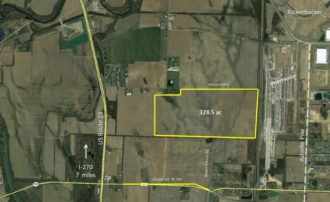
0 Bulen Pierce Rd
Columbus, OH
PT N 1/2
D12-0-003-00-268-00
PICKAWAY
Agriculturalland
Ohio
B and X Area of moderate flood hazard, usually the area between the limits of the 100-year and 500-year floods.
125.12 AC
2025
Pickaway County
2025
Columbus
009590
NEARBY LISTINGS FOR SALE OR LEASE
DEMOGRAPHICS near 0 Bulen Pierce Rd
1 mile
3 mile
5 mile
2025 Total Population
360
3,033
19,592
2030 Population
391
3,243
20,773
Pop Growth 2025-2030
+ 8.61%
+ 6.92%
+ 6.03%
Average Age
40
38
38
2025 Total Households
145
1,118
7,215
HH Growth 2025-2030
+ 8.97%
+ 7.16%
+ 6.17%
Median Household Inc
$44,530
$51,803
$71,483
Avg Household Size
2.50
2.70
2.70
2025 Avg HH Vehicles
2.00
2.00
2.00
Median Home Value
$61,309
$96,692
$258,327
Median Year Built
1976
1976
1987
Nearby Places
Map Layers
Map Styles
 Street
 Aerial
Layers
 Traffic
 Biking
Places
Listings with unknown addresses are not visible on the map
- Restaurants
- Banks
- Shops
- Fitness
- Groceries
PUBLIC TRANSPORTATION
AIRPORT
Rickenbacker International
Drive
Walk
Distance
Rickenbacker International
13 min
7.5 mi
John Glenn Columbus International
Drive
Walk
Distance
John Glenn Columbus International
33 min
22.5 mi
Freight Ports
Port of Toledo
Drive
Walk
Distance
Port of Toledo
203 min
152.0 mi
SALE & LEASE HISTORY
LISTING DATE
SALE/LEASE

Feb 22, 2019
For Sale
Nearby Properties
Address
Land Use
TOTAL SIZE
Lot Size
Zoning
Address
Land Use
TOTAL SIZE
Lot Size
Zoning
33,110 SF
168.33 AC
Address
Land Use
TOTAL SIZE
Lot Size
Zoning
43,254 SF
300.98 AC
Address
Land Use
TOTAL SIZE
Lot Size
Zoning
Address
Land Use
TOTAL SIZE
Lot Size
Zoning
Address
Land Use
TOTAL SIZE
Lot Size
Zoning
676,000 SF
35.76 AC
Address
Land Use
TOTAL SIZE
Lot Size
Zoning
592,120 SF
38.67 AC
Address
Land Use
TOTAL SIZE
Lot Size
Zoning
362,940 SF
8.69 AC
Address
Land Use
TOTAL SIZE
Lot Size
Zoning
943,080 SF
63.91 AC
Address
Land Use
TOTAL SIZE
Lot Size
Zoning
592,120 SF
38.67 AC
Address
Land Use
TOTAL SIZE
Lot Size
Zoning
47,622 SF
167.59 AC
Address
Land Use
TOTAL SIZE
Lot Size
Zoning
289,800 SF
23.71 AC
Address
Land Use
TOTAL SIZE
Lot Size
Zoning
31.09 AC
Address
Land Use
TOTAL SIZE
Lot Size
Zoning
61,560 SF
18.32 AC
Address
Land Use
TOTAL SIZE
Lot Size
Zoning
Address
Land Use
TOTAL SIZE
Lot Size
Zoning
2,261 SF
138.99 AC
Address
Land Use
TOTAL SIZE
Lot Size
Zoning
43,254 SF
1.96 AC
Address
Land Use
TOTAL SIZE
Lot Size
Zoning
105.32 AC
Address
Land Use
TOTAL SIZE
Lot Size
Zoning
Address
Land Use
TOTAL SIZE
Lot Size
Zoning
43,254 SF
167.42 AC
Address
Land Use
TOTAL SIZE
Lot Size
Zoning
61.02 AC
Address
Land Use
TOTAL SIZE
Lot Size
Zoning
1,380 SF
270.34 AC
Address
Land Use
TOTAL SIZE
Lot Size
Zoning
144.61 AC
Address
Land Use
TOTAL SIZE
Lot Size
Zoning
61.87 AC
Address
Land Use
TOTAL SIZE
Lot Size
Zoning
145.97 AC
Address
Land Use
TOTAL SIZE
Lot Size
Zoning
Address
Land Use
TOTAL SIZE
Lot Size
Zoning
2,160 SF
104.13 AC
Address
Land Use
TOTAL SIZE
Lot Size
Zoning
41.70 AC
Address
Land Use
TOTAL SIZE
Lot Size
Zoning
2,352 SF
27.34 AC
Address
Land Use
TOTAL SIZE
Lot Size
Zoning
4,372 SF
181.30 AC
Address
Land Use
TOTAL SIZE
Lot Size
Zoning
201.92 AC
The World's #1 Commercial Real Estate Marketplace
Connect with us
© 2026 CoStar Group
The information above has been obtained from sources believed reliable. While we do not doubt its accuracy we have not verified it and make no guarantee, warranty or representation about it. It is your responsibility to independently confirm its accuracy and completeness. Any projections, opinions, assumptions, or estimates used are for example only and do not represent the current or future performance of the property. The value of this transaction to you depends on tax and other factors which should be evaluated by your tax, financial, and legal advisors. You and your advisors should conduct a careful, independent investigation of the property to determine to your satisfaction the suitability of the property for your needs.