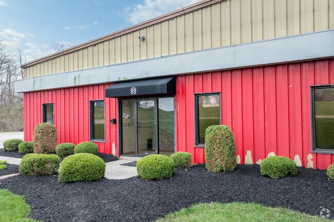
Property Record
Burnett Dr, Xenia, OH 45385


NEARBY LISTINGS FOR SALE OR LEASE
Property Detail
Burnett Dr
Dayton, OH
Xenia
M40-0002-0022-0-0017-00
RPLT XENIA IND & COMM PARK LOT 3D PT TRACT III 2.928A BURNETT DR
Warehouse
Greene
X
Ohio
39057C0145E
3
2024
2.93 AC
2024
Southeast Dayton
240200
Cincinnati/Dayton
55,190 SF
DEMOGRAPHICS near Burnett Dr
1 Mile
3 Mile
5 Mile
2024 Total Population
1,412
21,485
33,059
2029 Population
1,438
22,033
33,758
Pop Growth 2024-2029
+ 1.84%
+ 2.55%
+ 2.11%
Average Age
44
42
41
2024 Total Households
584
8,905
12,985
HH Growth 2024-2029
+ 1.71%
+ 2.64%
+ 2.24%
Median Household Inc
$70,499
$51,648
$60,247
Avg Household Size
2.40
2.20
2.30
2024 Avg HH Vehicles
3.00
2.00
2.00
Median Home Value
$154,518
$143,561
$151,575
Median Year Built
1954
1962
1969
Nearby Places
Map Layers
Map Styles
 Street
 Aerial
- Restaurants
- Banks
- Shops
- Fitness
- Groceries
PUBLIC TRANSPORTATION
AIRPORT
James M Cox Dayton International
DRIVE
WALK
Distance
James M Cox Dayton International
46 min
30.4 mi
Freight Ports
Port of Toledo
DRIVE
WALK
Distance
Port of Toledo
203 min
170.6 mi
SALE & LEASE HISTORY
LISTING DATE
SALE/LEASE

Sep 20, 2023
For Lease
Aug 08, 2024
For Sale
Nearby Properties
Address
Land Use
TOTAL SIZE
Lot Size
Zoning
Address
Land Use
TOTAL SIZE
Lot Size
Zoning
23,424 SF
7.42 AC
Address
Land Use
TOTAL SIZE
Lot Size
Zoning
2,048 SF
28.69 AC
Address
Land Use
TOTAL SIZE
Lot Size
Zoning
2,984 SF
98.36 AC
Address
Land Use
TOTAL SIZE
Lot Size
Zoning
2,853 SF
42.41 AC
Address
Land Use
TOTAL SIZE
Lot Size
Zoning
24,466 SF
34.44 AC
Address
Land Use
TOTAL SIZE
Lot Size
Zoning
136,667 SF
43.33 AC
Address
Land Use
TOTAL SIZE
Lot Size
Zoning
4,536 SF
6.73 AC
Address
Land Use
TOTAL SIZE
Lot Size
Zoning
26,912 SF
3.26 AC
Address
Land Use
TOTAL SIZE
Lot Size
Zoning
20,283 SF
19.18 AC
Address
Land Use
TOTAL SIZE
Lot Size
Zoning
41,120 SF
149.37 AC
Address
Land Use
TOTAL SIZE
Lot Size
Zoning
77,924 SF
11.18 AC
Address
Land Use
TOTAL SIZE
Lot Size
Zoning
24,466 SF
6.43 AC
Address
Land Use
TOTAL SIZE
Lot Size
Zoning
15,600 SF
40.59 AC
Address
Land Use
TOTAL SIZE
Lot Size
Zoning
22,500 SF
22.31 AC
Address
Land Use
TOTAL SIZE
Lot Size
Zoning
11,664 SF
16.37 AC
Address
Land Use
TOTAL SIZE
Lot Size
Zoning
48,523 SF
6.26 AC
Address
Land Use
TOTAL SIZE
Lot Size
Zoning
15,160 SF
7.48 AC
Address
Land Use
TOTAL SIZE
Lot Size
Zoning
34,728 SF
0.99 AC
Address
Land Use
TOTAL SIZE
Lot Size
Zoning
90,567 SF
0.18 AC
Address
Land Use
TOTAL SIZE
Lot Size
Zoning
43,365 SF
0.38 AC
Address
Land Use
TOTAL SIZE
Lot Size
Zoning
62,868 SF
8.35 AC
Address
Land Use
TOTAL SIZE
Lot Size
Zoning
101,886 SF
6.65 AC
Address
Land Use
TOTAL SIZE
Lot Size
Zoning
13,864 SF
5.66 AC
Address
Land Use
TOTAL SIZE
Lot Size
Zoning
72,408 SF
1.40 AC
Address
Land Use
TOTAL SIZE
Lot Size
Zoning
3,200 SF
33.43 AC
Address
Land Use
TOTAL SIZE
Lot Size
Zoning
7,824 SF
27.30 AC
Address
Land Use
TOTAL SIZE
Lot Size
Zoning
62,916 SF
1.76 AC
Address
Land Use
TOTAL SIZE
Lot Size
Zoning
32,800 SF
9.87 AC
Address
Land Use
TOTAL SIZE
Lot Size
Zoning
31,305 SF
0.25 AC
Address
Land Use
TOTAL SIZE
Lot Size
Zoning
60,632 SF
4.47 AC
The World's #1 Commercial Real Estate Marketplace
Connect with us
© 2025 CoStar Group
The information above has been obtained from sources believed reliable. While we do not doubt its accuracy we have not verified it and make no guarantee, warranty or representation about it. It is your responsibility to independently confirm its accuracy and completeness. Any projections, opinions, assumptions, or estimates used are for example only and do not represent the current or future performance of the property. The value of this transaction to you depends on tax and other factors which should be evaluated by your tax, financial, and legal advisors. You and your advisors should conduct a careful, independent investigation of the property to determine to your satisfaction the suitability of the property for your needs.