Property Record
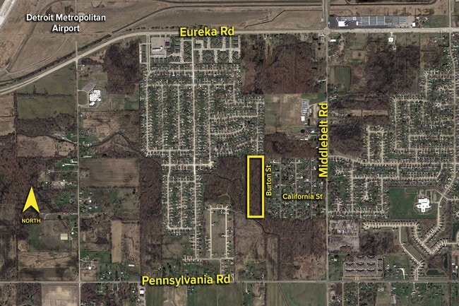
Burton, Romulus, MI 48174

This Property Is For Sale
NEARBY LISTINGS FOR SALE OR LEASE
Property Detail
Burton
Detroit-Warren-Dearborn, MI
Greenview Heights
80-140-99-0004-000
35MM2 THE E 1/2 OF THE N 1/2 OF TH E 1/2 OF THE W 1/2 OF THE SE 1/4 OF SEC 35 10.04 ACRES
Residentialacreage
Wayne
AE
Michigan
26163C0390F
0004
2025
10.04 AC
2025
Airport District
985400
Detroit
DEMOGRAPHICS near Burton
1 mile
3 mile
5 mile
2024 Total Population
5,494
20,311
67,934
2029 Population
5,240
19,454
65,332
Pop Growth 2024-2029
(4.62%)
(4.22%)
(3.83%)
Average Age
37
37
40
2024 Total Households
2,004
7,636
27,134
HH Growth 2024-2029
(4.69%)
(4.24%)
(3.83%)
Median Household Inc
$70,099
$58,836
$63,221
Avg Household Size
2.60
2.60
2.40
2024 Avg HH Vehicles
2.00
2.00
2.00
Median Home Value
$151,675
$168,607
$184,426
Median Year Built
1974
1974
1974
Nearby Places
Map Layers
Map Styles
 Street
 Aerial
Transit
 Traffic
 Biking
Places
Listings with unknown addresses are not visible on the map
- Restaurants
- Banks
- Shops
- Fitness
- Groceries
PUBLIC TRANSPORTATION
AIRPORT
Detroit Metro Wayne County
Drive
Walk
Distance
Detroit Metro Wayne County
8 min
4.5 mi
Windsor International
Drive
Walk
Distance
Windsor International
49 min
29.0 mi
Freight Ports
Port of Toledo
Drive
Walk
Distance
Port of Toledo
63 min
47.9 mi
Nearby Properties
Address
Land Use
TOTAL SIZE
Lot Size
Zoning
Address
Land Use
TOTAL SIZE
Lot Size
Zoning
752,400 SF
72.97 AC
PDA
Address
Land Use
TOTAL SIZE
Lot Size
Zoning
307,524 SF
63.94 AC
AP-AIRPORT
Address
Land Use
TOTAL SIZE
Lot Size
Zoning
516,762 SF
51.63 AC
PDA
Address
Land Use
TOTAL SIZE
Lot Size
Zoning
3,122,068 SF
260 AC
I-1
Address
Land Use
TOTAL SIZE
Lot Size
Zoning
146,562 SF
M2-GEN
Address
Land Use
TOTAL SIZE
Lot Size
Zoning
600,000 SF
M1-LIG
Address
Land Use
TOTAL SIZE
Lot Size
Zoning
268,272 SF
22.70 AC
M-1/COND
Address
Land Use
TOTAL SIZE
Lot Size
Zoning
244,760 SF
22.63 AC
M-1/COND
Address
Land Use
TOTAL SIZE
Lot Size
Zoning
312,000 SF
21.91 AC
M-T
Address
Land Use
TOTAL SIZE
Lot Size
Zoning
166,950 SF
22.86 AC
RM-MLTI
Address
Land Use
TOTAL SIZE
Lot Size
Zoning
129,260 SF
5.25 AC
AP-AIRPORT
Address
Land Use
TOTAL SIZE
Lot Size
Zoning
88,790 SF
M2-GEN
Address
Land Use
TOTAL SIZE
Lot Size
Zoning
235,200 SF
21.93 AC
M-T
Address
Land Use
TOTAL SIZE
Lot Size
Zoning
169,350 SF
12.45 AC
I-1
Address
Land Use
TOTAL SIZE
Lot Size
Zoning
176,500 SF
13.56 AC
I-1
Address
Land Use
TOTAL SIZE
Lot Size
Zoning
169,350 SF
12.26 AC
I-1
Address
Land Use
TOTAL SIZE
Lot Size
Zoning
101,200 SF
5.54 AC
AP-AIRPORT
Address
Land Use
TOTAL SIZE
Lot Size
Zoning
105,000 SF
15.26 AC
M2-GEN
Address
Land Use
TOTAL SIZE
Lot Size
Zoning
88,790 SF
10.48 AC
M2-GEN
Address
Land Use
TOTAL SIZE
Lot Size
Zoning
163,000 SF
12.11 AC
I-1
Address
Land Use
TOTAL SIZE
Lot Size
Zoning
71,500 SF
M1-LIG
Address
Land Use
TOTAL SIZE
Lot Size
Zoning
90,652 SF
18.41 AC
I-1
Address
Land Use
TOTAL SIZE
Lot Size
Zoning
120,000 SF
13.80 AC
I-1
Address
Land Use
TOTAL SIZE
Lot Size
Zoning
40 AC
R-3
Address
Land Use
TOTAL SIZE
Lot Size
Zoning
54,825 SF
M1-LIG
Address
Land Use
TOTAL SIZE
Lot Size
Zoning
131,200 SF
10.54 AC
M-T
Address
Land Use
TOTAL SIZE
Lot Size
Zoning
66,300 SF
11.27 AC
M1-LIG
Address
Land Use
TOTAL SIZE
Lot Size
Zoning
81,972 SF
9.54 AC
M-T
Address
Land Use
TOTAL SIZE
Lot Size
Zoning
62,194 SF
6 AC
AP-AIRPORT
Address
Land Use
TOTAL SIZE
Lot Size
Zoning
54,825 SF
7.48 AC
M1-LIG
The World's #1 Commercial Real Estate Marketplace
Connect with us
© 2026 CoStar Group
The information above has been obtained from sources believed reliable. While we do not doubt its accuracy we have not verified it and make no guarantee, warranty or representation about it. It is your responsibility to independently confirm its accuracy and completeness. Any projections, opinions, assumptions, or estimates used are for example only and do not represent the current or future performance of the property. The value of this transaction to you depends on tax and other factors which should be evaluated by your tax, financial, and legal advisors. You and your advisors should conduct a careful, independent investigation of the property to determine to your satisfaction the suitability of the property for your needs.