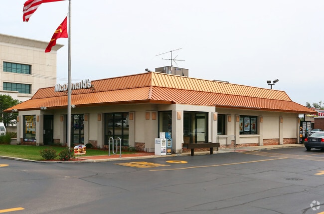
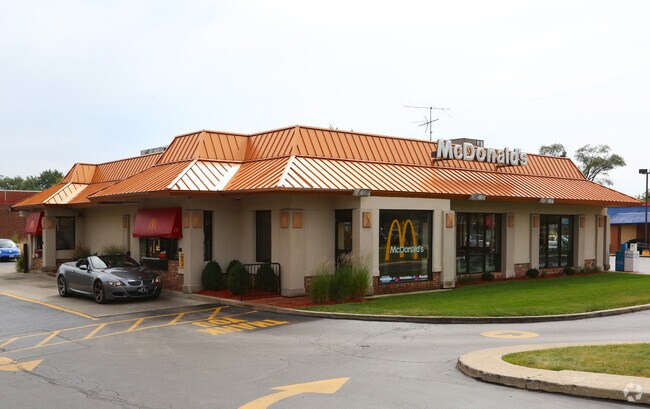
Property Record
Butterfield Rd, Elmhurst, IL 60126

Save to a Folder
{{folder.Name}}
{{folder.ListingIds.length}} Properties
{{folder.ListingIds.length}} Property
Create a New Folder
Property Detail
Butterfield Rd
06-13-301-032
FREDK H BARTLETTS COUNTRY FARM ESTATES FIRST ADD /EX S 150 FT/ E 50 FT /EX S 150 FT/ /EX S 150 FT/ & /EX PRT TAKEN FOR HWY/
Commercialnec
DUPAGE
C
Illinois
B and X Area of moderate flood hazard, usually the area between the limits of the 100-year and 500-year floods.
0.68 AC
2024
Eastern East/West Corr
2024
Chicago
842900
Chicago-Naperville-Elgin, IL-IN
3,865 SF
NEARBY LISTINGS FOR SALE OR LEASE
DEMOGRAPHICS near Butterfield Rd
1 mile
3 mile
5 mile
2025 Total Population
13,860
103,530
324,017
2030 Population
13,989
105,006
327,515
Pop Growth 2025-2030
+ 0.93%
+ 1.43%
+ 1.08%
Average Age
42
42
41
2025 Total Households
5,184
38,684
117,365
HH Growth 2025-2030
+ 0.95%
+ 1.48%
+ 1.12%
Median Household Inc
$135,476
$105,888
$97,986
Avg Household Size
2.60
2.60
2.70
2025 Avg HH Vehicles
2.00
2.00
2.00
Median Home Value
$603,022
$378,539
$346,725
Median Year Built
1966
1960
1960
Nearby Places
Map Layers
Map Styles
 Street
 Aerial
Layers
 Traffic
 Biking
Places
Listings with unknown addresses are not visible on the map
- Restaurants
- Banks
- Shops
- Fitness
- Groceries
PUBLIC TRANSPORTATION
COMMUTER RAIL
Elmhurst Station (Union Pacific West Line - Northeast Illinois Regional Commuter Railroad (Metra))
Drive
Walk
Distance
Elmhurst Station (Union Pacific West Line - Northeast Illinois Regional Commuter Railroad (Metra))
5 min
2.3 mi
Berkeley Station (Union Pacific West Line - Northeast Illinois Regional Commuter Railroad (Metra))
Drive
Walk
Distance
Berkeley Station (Union Pacific West Line - Northeast Illinois Regional Commuter Railroad (Metra))
8 min
3.5 mi
AIRPORT
Chicago O'Hare International
Drive
Walk
Distance
Chicago O'Hare International
23 min
11.9 mi
Chicago Midway International
Drive
Walk
Distance
Chicago Midway International
24 min
13.9 mi
Nearby Properties
Address
Land Use
TOTAL SIZE
Lot Size
Zoning
Address
Land Use
TOTAL SIZE
Lot Size
Zoning
588,603 SF
11.92 AC
C
Address
Land Use
TOTAL SIZE
Lot Size
Zoning
345,161 SF
23.37 AC
C
Address
Land Use
TOTAL SIZE
Lot Size
Zoning
347,240 SF
1.18 AC
Address
Land Use
TOTAL SIZE
Lot Size
Zoning
435,740 SF
17.74 AC
C
Address
Land Use
TOTAL SIZE
Lot Size
Zoning
312,131 SF
13.66 AC
M
Address
Land Use
TOTAL SIZE
Lot Size
Zoning
268,057 SF
5.03 AC
C
Address
Land Use
TOTAL SIZE
Lot Size
Zoning
309,570 SF
1.02 AC
Address
Land Use
TOTAL SIZE
Lot Size
Zoning
15.17 AC
Address
Land Use
TOTAL SIZE
Lot Size
Zoning
740,508 SF
9.82 AC
C
Address
Land Use
TOTAL SIZE
Lot Size
Zoning
338,664 SF
11.42 AC
M
Address
Land Use
TOTAL SIZE
Lot Size
Zoning
313,920 SF
13.18 AC
M
Address
Land Use
TOTAL SIZE
Lot Size
Zoning
224,145 SF
2.48 AC
Address
Land Use
TOTAL SIZE
Lot Size
Zoning
240,678 SF
19.83 AC
C
Address
Land Use
TOTAL SIZE
Lot Size
Zoning
440,000 SF
5.32 AC
C
Address
Land Use
TOTAL SIZE
Lot Size
Zoning
442,326 SF
12.47 AC
C
Address
Land Use
TOTAL SIZE
Lot Size
Zoning
240,073 SF
1.04 AC
Address
Land Use
TOTAL SIZE
Lot Size
Zoning
221,673 SF
4.49 AC
Address
Land Use
TOTAL SIZE
Lot Size
Zoning
973,922 SF
53.84 AC
I
Address
Land Use
TOTAL SIZE
Lot Size
Zoning
518,123 SF
18.20 AC
C
Address
Land Use
TOTAL SIZE
Lot Size
Zoning
271,822 SF
26.29 AC
Address
Land Use
TOTAL SIZE
Lot Size
Zoning
390,000 SF
12.46 AC
C
Address
Land Use
TOTAL SIZE
Lot Size
Zoning
12.40 AC
Address
Land Use
TOTAL SIZE
Lot Size
Zoning
204,600 SF
9.45 AC
M
Address
Land Use
TOTAL SIZE
Lot Size
Zoning
304,092 SF
3.67 AC
C
Address
Land Use
TOTAL SIZE
Lot Size
Zoning
251,223 SF
5.71 AC
C
Address
Land Use
TOTAL SIZE
Lot Size
Zoning
84,205 SF
0.99 AC
C
Address
Land Use
TOTAL SIZE
Lot Size
Zoning
176,923 SF
9.22 AC
C
Address
Land Use
TOTAL SIZE
Lot Size
Zoning
438,818 SF
5.90 AC
Address
Land Use
TOTAL SIZE
Lot Size
Zoning
0.84 AC
Address
Land Use
TOTAL SIZE
Lot Size
Zoning
220,900 SF
11.48 AC
M
The World's #1 Commercial Real Estate Marketplace
Connect with us
© 2026 CoStar Group
The information above has been obtained from sources believed reliable. While we do not doubt its accuracy we have not verified it and make no guarantee, warranty or representation about it. It is your responsibility to independently confirm its accuracy and completeness. Any projections, opinions, assumptions, or estimates used are for example only and do not represent the current or future performance of the property. The value of this transaction to you depends on tax and other factors which should be evaluated by your tax, financial, and legal advisors. You and your advisors should conduct a careful, independent investigation of the property to determine to your satisfaction the suitability of the property for your needs.