Property Record
14222 W Tufts Ave, Morrison, CO 80465


NEARBY LISTINGS FOR SALE OR LEASE
Property Detail
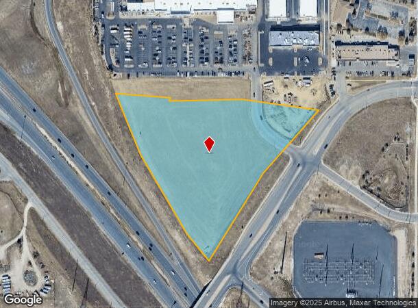
14222 W Tufts Ave
59-072-00-010
SECTION 07 TOWNSHIP 05 RANGE 69 QTR NW SIZE: 350575 VALUE: 8.048 KEY=053
Commercialnec
Jefferson
X
Colorado
08059C0293F
8.05 AC
2023
Southwest Denver
2024
Denver
012034
Denver-Aurora-Centennial, CO
DEMOGRAPHICS near 14222 W Tufts Ave
1 Mile
3 Mile
5 Mile
2024 Total Population
4,537
47,273
139,077
2029 Population
4,443
46,505
137,193
Pop Growth 2024-2029
(2.07%)
(1.62%)
(1.35%)
Average Age
40
42
42
2024 Total Households
1,659
17,577
55,892
HH Growth 2024-2029
(2.17%)
(1.73%)
(1.38%)
Median Household Inc
$115,753
$119,235
$104,445
Avg Household Size
2.70
2.60
2.40
2024 Avg HH Vehicles
3.00
2.00
2.00
Median Home Value
$559,103
$611,617
$567,564
Median Year Built
1978
1989
1985
Nearby Places
Map Layers
Map Styles
 Street
 Aerial
- Restaurants
- Banks
- Shops
- Fitness
- Groceries
PUBLIC TRANSPORTATION
AIRPORT
Denver International
DRIVE
WALK
Distance
Denver International
55 min
43.0 mi
SALE & LEASE HISTORY
LISTING DATE
SALE/LEASE

Sep 25, 2016
For Lease
Sep 24, 2016
For Sale
Aug 08, 2019
For Sale
Apr 19, 2017
For Sale
Nearby Properties
Address
Land Use
TOTAL SIZE
Lot Size
Zoning
Address
Land Use
TOTAL SIZE
Lot Size
Zoning
5,075 SF
1,955.14 AC
A2
Address
Land Use
TOTAL SIZE
Lot Size
Zoning
294,876 SF
12.25 AC
Address
Land Use
TOTAL SIZE
Lot Size
Zoning
150,951 SF
17.90 AC
PD
Address
Land Use
TOTAL SIZE
Lot Size
Zoning
151,602 SF
38.93 AC
Address
Land Use
TOTAL SIZE
Lot Size
Zoning
80,798 SF
12.27 AC
PD
Address
Land Use
TOTAL SIZE
Lot Size
Zoning
175,000 SF
36.25 AC
PD
Address
Land Use
TOTAL SIZE
Lot Size
Zoning
97,000 SF
9.88 AC
PD
Address
Land Use
TOTAL SIZE
Lot Size
Zoning
230,358 SF
13.64 AC
Address
Land Use
TOTAL SIZE
Lot Size
Zoning
218,391 SF
9.73 AC
PD
Address
Land Use
TOTAL SIZE
Lot Size
Zoning
70,614 SF
4.78 AC
CDOLI
Address
Land Use
TOTAL SIZE
Lot Size
Zoning
86,898 SF
8.70 AC
PD
Address
Land Use
TOTAL SIZE
Lot Size
Zoning
120,766 SF
20.56 AC
PD
Address
Land Use
TOTAL SIZE
Lot Size
Zoning
188,653 SF
17.64 AC
PD
Address
Land Use
TOTAL SIZE
Lot Size
Zoning
124,224 SF
1.56 AC
Address
Land Use
TOTAL SIZE
Lot Size
Zoning
65,463 SF
4.80 AC
PD
Address
Land Use
TOTAL SIZE
Lot Size
Zoning
68,365 SF
12.17 AC
PD
Address
Land Use
TOTAL SIZE
Lot Size
Zoning
107,693 SF
9.17 AC
PD
Address
Land Use
TOTAL SIZE
Lot Size
Zoning
57,221 SF
2.31 AC
Address
Land Use
TOTAL SIZE
Lot Size
Zoning
177,688 SF
8.45 AC
Address
Land Use
TOTAL SIZE
Lot Size
Zoning
53,107 SF
10.36 AC
C2
Address
Land Use
TOTAL SIZE
Lot Size
Zoning
20,000 SF
290.91 AC
A2
Address
Land Use
TOTAL SIZE
Lot Size
Zoning
77,135 SF
8.09 AC
Address
Land Use
TOTAL SIZE
Lot Size
Zoning
71,791 SF
24.38 AC
PD
Address
Land Use
TOTAL SIZE
Lot Size
Zoning
134.98 AC
PD
Address
Land Use
TOTAL SIZE
Lot Size
Zoning
72,694 SF
13.85 AC
Address
Land Use
TOTAL SIZE
Lot Size
Zoning
45,862 SF
10 AC
Address
Land Use
TOTAL SIZE
Lot Size
Zoning
52,184 SF
4.10 AC
PD
Address
Land Use
TOTAL SIZE
Lot Size
Zoning
56,769 SF
2.28 AC
Address
Land Use
TOTAL SIZE
Lot Size
Zoning
33,467 SF
2.51 AC
CDOLI
Address
Land Use
TOTAL SIZE
Lot Size
Zoning
64,336 SF
2.56 AC
PD
The World's #1 Commercial Real Estate Marketplace
Connect with us
© 2026 CoStar Group
The information above has been obtained from sources believed reliable. While we do not doubt its accuracy we have not verified it and make no guarantee, warranty or representation about it. It is your responsibility to independently confirm its accuracy and completeness. Any projections, opinions, assumptions, or estimates used are for example only and do not represent the current or future performance of the property. The value of this transaction to you depends on tax and other factors which should be evaluated by your tax, financial, and legal advisors. You and your advisors should conduct a careful, independent investigation of the property to determine to your satisfaction the suitability of the property for your needs.