Property Record
Cadle Creek Rd, Mayo, MD 21106
NEARBY LISTINGS FOR SALE OR LEASE
-
-
View all Mayo listings for sale on LoopNet.com
Property Detail
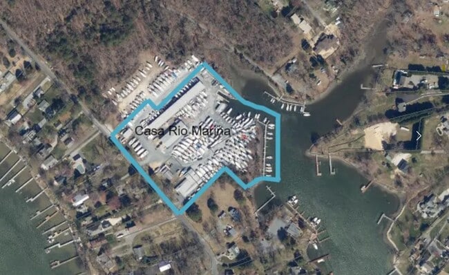
Cadle Creek Rd
Baltimore-Columbia-Towson, MD
Mayo
01-000-06918650
.99 ACRE CADLE CREEK RD MAYO
Commercialacreage
Anne Arundel
AE
Maryland
24003C0244F
0.99 AC
2024
Southern Anne Arundel
2025
Baltimore
701202
DEMOGRAPHICS near Cadle Creek Rd
1 Mile
3 Mile
5 Mile
2024 Total Population
3,010
10,375
45,452
2029 Population
3,067
10,651
46,636
Pop Growth 2024-2029
+ 1.89%
+ 2.66%
+ 2.60%
Average Age
42
42
42
2024 Total Households
1,142
3,866
17,419
HH Growth 2024-2029
+ 1.84%
+ 2.69%
+ 2.68%
Median Household Inc
$134,375
$135,368
$118,343
Avg Household Size
2.60
2.60
2.60
2024 Avg HH Vehicles
2.00
2.00
2.00
Median Home Value
$661,910
$621,944
$499,675
Median Year Built
1967
1979
1980
Nearby Places
Map Layers
Map Styles
 Street
 Aerial
- Restaurants
- Banks
- Shops
- Fitness
- Groceries
PUBLIC TRANSPORTATION
AIRPORT
Baltimore/Washington International Thurgood Marshall
DRIVE
WALK
Distance
Baltimore/Washington International Thurgood Marshall
47 min
30.5 mi
Ronald Reagan Washington Ntl
DRIVE
WALK
Distance
Ronald Reagan Washington Ntl
60 min
35.9 mi
Freight Ports
Port of Baltimore
DRIVE
WALK
Distance
Port of Baltimore
55 min
36.0 mi
SALE & LEASE HISTORY
LISTING DATE
SALE/LEASE

Dec 06, 2024
For Sale
Nearby Properties
Address
Land Use
TOTAL SIZE
Lot Size
Zoning
Address
Land Use
TOTAL SIZE
Lot Size
Zoning
341.13 AC
R5
Address
Land Use
TOTAL SIZE
Lot Size
Zoning
48,572 SF
7.27 AC
R2
Address
Land Use
TOTAL SIZE
Lot Size
Zoning
5,498 SF
17.69 AC
MB
Address
Land Use
TOTAL SIZE
Lot Size
Zoning
1,760 SF
323.30 AC
OS
Address
Land Use
TOTAL SIZE
Lot Size
Zoning
1,848 SF
1.68 AC
MC
Address
Land Use
TOTAL SIZE
Lot Size
Zoning
7,706 SF
5.30 AC
MA2
Address
Land Use
TOTAL SIZE
Lot Size
Zoning
350 AC
RA
Address
Land Use
TOTAL SIZE
Lot Size
Zoning
11,237 SF
19.14 AC
R1
Address
Land Use
TOTAL SIZE
Lot Size
Zoning
26,772 SF
3.45 AC
C1B
Address
Land Use
TOTAL SIZE
Lot Size
Zoning
27,500 SF
10 AC
C4
Address
Land Use
TOTAL SIZE
Lot Size
Zoning
15,106 SF
13.34 AC
MC
Address
Land Use
TOTAL SIZE
Lot Size
Zoning
5,206 SF
1.76 AC
MC
Address
Land Use
TOTAL SIZE
Lot Size
Zoning
4,773 SF
250.90 AC
OS
Address
Land Use
TOTAL SIZE
Lot Size
Zoning
100 AC
OS
Address
Land Use
TOTAL SIZE
Lot Size
Zoning
26,400 SF
5.89 AC
C4
Address
Land Use
TOTAL SIZE
Lot Size
Zoning
67,421 SF
6.98 AC
W1
Address
Land Use
TOTAL SIZE
Lot Size
Zoning
13,508 SF
15 AC
R1
Address
Land Use
TOTAL SIZE
Lot Size
Zoning
8,324 SF
5.14 AC
MB
Address
Land Use
TOTAL SIZE
Lot Size
Zoning
2,240 SF
1.01 AC
MA2
Address
Land Use
TOTAL SIZE
Lot Size
Zoning
10,084 SF
5.70 AC
RA
Address
Land Use
TOTAL SIZE
Lot Size
Zoning
4,854 SF
2.61 AC
MA3
Address
Land Use
TOTAL SIZE
Lot Size
Zoning
280 SF
2.04 AC
R2
Address
Land Use
TOTAL SIZE
Lot Size
Zoning
3,600 SF
3.79 AC
MB
Address
Land Use
TOTAL SIZE
Lot Size
Zoning
160 SF
1.61 AC
MA2
Address
Land Use
TOTAL SIZE
Lot Size
Zoning
20,158 SF
3.72 AC
MB
Address
Land Use
TOTAL SIZE
Lot Size
Zoning
4,446 SF
0.50 AC
R5
Address
Land Use
TOTAL SIZE
Lot Size
Zoning
4,783 SF
2.40 AC
C3
Address
Land Use
TOTAL SIZE
Lot Size
Zoning
3,781 SF
0.93 AC
R2
Address
Land Use
TOTAL SIZE
Lot Size
Zoning
1,786 SF
1.36 AC
MA2
Address
Land Use
TOTAL SIZE
Lot Size
Zoning
5,534 SF
1.29 AC
R1
The World's #1 Commercial Real Estate Marketplace
Connect with us
© 2025 CoStar Group
The information above has been obtained from sources believed reliable. While we do not doubt its accuracy we have not verified it and make no guarantee, warranty or representation about it. It is your responsibility to independently confirm its accuracy and completeness. Any projections, opinions, assumptions, or estimates used are for example only and do not represent the current or future performance of the property. The value of this transaction to you depends on tax and other factors which should be evaluated by your tax, financial, and legal advisors. You and your advisors should conduct a careful, independent investigation of the property to determine to your satisfaction the suitability of the property for your needs.