Property Record
Cahuilla Rd, Apple Valley, CA 92307


Save to a Folder
{{folder.Name}}
{{folder.ListingIds.length}} Properties
{{folder.ListingIds.length}} Property
Create a New Folder
Property Detail
Cahuilla Rd
Riverside-San Bernardino-Ontario, CA
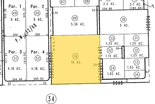
SW 1/4 SE 1/4 SE 1/4 SEC 2 TP 5N R 3W 10 AC
0437-531-16
SAN BERNARDINO
Vacantlandnec
California
B and X Area of moderate flood hazard, usually the area between the limits of the 100-year and 500-year floods.
10 AC
2025
Mojave River Valley
2026
Inland Empire (California)
009714
NEARBY LISTINGS FOR SALE OR LEASE
DEMOGRAPHICS near Cahuilla Rd
1 mile
3 mile
5 mile
2025 Total Population
2,155
12,630
43,054
2030 Population
2,204
12,824
43,638
Pop Growth 2025-2030
+ 2.27%
+ 1.54%
+ 1.36%
Average Age
40
39
38
2025 Total Households
705
4,106
13,964
HH Growth 2025-2030
+ 2.27%
+ 1.56%
+ 1.37%
Median Household Inc
$86,260
$83,403
$69,958
Avg Household Size
2.90
3.00
3.00
2025 Avg HH Vehicles
3.00
2.00
2.00
Median Home Value
$396,523
$390,671
$402,191
Median Year Built
1987
1986
1984
Nearby Places
Map Layers
Map Styles
 Street
 Aerial
Layers
 Traffic
 Biking
Places
Listings with unknown addresses are not visible on the map
- Restaurants
- Banks
- Shops
- Fitness
- Groceries
PUBLIC TRANSPORTATION
COMMUTER RAIL
Drive
Walk
Distance
21 min
9.7 mi
Nearby Properties
Address
Land Use
TOTAL SIZE
Lot Size
Zoning
Address
Land Use
TOTAL SIZE
Lot Size
Zoning
10,456 SF
53.41 AC
RL
Address
Land Use
TOTAL SIZE
Lot Size
Zoning
67.89 AC
Address
Land Use
TOTAL SIZE
Lot Size
Zoning
22,700 SF
6.19 AC
Address
Land Use
TOTAL SIZE
Lot Size
Zoning
35.63 AC
Address
Land Use
TOTAL SIZE
Lot Size
Zoning
35.60 AC
Address
Land Use
TOTAL SIZE
Lot Size
Zoning
35.11 AC
Address
Land Use
TOTAL SIZE
Lot Size
Zoning
35.08 AC
Address
Land Use
TOTAL SIZE
Lot Size
Zoning
Address
Land Use
TOTAL SIZE
Lot Size
Zoning
30,573 SF
Address
Land Use
TOTAL SIZE
Lot Size
Zoning
Address
Land Use
TOTAL SIZE
Lot Size
Zoning
30,573 SF
2.91 AC
Address
Land Use
TOTAL SIZE
Lot Size
Zoning
9.16 AC
Address
Land Use
TOTAL SIZE
Lot Size
Zoning
3,080 SF
1.87 AC
Address
Land Use
TOTAL SIZE
Lot Size
Zoning
29,615 SF
3.27 AC
Address
Land Use
TOTAL SIZE
Lot Size
Zoning
650 SF
11.80 AC
Address
Land Use
TOTAL SIZE
Lot Size
Zoning
Address
Land Use
TOTAL SIZE
Lot Size
Zoning
Address
Land Use
TOTAL SIZE
Lot Size
Zoning
Address
Land Use
TOTAL SIZE
Lot Size
Zoning
6,265 SF
5 AC
Address
Land Use
TOTAL SIZE
Lot Size
Zoning
12,500 SF
0.89 AC
Address
Land Use
TOTAL SIZE
Lot Size
Zoning
15,000 SF
0.69 AC
Address
Land Use
TOTAL SIZE
Lot Size
Zoning
14,300 SF
5 AC
Address
Land Use
TOTAL SIZE
Lot Size
Zoning
63.26 AC
Address
Land Use
TOTAL SIZE
Lot Size
Zoning
18.84 AC
Address
Land Use
TOTAL SIZE
Lot Size
Zoning
4.39 AC
Address
Land Use
TOTAL SIZE
Lot Size
Zoning
15,000 SF
14.48 AC
Address
Land Use
TOTAL SIZE
Lot Size
Zoning
Address
Land Use
TOTAL SIZE
Lot Size
Zoning
19.56 AC
Address
Land Use
TOTAL SIZE
Lot Size
Zoning
16.26 AC
The World's #1 Commercial Real Estate Marketplace
Connect with us
© 2026 CoStar Group
The information above has been obtained from sources believed reliable. While we do not doubt its accuracy we have not verified it and make no guarantee, warranty or representation about it. It is your responsibility to independently confirm its accuracy and completeness. Any projections, opinions, assumptions, or estimates used are for example only and do not represent the current or future performance of the property. The value of this transaction to you depends on tax and other factors which should be evaluated by your tax, financial, and legal advisors. You and your advisors should conduct a careful, independent investigation of the property to determine to your satisfaction the suitability of the property for your needs.