Property Record
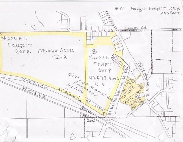
Cairns Rd, Mansfield, OH 44907

Property Detail
Cairns Rd
Mansfield, OH
SW 103.560 AC
066-69-002-01-000
RICHLAND
Agriculturalland
Ohio
A Areas with a 1% annual chance of flooding and a 26% chance of flooding over the life of a 30-year mortgage.
103.56 AC
2024
Richland County
2025
Cleveland
001100
NEARBY LISTINGS FOR SALE OR LEASE
DEMOGRAPHICS near Cairns Rd
1 mile
3 mile
5 mile
2025 Total Population
501
18,708
57,549
2030 Population
506
18,826
57,507
Pop Growth 2025-2030
+ 1.00%
+ 0.63%
(0.07%)
Average Age
42
41
41
2025 Total Households
198
5,657
22,497
HH Growth 2025-2030
0.00%
+ 0.83%
(0.12%)
Median Household Inc
$54,091
$42,745
$47,310
Avg Household Size
2.30
2.20
2.20
2025 Avg HH Vehicles
2.00
2.00
2.00
Median Home Value
$118,868
$91,197
$129,595
Median Year Built
1956
1960
1957
Nearby Places
Map Layers
Map Styles
 Street
 Aerial
Layers
 Traffic
 Biking
Places
Listings with unknown addresses are not visible on the map
- Restaurants
- Banks
- Shops
- Fitness
- Groceries
Nearby Properties
Address
Land Use
TOTAL SIZE
Lot Size
Zoning
Address
Land Use
TOTAL SIZE
Lot Size
Zoning
456.50 AC
Address
Land Use
TOTAL SIZE
Lot Size
Zoning
6,400 SF
137.67 AC
Address
Land Use
TOTAL SIZE
Lot Size
Zoning
354,710 SF
7.07 AC
Address
Land Use
TOTAL SIZE
Lot Size
Zoning
263,840 SF
16 AC
Address
Land Use
TOTAL SIZE
Lot Size
Zoning
27,360 SF
63.77 AC
Address
Land Use
TOTAL SIZE
Lot Size
Zoning
404,200 SF
14.77 AC
Address
Land Use
TOTAL SIZE
Lot Size
Zoning
221,864 SF
20 AC
Address
Land Use
TOTAL SIZE
Lot Size
Zoning
36,708 SF
12.56 AC
Address
Land Use
TOTAL SIZE
Lot Size
Zoning
318,366 SF
26.16 AC
Address
Land Use
TOTAL SIZE
Lot Size
Zoning
204,882 SF
32.98 AC
Address
Land Use
TOTAL SIZE
Lot Size
Zoning
458,316 SF
27.90 AC
Address
Land Use
TOTAL SIZE
Lot Size
Zoning
131,816 SF
17.69 AC
Address
Land Use
TOTAL SIZE
Lot Size
Zoning
15,490 SF
89.80 AC
Address
Land Use
TOTAL SIZE
Lot Size
Zoning
58,960 SF
2.30 AC
Address
Land Use
TOTAL SIZE
Lot Size
Zoning
4,950 SF
158.55 AC
Address
Land Use
TOTAL SIZE
Lot Size
Zoning
125,778 SF
11.63 AC
Address
Land Use
TOTAL SIZE
Lot Size
Zoning
27,501 SF
16.40 AC
Address
Land Use
TOTAL SIZE
Lot Size
Zoning
134,984 SF
17.98 AC
Address
Land Use
TOTAL SIZE
Lot Size
Zoning
161,800 SF
15.87 AC
Address
Land Use
TOTAL SIZE
Lot Size
Zoning
47.90 AC
Address
Land Use
TOTAL SIZE
Lot Size
Zoning
26,616 SF
1.10 AC
Address
Land Use
TOTAL SIZE
Lot Size
Zoning
161,297 SF
8.12 AC
Address
Land Use
TOTAL SIZE
Lot Size
Zoning
106,361 SF
5.06 AC
Address
Land Use
TOTAL SIZE
Lot Size
Zoning
6,968 SF
8.43 AC
Address
Land Use
TOTAL SIZE
Lot Size
Zoning
26,700 SF
1.08 AC
Address
Land Use
TOTAL SIZE
Lot Size
Zoning
53,034 SF
2.67 AC
Address
Land Use
TOTAL SIZE
Lot Size
Zoning
21,337 SF
11.30 AC
Address
Land Use
TOTAL SIZE
Lot Size
Zoning
80,956 SF
17.24 AC
Address
Land Use
TOTAL SIZE
Lot Size
Zoning
39,000 SF
20.35 AC
Address
Land Use
TOTAL SIZE
Lot Size
Zoning
31,064 SF
9 AC
The World's #1 Commercial Real Estate Marketplace
Connect with us
© 2026 CoStar Group
The information above has been obtained from sources believed reliable. While we do not doubt its accuracy we have not verified it and make no guarantee, warranty or representation about it. It is your responsibility to independently confirm its accuracy and completeness. Any projections, opinions, assumptions, or estimates used are for example only and do not represent the current or future performance of the property. The value of this transaction to you depends on tax and other factors which should be evaluated by your tax, financial, and legal advisors. You and your advisors should conduct a careful, independent investigation of the property to determine to your satisfaction the suitability of the property for your needs.