Property Record
Calk Rd, Tioga, TX 76271
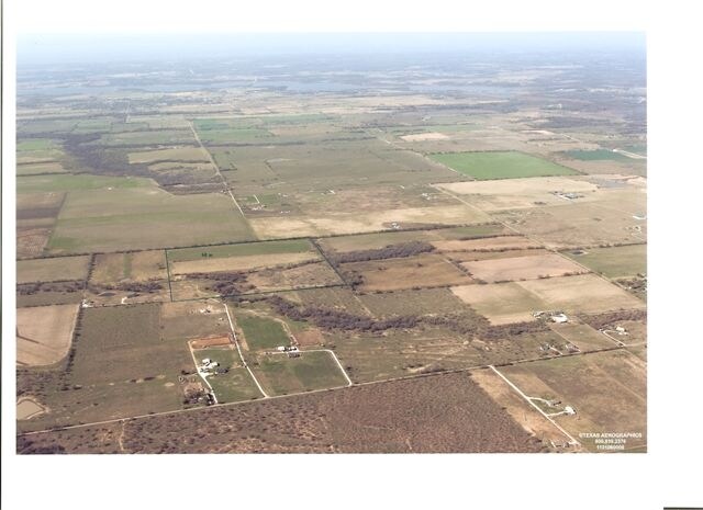

Property Detail
Calk Rd
Sherman-Denison, TX
G-0903 NOUNAN BEN S A-G0903, ACRES 60.441
131578
GRAYSON
Agriculturalland
Texas
B and X Area of moderate flood hazard, usually the area between the limits of the 100-year and 500-year floods.
60.44 AC
2024
Tioga
2025
Other Market Areas
001902
NEARBY LISTINGS FOR SALE OR LEASE
-
-
View all Tioga listings for sale on LoopNet.com
DEMOGRAPHICS near Calk Rd
1 mile
3 mile
5 mile
2024 Total Population
55
241
2,342
2029 Population
59
262
2,544
Pop Growth 2024-2029
+ 7.27%
+ 8.71%
+ 8.63%
Average Age
40
39
39
2024 Total Households
20
86
850
HH Growth 2024-2029
+ 10.00%
+ 8.14%
+ 8.71%
Median Household Inc
$74,999
$103,125
$92,815
Avg Household Size
2.70
2.80
2.70
2024 Avg HH Vehicles
2.00
3.00
2.00
Median Home Value
$350,000
$365,217
$350,404
Median Year Built
1997
2001
2000
Nearby Places
Map Layers
Map Styles
 Street
 Aerial
Transit
 Traffic
 Biking
Places
Listings with unknown addresses are not visible on the map
- Restaurants
- Banks
- Shops
- Fitness
- Groceries
SALE & LEASE HISTORY
LISTING DATE
SALE/LEASE

Jul 26, 2017
For Sale
Nearby Properties
Address
Land Use
TOTAL SIZE
Lot Size
Zoning
Address
Land Use
TOTAL SIZE
Lot Size
Zoning
2,400 SF
4.98 AC
Address
Land Use
TOTAL SIZE
Lot Size
Zoning
29,392 SF
8.56 AC
Address
Land Use
TOTAL SIZE
Lot Size
Zoning
7,677 SF
193.51 AC
Address
Land Use
TOTAL SIZE
Lot Size
Zoning
6,919 SF
193.34 AC
Address
Land Use
TOTAL SIZE
Lot Size
Zoning
5,320 SF
2.34 AC
Address
Land Use
TOTAL SIZE
Lot Size
Zoning
8,400 SF
3.12 AC
Address
Land Use
TOTAL SIZE
Lot Size
Zoning
5,870 SF
74.95 AC
Address
Land Use
TOTAL SIZE
Lot Size
Zoning
6,004 SF
33.72 AC
Address
Land Use
TOTAL SIZE
Lot Size
Zoning
3,845 SF
35.07 AC
Address
Land Use
TOTAL SIZE
Lot Size
Zoning
6,128 SF
5 AC
Address
Land Use
TOTAL SIZE
Lot Size
Zoning
3,560 SF
15 AC
Address
Land Use
TOTAL SIZE
Lot Size
Zoning
3,765 SF
5 AC
Address
Land Use
TOTAL SIZE
Lot Size
Zoning
2,547 SF
50 AC
Address
Land Use
TOTAL SIZE
Lot Size
Zoning
924 SF
2.45 AC
Address
Land Use
TOTAL SIZE
Lot Size
Zoning
3,782 SF
72.52 AC
Address
Land Use
TOTAL SIZE
Lot Size
Zoning
3,398 SF
17.28 AC
Address
Land Use
TOTAL SIZE
Lot Size
Zoning
2,234 SF
30.31 AC
Address
Land Use
TOTAL SIZE
Lot Size
Zoning
3,870 SF
11.47 AC
Address
Land Use
TOTAL SIZE
Lot Size
Zoning
5,747 SF
208.67 AC
Address
Land Use
TOTAL SIZE
Lot Size
Zoning
3,901 SF
9.96 AC
Address
Land Use
TOTAL SIZE
Lot Size
Zoning
2,474 SF
12.11 AC
Address
Land Use
TOTAL SIZE
Lot Size
Zoning
1,827 SF
6.89 AC
Address
Land Use
TOTAL SIZE
Lot Size
Zoning
1,312 SF
111.74 AC
Address
Land Use
TOTAL SIZE
Lot Size
Zoning
2,839 SF
63.13 AC
Address
Land Use
TOTAL SIZE
Lot Size
Zoning
1,738 SF
15.78 AC
Address
Land Use
TOTAL SIZE
Lot Size
Zoning
512 SF
182.39 AC
Address
Land Use
TOTAL SIZE
Lot Size
Zoning
1,584 SF
33.98 AC
Address
Land Use
TOTAL SIZE
Lot Size
Zoning
720 SF
125.81 AC
Address
Land Use
TOTAL SIZE
Lot Size
Zoning
2,198 SF
60.99 AC
The World's #1 Commercial Real Estate Marketplace
Connect with us
© 2026 CoStar Group
The information above has been obtained from sources believed reliable. While we do not doubt its accuracy we have not verified it and make no guarantee, warranty or representation about it. It is your responsibility to independently confirm its accuracy and completeness. Any projections, opinions, assumptions, or estimates used are for example only and do not represent the current or future performance of the property. The value of this transaction to you depends on tax and other factors which should be evaluated by your tax, financial, and legal advisors. You and your advisors should conduct a careful, independent investigation of the property to determine to your satisfaction the suitability of the property for your needs.