Property Record
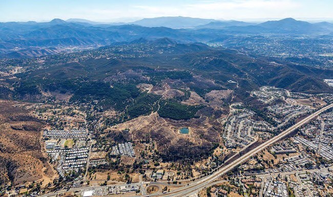
Camino Canada, El Cajon, CA 92021
Property Detail
Camino Canada
San Diego-Chula Vista-Carlsbad, CA
LOTS 48 & 49 POR TR DB0170PG071
401-040-05
SAN DIEGO
Orchard
California
A70
48,49
B and X Area of moderate flood hazard, usually the area between the limits of the 100-year and 500-year floods.
430.04 AC
2024
Outlying SD County S
2025
San Diego
015501
NEARBY LISTINGS FOR SALE OR LEASE
DEMOGRAPHICS near Camino Canada
1 mile
3 mile
5 mile
2025 Total Population
5,702
45,480
148,362
2030 Population
5,711
45,564
148,458
Pop Growth 2025-2030
+ 0.16%
+ 0.18%
+ 0.06%
Average Age
42
41
40
2025 Total Households
1,980
15,635
50,257
HH Growth 2025-2030
0.00%
(0.01%)
(0.10%)
Median Household Inc
$115,153
$106,282
$89,649
Avg Household Size
2.90
2.80
2.90
2025 Avg HH Vehicles
2.00
2.00
2.00
Median Home Value
$657,478
$682,817
$690,934
Median Year Built
1984
1978
1977
Nearby Places
Map Layers
Map Styles
 Street
 Aerial
Layers
 Traffic
 Biking
Places
Listings with unknown addresses are not visible on the map
- Restaurants
- Banks
- Shops
- Fitness
- Groceries
PUBLIC TRANSPORTATION
AIRPORT
San Diego International
Drive
Walk
Distance
San Diego International
40 min
25.0 mi
Freight Ports
Port of San Diego
Drive
Walk
Distance
Port of San Diego
38 min
23.8 mi
SALE & LEASE HISTORY
LISTING DATE
SALE/LEASE

Feb 01, 2018
For Sale
Nearby Properties
Address
Land Use
TOTAL SIZE
Lot Size
Zoning
Address
Land Use
TOTAL SIZE
Lot Size
Zoning
38.80 AC
RMH8
Address
Land Use
TOTAL SIZE
Lot Size
Zoning
67,722 SF
3.57 AC
RM-2500
Address
Land Use
TOTAL SIZE
Lot Size
Zoning
2,736 SF
32.31 AC
RS-20
Address
Land Use
TOTAL SIZE
Lot Size
Zoning
14.80 AC
S88
Address
Land Use
TOTAL SIZE
Lot Size
Zoning
56,525 SF
6.29 AC
S88
Address
Land Use
TOTAL SIZE
Lot Size
Zoning
35,424 SF
3.13 AC
RV
Address
Land Use
TOTAL SIZE
Lot Size
Zoning
3,368 SF
33.63 AC
RMH6
Address
Land Use
TOTAL SIZE
Lot Size
Zoning
50,607 SF
4.11 AC
C-G
Address
Land Use
TOTAL SIZE
Lot Size
Zoning
28,370 SF
3.31 AC
S88
Address
Land Use
TOTAL SIZE
Lot Size
Zoning
33,096 SF
1.11 AC
RC
Address
Land Use
TOTAL SIZE
Lot Size
Zoning
6.19 AC
RMH10
Address
Land Use
TOTAL SIZE
Lot Size
Zoning
38,483 SF
2.69 AC
M52
Address
Land Use
TOTAL SIZE
Lot Size
Zoning
93,812 SF
1.93 AC
M52
Address
Land Use
TOTAL SIZE
Lot Size
Zoning
19,169 SF
3.91 AC
C36
Address
Land Use
TOTAL SIZE
Lot Size
Zoning
280.85 AC
A70
Address
Land Use
TOTAL SIZE
Lot Size
Zoning
5,574 SF
2.87 AC
M52
Address
Land Use
TOTAL SIZE
Lot Size
Zoning
4.93 AC
RV
Address
Land Use
TOTAL SIZE
Lot Size
Zoning
5.07 AC
RS
Address
Land Use
TOTAL SIZE
Lot Size
Zoning
690 SF
8.43 AC
M52
Address
Land Use
TOTAL SIZE
Lot Size
Zoning
57,090 SF
1.98 AC
RV
Address
Land Use
TOTAL SIZE
Lot Size
Zoning
3,188 SF
11.54 AC
RRO
Address
Land Use
TOTAL SIZE
Lot Size
Zoning
19.94 AC
RMH7
Address
Land Use
TOTAL SIZE
Lot Size
Zoning
5 AC
RMH10
Address
Land Use
TOTAL SIZE
Lot Size
Zoning
6.11 AC
M54
Address
Land Use
TOTAL SIZE
Lot Size
Zoning
14.55 AC
O-P
Address
Land Use
TOTAL SIZE
Lot Size
Zoning
13,200 SF
1.16 AC
M52
Address
Land Use
TOTAL SIZE
Lot Size
Zoning
32,800 SF
3.40 AC
C-N
Address
Land Use
TOTAL SIZE
Lot Size
Zoning
3.53 AC
C-G
Address
Land Use
TOTAL SIZE
Lot Size
Zoning
27,529 SF
3.75 AC
RS-20
Address
Land Use
TOTAL SIZE
Lot Size
Zoning
4,831 SF
12.81 AC
RMH8
The World's #1 Commercial Real Estate Marketplace
Connect with us
© 2026 CoStar Group
The information above has been obtained from sources believed reliable. While we do not doubt its accuracy we have not verified it and make no guarantee, warranty or representation about it. It is your responsibility to independently confirm its accuracy and completeness. Any projections, opinions, assumptions, or estimates used are for example only and do not represent the current or future performance of the property. The value of this transaction to you depends on tax and other factors which should be evaluated by your tax, financial, and legal advisors. You and your advisors should conduct a careful, independent investigation of the property to determine to your satisfaction the suitability of the property for your needs.