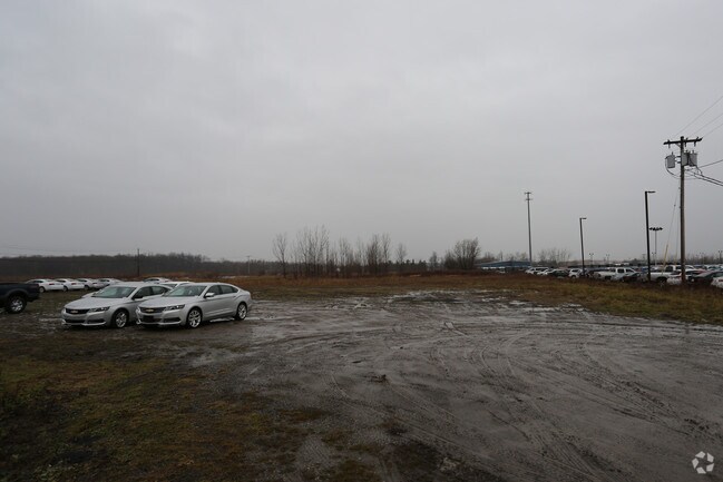
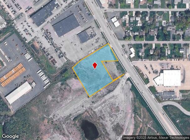
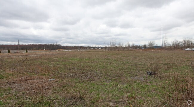
Property Record
Camp Rd, Hamburg, NY 14075
NEARBY LISTINGS FOR SALE OR LEASE
Property Detail
Camp Rd
Buffalo-Cheektowaga-Niagara Falls, NY
SPLIT 1990
144889-182-000-0002-037-200
Erie
Commercialacreage
New York
X
37.200
36029C0476H
2.50 AC
2025
South
2024
Buffalo/Niagara Falls
013400
DEMOGRAPHICS near Camp Rd
1 Mile
3 Mile
5 Mile
2024 Total Population
6,653
43,685
76,608
2029 Population
6,697
43,892
76,705
Pop Growth 2024-2029
+ 0.66%
+ 0.47%
+ 0.13%
Average Age
43
44
43
2024 Total Households
2,893
18,909
32,794
HH Growth 2024-2029
+ 0.48%
+ 0.35%
+ 0.04%
Median Household Inc
$76,960
$74,251
$73,071
Avg Household Size
2.30
2.20
2.30
2024 Avg HH Vehicles
2.00
2.00
2.00
Median Home Value
$229,139
$226,352
$218,722
Median Year Built
1979
1974
1971
Nearby Places
- Restaurants
- Banks
- Shops
- Fitness
- Groceries
PUBLIC TRANSPORTATION
AIRPORT
Buffalo Niagara International
DRIVE
WALK
Distance
Buffalo Niagara International
29 min
19.7 mi
Niagara Falls International
DRIVE
WALK
Distance
Niagara Falls International
46 min
30.4 mi
Freight Ports
Port of Toledo
DRIVE
WALK
Distance
Port of Toledo
343 min
292.2 mi
Nearby Properties
Address
Land Use
TOTAL SIZE
Lot Size
Zoning
Address
Land Use
TOTAL SIZE
Lot Size
Zoning
42.90 AC
M1
Address
Land Use
TOTAL SIZE
Lot Size
Zoning
14,835 SF
215.22 AC
C2
Address
Land Use
TOTAL SIZE
Lot Size
Zoning
184,188 SF
110.75 AC
Address
Land Use
TOTAL SIZE
Lot Size
Zoning
77,270 SF
46.15 AC
C3
Address
Land Use
TOTAL SIZE
Lot Size
Zoning
337,198 SF
51.05 AC
M1
Address
Land Use
TOTAL SIZE
Lot Size
Zoning
18,840 SF
114.12 AC
M3
Address
Land Use
TOTAL SIZE
Lot Size
Zoning
118,358 SF
59.67 AC
Address
Land Use
TOTAL SIZE
Lot Size
Zoning
218,461 SF
27.59 AC
C2
Address
Land Use
TOTAL SIZE
Lot Size
Zoning
34,888 SF
29 AC
C1
Address
Land Use
TOTAL SIZE
Lot Size
Zoning
91,618 SF
11.30 AC
Address
Land Use
TOTAL SIZE
Lot Size
Zoning
157,973 SF
16.50 AC
Address
Land Use
TOTAL SIZE
Lot Size
Zoning
10,486 SF
25.30 AC
R3
Address
Land Use
TOTAL SIZE
Lot Size
Zoning
86.94 AC
R4
Address
Land Use
TOTAL SIZE
Lot Size
Zoning
221,896 SF
21.50 AC
Address
Land Use
TOTAL SIZE
Lot Size
Zoning
5,600 SF
106.10 AC
PR
Address
Land Use
TOTAL SIZE
Lot Size
Zoning
137,276 SF
5.10 AC
Address
Land Use
TOTAL SIZE
Lot Size
Zoning
181,500 SF
58 AC
M3P
Address
Land Use
TOTAL SIZE
Lot Size
Zoning
8,352 SF
27.62 AC
R3
Address
Land Use
TOTAL SIZE
Lot Size
Zoning
127,582 SF
77.30 AC
Address
Land Use
TOTAL SIZE
Lot Size
Zoning
7,448 SF
24.51 AC
R3
Address
Land Use
TOTAL SIZE
Lot Size
Zoning
6,768 SF
13.89 AC
R3
Address
Land Use
TOTAL SIZE
Lot Size
Zoning
7,680 SF
14.20 AC
R3
Address
Land Use
TOTAL SIZE
Lot Size
Zoning
7,448 SF
12.16 AC
Address
Land Use
TOTAL SIZE
Lot Size
Zoning
74,669 SF
9.23 AC
Address
Land Use
TOTAL SIZE
Lot Size
Zoning
33,296 SF
12.50 AC
C1
Address
Land Use
TOTAL SIZE
Lot Size
Zoning
62,338 SF
10.27 AC
C1
Address
Land Use
TOTAL SIZE
Lot Size
Zoning
136,770 SF
15.20 AC
Address
Land Use
TOTAL SIZE
Lot Size
Zoning
2,252 SF
7.01 AC
R3
Address
Land Use
TOTAL SIZE
Lot Size
Zoning
139,145 SF
33.24 AC
C1
Address
Land Use
TOTAL SIZE
Lot Size
Zoning
8,352 SF
16.89 AC
R3
The World's #1 Commercial Real Estate Marketplace
Connect with us
© 2025 CoStar Group
The information above has been obtained from sources believed reliable. While we do not doubt its accuracy we have not verified it and make no guarantee, warranty or representation about it. It is your responsibility to independently confirm its accuracy and completeness. Any projections, opinions, assumptions, or estimates used are for example only and do not represent the current or future performance of the property. The value of this transaction to you depends on tax and other factors which should be evaluated by your tax, financial, and legal advisors. You and your advisors should conduct a careful, independent investigation of the property to determine to your satisfaction the suitability of the property for your needs.