Property Record
Cane Branch Rd, Walterboro, SC 29488


NEARBY LISTINGS FOR SALE OR LEASE
-
-
View all Walterboro listings for sale on LoopNet.com
Property Detail
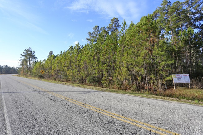
Cane Branch Rd
178-00-00-292
TRACT S-15-193 CANE BRANCH RD MAPPLATB 791 MAPPLATP 6
Commercialacreage
Colleton
X
South Carolina
45029C0315G
2.50 AC
2025
I-95 Walterboro/Hardeeville
2024
Other Market Areas
970502
DEMOGRAPHICS near Cane Branch Rd
1 Mile
3 Mile
5 Mile
2024 Total Population
355
2,701
11,490
2029 Population
349
2,656
11,370
Pop Growth 2024-2029
(1.69%)
(1.67%)
(1.04%)
Average Age
38
39
41
2024 Total Households
148
1,128
4,752
HH Growth 2024-2029
(2.03%)
(1.86%)
(1.18%)
Median Household Inc
$34,721
$40,819
$41,227
Avg Household Size
2.40
2.40
2.40
2024 Avg HH Vehicles
1.00
2.00
2.00
Median Home Value
$172,413
$155,411
$122,400
Median Year Built
1988
1986
1980
Nearby Places
Map Layers
Map Styles
 Street
 Aerial
- Restaurants
- Banks
- Shops
- Fitness
- Groceries
SALE & LEASE HISTORY
LISTING DATE
SALE/LEASE

Jan 14, 2019
For Sale
Nearby Properties
Address
Land Use
TOTAL SIZE
Lot Size
Zoning
Address
Land Use
TOTAL SIZE
Lot Size
Zoning
44,016 SF
2.90 AC
UD
Address
Land Use
TOTAL SIZE
Lot Size
Zoning
30,757 SF
46.20 AC
UD
Address
Land Use
TOTAL SIZE
Lot Size
Zoning
58,716 SF
2.20 AC
Address
Land Use
TOTAL SIZE
Lot Size
Zoning
4,936 SF
10.70 AC
UD
Address
Land Use
TOTAL SIZE
Lot Size
Zoning
43,660 SF
5.40 AC
Address
Land Use
TOTAL SIZE
Lot Size
Zoning
36,012 SF
3 AC
UD
Address
Land Use
TOTAL SIZE
Lot Size
Zoning
1,706 SF
5.30 AC
UD
Address
Land Use
TOTAL SIZE
Lot Size
Zoning
24,149 SF
6.30 AC
UD
Address
Land Use
TOTAL SIZE
Lot Size
Zoning
24,530 SF
2.60 AC
UD
Address
Land Use
TOTAL SIZE
Lot Size
Zoning
31,262 SF
5.10 AC
Address
Land Use
TOTAL SIZE
Lot Size
Zoning
3,808 SF
1.20 AC
UD
Address
Land Use
TOTAL SIZE
Lot Size
Zoning
2,100 SF
1.01 AC
UD
Address
Land Use
TOTAL SIZE
Lot Size
Zoning
29,478 SF
2.30 AC
UD
Address
Land Use
TOTAL SIZE
Lot Size
Zoning
20,258 SF
15.30 AC
UD
Address
Land Use
TOTAL SIZE
Lot Size
Zoning
24,113 SF
2.70 AC
UD
Address
Land Use
TOTAL SIZE
Lot Size
Zoning
28,642 SF
1.90 AC
UD
Address
Land Use
TOTAL SIZE
Lot Size
Zoning
44,076 SF
3 AC
UD
Address
Land Use
TOTAL SIZE
Lot Size
Zoning
19,387 SF
3 AC
UD
Address
Land Use
TOTAL SIZE
Lot Size
Zoning
19.50 AC
Address
Land Use
TOTAL SIZE
Lot Size
Zoning
9,823 SF
3.30 AC
UD
Address
Land Use
TOTAL SIZE
Lot Size
Zoning
5,290 SF
1.20 AC
UD
Address
Land Use
TOTAL SIZE
Lot Size
Zoning
3,970 SF
13.40 AC
UD
Address
Land Use
TOTAL SIZE
Lot Size
Zoning
27,057 SF
4.20 AC
UD
Address
Land Use
TOTAL SIZE
Lot Size
Zoning
14,014 SF
9 AC
UD
Address
Land Use
TOTAL SIZE
Lot Size
Zoning
19,396 SF
3.20 AC
UD
Address
Land Use
TOTAL SIZE
Lot Size
Zoning
7,856 SF
4.60 AC
UD
Address
Land Use
TOTAL SIZE
Lot Size
Zoning
11,220 SF
1.30 AC
UD
Address
Land Use
TOTAL SIZE
Lot Size
Zoning
11,295 SF
0.80 AC
UD
Address
Land Use
TOTAL SIZE
Lot Size
Zoning
18,081 SF
1.10 AC
UD
Address
Land Use
TOTAL SIZE
Lot Size
Zoning
18.90 AC
UD
The World's #1 Commercial Real Estate Marketplace
Connect with us
© 2026 CoStar Group
The information above has been obtained from sources believed reliable. While we do not doubt its accuracy we have not verified it and make no guarantee, warranty or representation about it. It is your responsibility to independently confirm its accuracy and completeness. Any projections, opinions, assumptions, or estimates used are for example only and do not represent the current or future performance of the property. The value of this transaction to you depends on tax and other factors which should be evaluated by your tax, financial, and legal advisors. You and your advisors should conduct a careful, independent investigation of the property to determine to your satisfaction the suitability of the property for your needs.