Property Record
Cane Branch Rd, Walterboro, SC 29488
Property Detail
Cane Branch Rd
192-00-00-001
TRACT SC63 SNIDERS HWY W WBORO MAPPLATB 9 MAPPLATP 24
Agriculturalland
COLLETON
UD
South Carolina
B and X Area of moderate flood hazard, usually the area between the limits of the 100-year and 500-year floods.
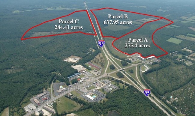
191.30 AC
2025
I-95 Walterboro/Hardeeville
2025
Other Market Areas
970502
NEARBY LISTINGS FOR SALE OR LEASE
-
-
View all Walterboro listings for sale on LoopNet.com
DEMOGRAPHICS near Cane Branch Rd
1 mile
3 mile
5 mile
2025 Total Population
198
2,287
10,351
2030 Population
200
2,324
10,452
Pop Growth 2025-2030
+ 1.01%
+ 1.62%
+ 0.98%
Average Age
37
39
41
2025 Total Households
81
950
4,288
HH Growth 2025-2030
+ 1.23%
+ 1.58%
+ 0.82%
Median Household Inc
$31,125
$36,518
$47,280
Avg Household Size
2.50
2.40
2.40
2025 Avg HH Vehicles
1.00
2.00
2.00
Median Home Value
$237,500
$258,064
$194,006
Median Year Built
1987
1989
1979
Nearby Places
Map Layers
Map Styles
 Street
 Aerial
Layers
 Traffic
 Biking
Places
Listings with unknown addresses are not visible on the map
- Restaurants
- Banks
- Shops
- Fitness
- Groceries
SALE & LEASE HISTORY
LISTING DATE
SALE/LEASE

Sep 24, 2016
For Sale
Sep 24, 2016
For Sale
Sep 24, 2016
For Sale
Jun 14, 2018
For Sale
Nearby Properties
Address
Land Use
TOTAL SIZE
Lot Size
Zoning
Address
Land Use
TOTAL SIZE
Lot Size
Zoning
4,936 SF
10.70 AC
UD
Address
Land Use
TOTAL SIZE
Lot Size
Zoning
44,016 SF
2.90 AC
UD
Address
Land Use
TOTAL SIZE
Lot Size
Zoning
30,757 SF
46.20 AC
UD
Address
Land Use
TOTAL SIZE
Lot Size
Zoning
58,716 SF
2.20 AC
Address
Land Use
TOTAL SIZE
Lot Size
Zoning
43,660 SF
5.40 AC
Address
Land Use
TOTAL SIZE
Lot Size
Zoning
36,012 SF
3 AC
UD
Address
Land Use
TOTAL SIZE
Lot Size
Zoning
1,706 SF
5.30 AC
UD
Address
Land Use
TOTAL SIZE
Lot Size
Zoning
24,149 SF
6.30 AC
UD
Address
Land Use
TOTAL SIZE
Lot Size
Zoning
24,530 SF
2.60 AC
UD
Address
Land Use
TOTAL SIZE
Lot Size
Zoning
31,262 SF
5.10 AC
Address
Land Use
TOTAL SIZE
Lot Size
Zoning
3,808 SF
1.20 AC
UD
Address
Land Use
TOTAL SIZE
Lot Size
Zoning
2,100 SF
1 AC
UD
Address
Land Use
TOTAL SIZE
Lot Size
Zoning
29,478 SF
2.30 AC
UD
Address
Land Use
TOTAL SIZE
Lot Size
Zoning
20,258 SF
15.30 AC
UD
Address
Land Use
TOTAL SIZE
Lot Size
Zoning
2.20 AC
UD
Address
Land Use
TOTAL SIZE
Lot Size
Zoning
24,113 SF
2.70 AC
UD
Address
Land Use
TOTAL SIZE
Lot Size
Zoning
28,642 SF
1.90 AC
UD
Address
Land Use
TOTAL SIZE
Lot Size
Zoning
44,076 SF
3 AC
UD
Address
Land Use
TOTAL SIZE
Lot Size
Zoning
19.50 AC
Address
Land Use
TOTAL SIZE
Lot Size
Zoning
19,387 SF
3 AC
UD
Address
Land Use
TOTAL SIZE
Lot Size
Zoning
9,823 SF
3.30 AC
UD
Address
Land Use
TOTAL SIZE
Lot Size
Zoning
5,290 SF
1.20 AC
UD
Address
Land Use
TOTAL SIZE
Lot Size
Zoning
3,970 SF
13.40 AC
UD
Address
Land Use
TOTAL SIZE
Lot Size
Zoning
19,396 SF
3.20 AC
UD
Address
Land Use
TOTAL SIZE
Lot Size
Zoning
7,856 SF
4.60 AC
UD
Address
Land Use
TOTAL SIZE
Lot Size
Zoning
11,295 SF
0.80 AC
UD
Address
Land Use
TOTAL SIZE
Lot Size
Zoning
18,081 SF
1.10 AC
UD
Address
Land Use
TOTAL SIZE
Lot Size
Zoning
18.90 AC
UD
Address
Land Use
TOTAL SIZE
Lot Size
Zoning
3,362 SF
0.52 AC
UD
Address
Land Use
TOTAL SIZE
Lot Size
Zoning
30,548 SF
2.10 AC
The World's #1 Commercial Real Estate Marketplace
Connect with us
© 2026 CoStar Group
The information above has been obtained from sources believed reliable. While we do not doubt its accuracy we have not verified it and make no guarantee, warranty or representation about it. It is your responsibility to independently confirm its accuracy and completeness. Any projections, opinions, assumptions, or estimates used are for example only and do not represent the current or future performance of the property. The value of this transaction to you depends on tax and other factors which should be evaluated by your tax, financial, and legal advisors. You and your advisors should conduct a careful, independent investigation of the property to determine to your satisfaction the suitability of the property for your needs.