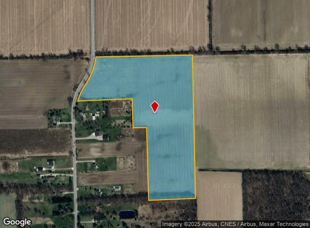
Property Record
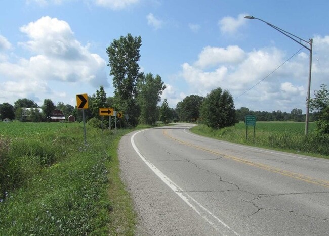
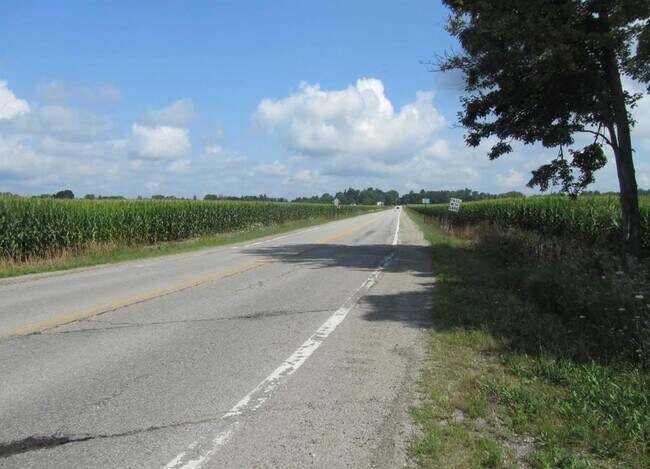
Capac Rd, Armada, MI 48005
This Property Is For Sale
Property Detail
Capac Rd
13-02-04-100-022
02-04-100-022 SEC 4 T5N R13E COMM NW 1/4 COR, TH ALG N SEC LN S 89-45-53 E 240.51 FT TO SW 1/4 COR SEC 33 T6N,R13E; TH EXT
Agriculturalland
Macomb
X
Michigan
26147C0265D
27.91 AC
2025
St Clair & Lapeer Counties
2025
Detroit
212000
Detroit-Warren-Dearborn, MI
NEARBY LISTINGS FOR SALE OR LEASE
-
-
View all Armada listings for sale on LoopNet.com
DEMOGRAPHICS near Capac Rd
1 mile
3 mile
5 mile
2024 Total Population
397
2,890
9,998
2029 Population
391
2,849
9,864
Pop Growth 2024-2029
(1.51%)
(1.42%)
(1.34%)
Average Age
43
43
43
2024 Total Households
143
1,036
3,581
HH Growth 2024-2029
(1.40%)
(1.54%)
(1.54%)
Median Household Inc
$74,422
$80,877
$89,677
Avg Household Size
2.70
2.70
2.70
2024 Avg HH Vehicles
3.00
3.00
3.00
Median Home Value
$274,999
$279,564
$275,418
Median Year Built
1976
1977
1979
Nearby Places
Map Layers
Map Styles
 Street
 Aerial
Transit
 Traffic
 Biking
Places
Listings with unknown addresses are not visible on the map
- Restaurants
- Banks
- Shops
- Fitness
- Groceries
Nearby Properties
Address
Land Use
TOTAL SIZE
Lot Size
Zoning
Address
Land Use
TOTAL SIZE
Lot Size
Zoning
2,259 SF
120 AC
AG 1.75
Address
Land Use
TOTAL SIZE
Lot Size
Zoning
6,284 SF
51.99 AC
R-S
Address
Land Use
TOTAL SIZE
Lot Size
Zoning
1,932 SF
108 AC
AG 1.75
Address
Land Use
TOTAL SIZE
Lot Size
Zoning
4,160 SF
235.05 AC
AG 1.75
Address
Land Use
TOTAL SIZE
Lot Size
Zoning
251.54 AC
AG
Address
Land Use
TOTAL SIZE
Lot Size
Zoning
2,232 SF
20.14 AC
AG 1.75
Address
Land Use
TOTAL SIZE
Lot Size
Zoning
3,350 SF
10.01 AC
AG 1.75
Address
Land Use
TOTAL SIZE
Lot Size
Zoning
2,896 SF
10.03 AC
AG 1.75
Address
Land Use
TOTAL SIZE
Lot Size
Zoning
3,436 SF
54.24 AC
AG 1.75
Address
Land Use
TOTAL SIZE
Lot Size
Zoning
1,404 SF
181.35 AC
AG 1.75
Address
Land Use
TOTAL SIZE
Lot Size
Zoning
3,326 SF
14 AC
AG
Address
Land Use
TOTAL SIZE
Lot Size
Zoning
2,872 SF
2.35 AC
AG 1.75
Address
Land Use
TOTAL SIZE
Lot Size
Zoning
3,884 SF
9.84 AC
AR
Address
Land Use
TOTAL SIZE
Lot Size
Zoning
2,555 SF
14.42 AC
AG 1.75
Address
Land Use
TOTAL SIZE
Lot Size
Zoning
4,756 SF
1.02 AC
AG 1.75
Address
Land Use
TOTAL SIZE
Lot Size
Zoning
3,010 SF
14.39 AC
AG 1.75
Address
Land Use
TOTAL SIZE
Lot Size
Zoning
3,837 SF
4 AC
R-S
Address
Land Use
TOTAL SIZE
Lot Size
Zoning
3,726 SF
9.70 AC
AG 1.75
Address
Land Use
TOTAL SIZE
Lot Size
Zoning
1,350 SF
158 AC
AG
Address
Land Use
TOTAL SIZE
Lot Size
Zoning
4,628 SF
7.66 AC
AG
Address
Land Use
TOTAL SIZE
Lot Size
Zoning
173.60 AC
AG
Address
Land Use
TOTAL SIZE
Lot Size
Zoning
3,243 SF
6.75 AC
AG 1.75
Address
Land Use
TOTAL SIZE
Lot Size
Zoning
3,708 SF
8.01 AC
AR
Address
Land Use
TOTAL SIZE
Lot Size
Zoning
2,891 SF
10 AC
R-S
Address
Land Use
TOTAL SIZE
Lot Size
Zoning
5,378 SF
10 AC
AG 1.75
Address
Land Use
TOTAL SIZE
Lot Size
Zoning
4,919 SF
119.16 AC
AG
Address
Land Use
TOTAL SIZE
Lot Size
Zoning
240 AC
AG 1.75
Address
Land Use
TOTAL SIZE
Lot Size
Zoning
2,284 SF
116.92 AC
AG 1.75
Address
Land Use
TOTAL SIZE
Lot Size
Zoning
3,324 SF
9.85 AC
AR
Address
Land Use
TOTAL SIZE
Lot Size
Zoning
2,593 SF
47.61 AC
AG 1.75
The World's #1 Commercial Real Estate Marketplace
Connect with us
© 2026 CoStar Group
The information above has been obtained from sources believed reliable. While we do not doubt its accuracy we have not verified it and make no guarantee, warranty or representation about it. It is your responsibility to independently confirm its accuracy and completeness. Any projections, opinions, assumptions, or estimates used are for example only and do not represent the current or future performance of the property. The value of this transaction to you depends on tax and other factors which should be evaluated by your tax, financial, and legal advisors. You and your advisors should conduct a careful, independent investigation of the property to determine to your satisfaction the suitability of the property for your needs.