Property Record
Carl-Cedar Hill Rd, Winder, GA 30680


Property Detail
Carl-Cedar Hill Rd
Atlanta-Sandy Springs-Roswell, GA
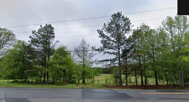
CARL-CEDAR HILL RD
CA03-005A
BARROW
Agriculturalland
Georgia
M-2
41.48 AC
2025
Barrow County
2025
Atlanta
180203
NEARBY LISTINGS FOR SALE OR LEASE
DEMOGRAPHICS near Carl-Cedar Hill Rd
1 mile
3 mile
5 mile
2025 Total Population
2,666
17,235
58,792
2030 Population
2,974
19,359
65,082
Pop Growth 2025-2030
+ 11.55%
+ 12.32%
+ 10.70%
Average Age
38
38
38
2025 Total Households
900
5,862
19,365
HH Growth 2025-2030
+ 11.67%
+ 12.49%
+ 10.97%
Median Household Inc
$66,152
$74,347
$81,471
Avg Household Size
3.00
2.90
3.00
2025 Avg HH Vehicles
2.00
2.00
2.00
Median Home Value
$250,214
$284,865
$332,636
Median Year Built
1989
1993
2000
Nearby Places
Map Layers
Map Styles
 Street
 Aerial
Layers
 Traffic
 Biking
Places
Listings with unknown addresses are not visible on the map
- Restaurants
- Banks
- Shops
- Fitness
- Groceries
SALE & LEASE HISTORY
LISTING DATE
SALE/LEASE

Sep 24, 2023
For Sale
Nearby Properties
Address
Land Use
TOTAL SIZE
Lot Size
Zoning
Address
Land Use
TOTAL SIZE
Lot Size
Zoning
222,481 SF
23.21 AC
M-1
Address
Land Use
TOTAL SIZE
Lot Size
Zoning
Address
Land Use
TOTAL SIZE
Lot Size
Zoning
165,737 SF
124.90 AC
G
Address
Land Use
TOTAL SIZE
Lot Size
Zoning
690,427 SF
156.03 AC
M-1
Address
Land Use
TOTAL SIZE
Lot Size
Zoning
202,250 SF
36.84 AC
M-1
Address
Land Use
TOTAL SIZE
Lot Size
Zoning
137,200 SF
20 AC
M-2
Address
Land Use
TOTAL SIZE
Lot Size
Zoning
84,363 SF
20.81 AC
C-2
Address
Land Use
TOTAL SIZE
Lot Size
Zoning
24,188 SF
40.70 AC
M-1
Address
Land Use
TOTAL SIZE
Lot Size
Zoning
26,616 SF
0.66 AC
Address
Land Use
TOTAL SIZE
Lot Size
Zoning
69,285 SF
53.11 AC
M-2
Address
Land Use
TOTAL SIZE
Lot Size
Zoning
59,898 SF
38.86 AC
M-1
Address
Land Use
TOTAL SIZE
Lot Size
Zoning
65,500 SF
10.50 AC
DOWNTOWN O
Address
Land Use
TOTAL SIZE
Lot Size
Zoning
71,300 SF
13.82 AC
M-2
Address
Land Use
TOTAL SIZE
Lot Size
Zoning
24,400 SF
20 AC
M-2
Address
Land Use
TOTAL SIZE
Lot Size
Zoning
60,307 SF
33.41 AC
AG
Address
Land Use
TOTAL SIZE
Lot Size
Zoning
387.40 AC
AG
Address
Land Use
TOTAL SIZE
Lot Size
Zoning
1,736 SF
24.24 AC
RM8
Address
Land Use
TOTAL SIZE
Lot Size
Zoning
2,455 SF
14.74 AC
RM8
Address
Land Use
TOTAL SIZE
Lot Size
Zoning
2,601 SF
52.16 AC
R-3
Address
Land Use
TOTAL SIZE
Lot Size
Zoning
7,800 SF
2.82 AC
PSV
Address
Land Use
TOTAL SIZE
Lot Size
Zoning
6,000 SF
25.37 AC
M-2
Address
Land Use
TOTAL SIZE
Lot Size
Zoning
12,742 SF
8.83 AC
M-1
Address
Land Use
TOTAL SIZE
Lot Size
Zoning
36,450 SF
7.80 AC
M-2
Address
Land Use
TOTAL SIZE
Lot Size
Zoning
3,960 SF
5 AC
M-2
Address
Land Use
TOTAL SIZE
Lot Size
Zoning
74.19 AC
R1 C1
Address
Land Use
TOTAL SIZE
Lot Size
Zoning
76.58 AC
RA200
Address
Land Use
TOTAL SIZE
Lot Size
Zoning
70.98 AC
Address
Land Use
TOTAL SIZE
Lot Size
Zoning
24,000 SF
6.04 AC
M-1
Address
Land Use
TOTAL SIZE
Lot Size
Zoning
14,000 SF
11.07 AC
M-1
Address
Land Use
TOTAL SIZE
Lot Size
Zoning
82.32 AC
RA200
The World's #1 Commercial Real Estate Marketplace
Connect with us
© 2026 CoStar Group
The information above has been obtained from sources believed reliable. While we do not doubt its accuracy we have not verified it and make no guarantee, warranty or representation about it. It is your responsibility to independently confirm its accuracy and completeness. Any projections, opinions, assumptions, or estimates used are for example only and do not represent the current or future performance of the property. The value of this transaction to you depends on tax and other factors which should be evaluated by your tax, financial, and legal advisors. You and your advisors should conduct a careful, independent investigation of the property to determine to your satisfaction the suitability of the property for your needs.