Property Record
Fm 1732, Brownsville, TX 78520
This Property Is For Sale
NEARBY LISTINGS FOR SALE OR LEASE
Property Detail
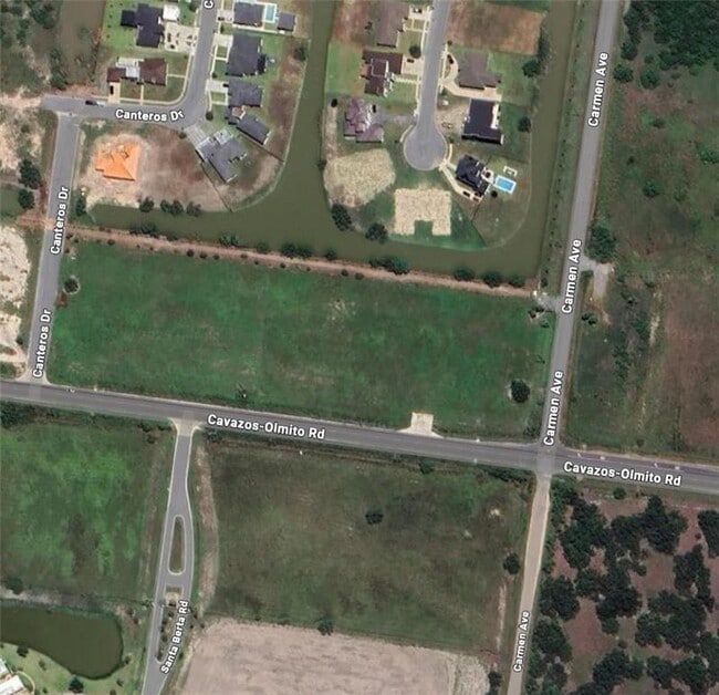
Fm 1732
Brownsville-Harlingen, TX
Las Haciendas At Rancho Viejo Sub Sec I
790126-0010-001000
LOT 1 BLK 1 LAS HACIENDAS AT RANCHO VIEJO SUB SEC I AMENDED PLAT (2019 C1-3689 CCMR FILED 2/15/2018)(2017 C1-3542 CCMR FILED 12/02/2016)
Vacantlandnec
Cameron
AO
Texas
48061C0445F
1
2024
4.06 AC
2025
Outlying Cameron County
012900
Brownsville/Harlingen
DEMOGRAPHICS near Fm 1732
1 Mile
3 Mile
5 Mile
2024 Total Population
1,051
19,318
55,459
2029 Population
1,106
20,078
57,168
Pop Growth 2024-2029
+ 5.23%
+ 3.93%
+ 3.08%
Average Age
37
35
35
2024 Total Households
327
5,364
15,688
HH Growth 2024-2029
+ 5.20%
+ 4.23%
+ 3.28%
Median Household Inc
$81,976
$76,217
$74,360
Avg Household Size
3.20
3.40
3.40
2024 Avg HH Vehicles
2.00
2.00
2.00
Median Home Value
$263,235
$229,316
$204,621
Median Year Built
2002
2004
2004
Nearby Places
- Restaurants
- Banks
- Shops
- Fitness
- Groceries
PUBLIC TRANSPORTATION
AIRPORT
Brownsville/South Padre Island International
DRIVE
WALK
Distance
Brownsville/South Padre Island International
21 min
13.2 mi
Valley International
DRIVE
WALK
Distance
Valley International
29 min
21.2 mi
Freight Ports
Port of Brownsville
DRIVE
WALK
Distance
Port of Brownsville
16 min
12.6 mi
Nearby Properties
Address
Land Use
TOTAL SIZE
Lot Size
Zoning
Address
Land Use
TOTAL SIZE
Lot Size
Zoning
72,320 SF
27.36 AC
Address
Land Use
TOTAL SIZE
Lot Size
Zoning
171,375 SF
8.99 AC
Address
Land Use
TOTAL SIZE
Lot Size
Zoning
155,855 SF
14.65 AC
C
Address
Land Use
TOTAL SIZE
Lot Size
Zoning
80,493 SF
4.40 AC
Address
Land Use
TOTAL SIZE
Lot Size
Zoning
122,224 SF
9.93 AC
Address
Land Use
TOTAL SIZE
Lot Size
Zoning
121,377 SF
12.63 AC
Address
Land Use
TOTAL SIZE
Lot Size
Zoning
27,047 SF
1.93 AC
Address
Land Use
TOTAL SIZE
Lot Size
Zoning
1,059.47 AC
Address
Land Use
TOTAL SIZE
Lot Size
Zoning
6,084 SF
159.42 AC
Address
Land Use
TOTAL SIZE
Lot Size
Zoning
9,071 SF
0.82 AC
Address
Land Use
TOTAL SIZE
Lot Size
Zoning
29,040 SF
3 AC
Address
Land Use
TOTAL SIZE
Lot Size
Zoning
3,942 SF
3.38 AC
Address
Land Use
TOTAL SIZE
Lot Size
Zoning
5,580 SF
1.38 AC
A-C
Address
Land Use
TOTAL SIZE
Lot Size
Zoning
47.25 AC
Address
Land Use
TOTAL SIZE
Lot Size
Zoning
19,560 SF
0.82 AC
Address
Land Use
TOTAL SIZE
Lot Size
Zoning
24,730 SF
6.86 AC
Address
Land Use
TOTAL SIZE
Lot Size
Zoning
12,500 SF
21.37 AC
Address
Land Use
TOTAL SIZE
Lot Size
Zoning
9,016 SF
2 AC
Address
Land Use
TOTAL SIZE
Lot Size
Zoning
4,250 SF
2.70 AC
C
Address
Land Use
TOTAL SIZE
Lot Size
Zoning
22,514 SF
4 AC
Address
Land Use
TOTAL SIZE
Lot Size
Zoning
6,430 SF
1.58 AC
Address
Land Use
TOTAL SIZE
Lot Size
Zoning
7,308 SF
0.77 AC
C
Address
Land Use
TOTAL SIZE
Lot Size
Zoning
25,212 SF
8.01 AC
A-C
Address
Land Use
TOTAL SIZE
Lot Size
Zoning
25,023 SF
7.54 AC
A-C
Address
Land Use
TOTAL SIZE
Lot Size
Zoning
13,750 SF
24.24 AC
Address
Land Use
TOTAL SIZE
Lot Size
Zoning
28,800 SF
1.29 AC
Address
Land Use
TOTAL SIZE
Lot Size
Zoning
26,224 SF
3.31 AC
Address
Land Use
TOTAL SIZE
Lot Size
Zoning
11,022 SF
85.82 AC
Address
Land Use
TOTAL SIZE
Lot Size
Zoning
2,682 SF
18.01 AC
A-C
Address
Land Use
TOTAL SIZE
Lot Size
Zoning
10,000 SF
1.03 AC
The World's #1 Commercial Real Estate Marketplace
Connect with us
© 2025 CoStar Group
The information above has been obtained from sources believed reliable. While we do not doubt its accuracy we have not verified it and make no guarantee, warranty or representation about it. It is your responsibility to independently confirm its accuracy and completeness. Any projections, opinions, assumptions, or estimates used are for example only and do not represent the current or future performance of the property. The value of this transaction to you depends on tax and other factors which should be evaluated by your tax, financial, and legal advisors. You and your advisors should conduct a careful, independent investigation of the property to determine to your satisfaction the suitability of the property for your needs.