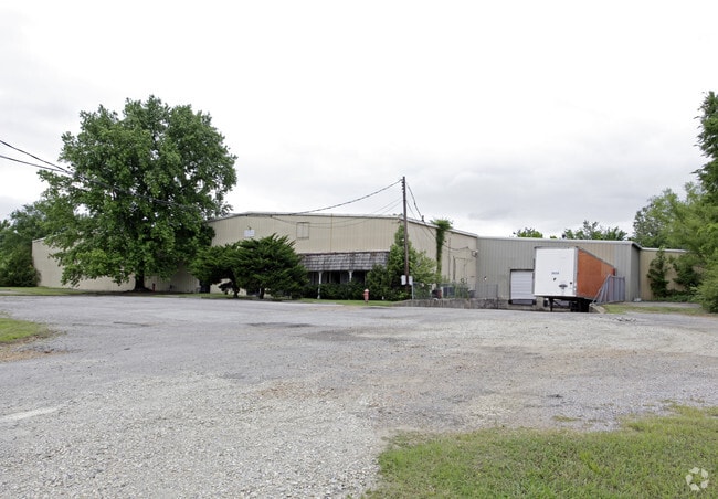
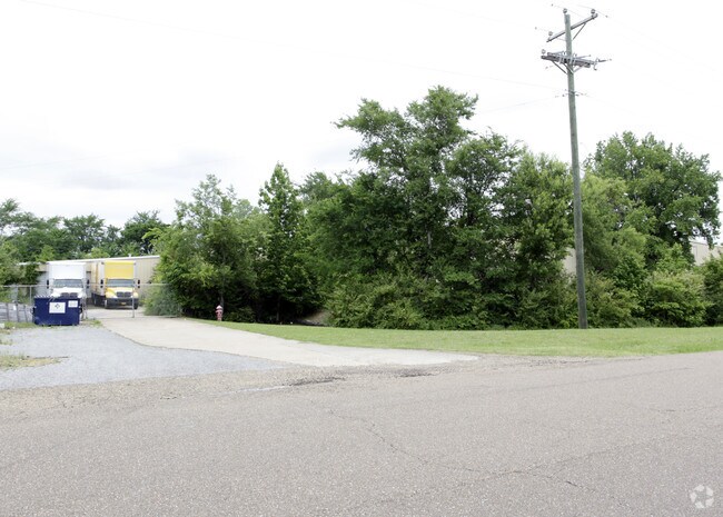
Property Record
8804 Caroma St, Olive Branch, MS 38654
NEARBY LISTINGS FOR SALE OR LEASE
Property Detail
8804 Caroma St
Memphis, TN-MS-AR
Commercial & Industria Resub
1068337640001800
CAROMA COMMERCIAL & INDUSTRIA RESUB OF LOTS 17&18 W1/2 19 LOT 18
Commercialnec
DeSoto
X
Mississippi
28033C0104H
18
2024
3.40 AC
2024
DeSoto
070821
Memphis
36,873 SF
DEMOGRAPHICS near 8804 Caroma St
1 Mile
3 Mile
5 Mile
2024 Total Population
4,831
34,153
75,686
2029 Population
5,266
37,020
79,814
Pop Growth 2024-2029
+ 9.00%
+ 8.39%
+ 5.45%
Average Age
38
39
38
2024 Total Households
1,896
12,528
26,945
HH Growth 2024-2029
+ 9.02%
+ 8.41%
+ 5.45%
Median Household Inc
$80,411
$77,998
$80,208
Avg Household Size
2.50
2.70
2.80
2024 Avg HH Vehicles
2.00
2.00
2.00
Median Home Value
$197,841
$231,157
$237,216
Median Year Built
1996
1997
1997
Nearby Places
- Restaurants
- Banks
- Shops
- Fitness
- Groceries
PUBLIC TRANSPORTATION
AIRPORT
Memphis International
DRIVE
WALK
Distance
Memphis International
20 min
13.9 mi
Freight Ports
Port of Shreveport
DRIVE
WALK
Distance
Port of Shreveport
425 min
387.7 mi
Nearby Properties
Address
Land Use
TOTAL SIZE
Lot Size
Zoning
Address
Land Use
TOTAL SIZE
Lot Size
Zoning
1,063,915 SF
74.33 AC
M-2
Address
Land Use
TOTAL SIZE
Lot Size
Zoning
865,146 SF
72.19 AC
M-1
Address
Land Use
TOTAL SIZE
Lot Size
Zoning
928,416 SF
42.73 AC
PB
Address
Land Use
TOTAL SIZE
Lot Size
Zoning
865,433 SF
54.55 AC
M-1
Address
Land Use
TOTAL SIZE
Lot Size
Zoning
814,637 SF
38.72 AC
PB
Address
Land Use
TOTAL SIZE
Lot Size
Zoning
1,085,489 SF
57.74 AC
PB
Address
Land Use
TOTAL SIZE
Lot Size
Zoning
693,896 SF
47.15 AC
M-1
Address
Land Use
TOTAL SIZE
Lot Size
Zoning
815,142 SF
51.14 AC
M-1
Address
Land Use
TOTAL SIZE
Lot Size
Zoning
395,779 SF
122.03 AC
M-1
Address
Land Use
TOTAL SIZE
Lot Size
Zoning
28.41 AC
PB
Address
Land Use
TOTAL SIZE
Lot Size
Zoning
447,551 SF
32.34 AC
M-1
Address
Land Use
TOTAL SIZE
Lot Size
Zoning
400,185 SF
19.97 AC
M-1
Address
Land Use
TOTAL SIZE
Lot Size
Zoning
27,669 SF
34.27 AC
R-4
Address
Land Use
TOTAL SIZE
Lot Size
Zoning
480,000 SF
23.80 AC
M-2
Address
Land Use
TOTAL SIZE
Lot Size
Zoning
22.08 AC
PB
Address
Land Use
TOTAL SIZE
Lot Size
Zoning
406,004 SF
43.17 AC
M-2
Address
Land Use
TOTAL SIZE
Lot Size
Zoning
10,155 SF
26.43 AC
R-4
Address
Land Use
TOTAL SIZE
Lot Size
Zoning
369,514 SF
21.85 AC
M-1
Address
Land Use
TOTAL SIZE
Lot Size
Zoning
293,854 SF
15.40 AC
M-1
Address
Land Use
TOTAL SIZE
Lot Size
Zoning
301,773 SF
19.98 AC
M-2
Address
Land Use
TOTAL SIZE
Lot Size
Zoning
303,560 SF
20 AC
M-2
Address
Land Use
TOTAL SIZE
Lot Size
Zoning
13,554 SF
15.32 AC
PUD
Address
Land Use
TOTAL SIZE
Lot Size
Zoning
329,828 SF
21.64 AC
M-1
Address
Land Use
TOTAL SIZE
Lot Size
Zoning
250,772 SF
13.72 AC
M-1
Address
Land Use
TOTAL SIZE
Lot Size
Zoning
9,682 SF
14 AC
PUD
Address
Land Use
TOTAL SIZE
Lot Size
Zoning
324,384 SF
16.20 AC
M-2
Address
Land Use
TOTAL SIZE
Lot Size
Zoning
222,790 SF
19.07 AC
M-1
Address
Land Use
TOTAL SIZE
Lot Size
Zoning
11,097 SF
13.39 AC
PUD
Address
Land Use
TOTAL SIZE
Lot Size
Zoning
162,440 SF
17 AC
M-2
Address
Land Use
TOTAL SIZE
Lot Size
Zoning
197,886 SF
18.49 AC
C-4
The World's #1 Commercial Real Estate Marketplace
Connect with us
© 2025 CoStar Group
The information above has been obtained from sources believed reliable. While we do not doubt its accuracy we have not verified it and make no guarantee, warranty or representation about it. It is your responsibility to independently confirm its accuracy and completeness. Any projections, opinions, assumptions, or estimates used are for example only and do not represent the current or future performance of the property. The value of this transaction to you depends on tax and other factors which should be evaluated by your tax, financial, and legal advisors. You and your advisors should conduct a careful, independent investigation of the property to determine to your satisfaction the suitability of the property for your needs.