Property Record
Carters Mill Rd, Feasterville Trevose, PA 19053


NEARBY LISTINGS FOR SALE OR LEASE
Property Detail
Carters Mill Rd
Philadelphia-Camden-Wilmington, PA-NJ-DE-MD
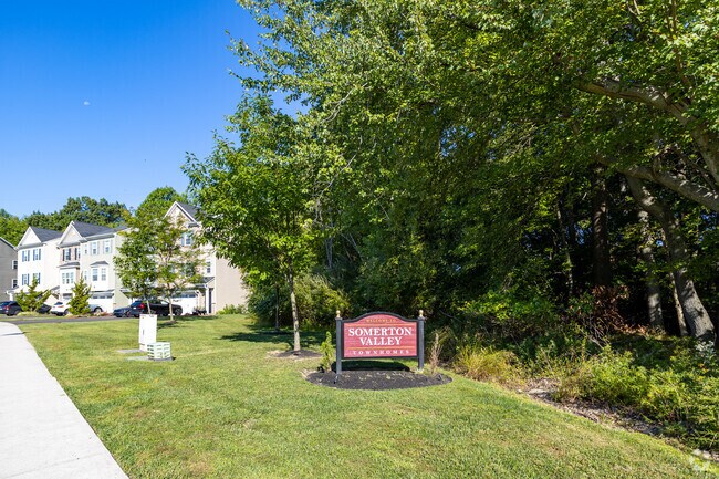
Somerton Homes
02-007-002
1.92AC OPEN SPACE E SOMERTON HOMES
Recreationalacreage
Bucks
X
Pennsylvania
42017C0438J
1.92 AC
0
Lower Bucks County
2025
Philadelphia
101405
DEMOGRAPHICS near Carters Mill Rd
1 mile
3 mile
5 mile
2024 Total Population
10,322
103,070
270,273
2029 Population
10,132
100,511
265,123
Pop Growth 2024-2029
(1.84%)
(2.48%)
(1.91%)
Average Age
44
42
42
2024 Total Households
3,856
39,115
102,506
HH Growth 2024-2029
(2.20%)
(2.70%)
(2.11%)
Median Household Inc
$81,107
$75,212
$80,086
Avg Household Size
2.60
2.60
2.50
2024 Avg HH Vehicles
2.00
2.00
2.00
Median Home Value
$306,485
$294,412
$308,537
Median Year Built
1972
1968
1969
Nearby Places
Map Layers
Map Styles
 Street
 Aerial
Transit
 Traffic
 Biking
Places
Listings with unknown addresses are not visible on the map
- Restaurants
- Banks
- Shops
- Fitness
- Groceries
PUBLIC TRANSPORTATION
COMMUTER RAIL
Trevose (R3 - Southeastern Pennsylvania Transportation Authority Regional Rail (SEPTA Regional Rail))
Drive
Walk
Distance
Trevose (R3 - Southeastern Pennsylvania Transportation Authority Regional Rail (SEPTA Regional Rail))
4 min
1.6 mi
Somerton (R3 - Southeastern Pennsylvania Transportation Authority Regional Rail (SEPTA Regional Rail))
Drive
Walk
Distance
Somerton (R3 - Southeastern Pennsylvania Transportation Authority Regional Rail (SEPTA Regional Rail))
5 min
1.8 mi
AIRPORT
Trenton Mercer
Drive
Walk
Distance
Trenton Mercer
27 min
16.8 mi
Philadelphia International
Drive
Walk
Distance
Philadelphia International
46 min
30.4 mi
Freight Ports
Port of Philadelphia
Drive
Walk
Distance
Port of Philadelphia
26 min
16.7 mi
Nearby Properties
Address
Land Use
TOTAL SIZE
Lot Size
Zoning
Address
Land Use
TOTAL SIZE
Lot Size
Zoning
34,350 SF
336 AC
SPPOA
Address
Land Use
TOTAL SIZE
Lot Size
Zoning
6,290 SF
177.73 AC
RSA4
Address
Land Use
TOTAL SIZE
Lot Size
Zoning
70,995 SF
5.34 AC
RSD1
Address
Land Use
TOTAL SIZE
Lot Size
Zoning
627,076 SF
36.89 AC
RSA1
Address
Land Use
TOTAL SIZE
Lot Size
Zoning
464,814 SF
23.90 AC
I1
Address
Land Use
TOTAL SIZE
Lot Size
Zoning
410.98 AC
R2
Address
Land Use
TOTAL SIZE
Lot Size
Zoning
68,850 SF
16.42 AC
I1
Address
Land Use
TOTAL SIZE
Lot Size
Zoning
283,878 SF
63.36 AC
RSA3
Address
Land Use
TOTAL SIZE
Lot Size
Zoning
250,000 SF
58.32 AC
I2
Address
Land Use
TOTAL SIZE
Lot Size
Zoning
358,323 SF
27.42 AC
CA1
Address
Land Use
TOTAL SIZE
Lot Size
Zoning
438,910 SF
24.42 AC
RSA4
Address
Land Use
TOTAL SIZE
Lot Size
Zoning
118,001 SF
25.60 AC
I2
Address
Land Use
TOTAL SIZE
Lot Size
Zoning
453,038 SF
34.79 AC
I1
Address
Land Use
TOTAL SIZE
Lot Size
Zoning
447,375 SF
26.32 AC
I2
Address
Land Use
TOTAL SIZE
Lot Size
Zoning
300,700 SF
30.41 AC
I1
Address
Land Use
TOTAL SIZE
Lot Size
Zoning
203,573 SF
9.94 AC
I1
Address
Land Use
TOTAL SIZE
Lot Size
Zoning
200.39 AC
SPPOP
Address
Land Use
TOTAL SIZE
Lot Size
Zoning
222,500 SF
14.58 AC
I1
Address
Land Use
TOTAL SIZE
Lot Size
Zoning
166,782 SF
8.45 AC
RSD3
Address
Land Use
TOTAL SIZE
Lot Size
Zoning
237,425 SF
15.30 AC
I1
Address
Land Use
TOTAL SIZE
Lot Size
Zoning
207,500 SF
16.18 AC
I1
Address
Land Use
TOTAL SIZE
Lot Size
Zoning
241,392 SF
24.15 AC
I1
Address
Land Use
TOTAL SIZE
Lot Size
Zoning
179,718 SF
6.61 AC
RM2
Address
Land Use
TOTAL SIZE
Lot Size
Zoning
248,178 SF
19.36 AC
I1
Address
Land Use
TOTAL SIZE
Lot Size
Zoning
223,170 SF
6.41 AC
RM2
Address
Land Use
TOTAL SIZE
Lot Size
Zoning
309,254 SF
12.76 AC
I1
Address
Land Use
TOTAL SIZE
Lot Size
Zoning
259,200 SF
24.95 AC
I1
Address
Land Use
TOTAL SIZE
Lot Size
Zoning
12,880 SF
1.15 AC
RSD1
Address
Land Use
TOTAL SIZE
Lot Size
Zoning
136,315 SF
11.38 AC
CA1
Address
Land Use
TOTAL SIZE
Lot Size
Zoning
234,965 SF
18.36 AC
CA1
The World's #1 Commercial Real Estate Marketplace
Connect with us
© 2026 CoStar Group
The information above has been obtained from sources believed reliable. While we do not doubt its accuracy we have not verified it and make no guarantee, warranty or representation about it. It is your responsibility to independently confirm its accuracy and completeness. Any projections, opinions, assumptions, or estimates used are for example only and do not represent the current or future performance of the property. The value of this transaction to you depends on tax and other factors which should be evaluated by your tax, financial, and legal advisors. You and your advisors should conduct a careful, independent investigation of the property to determine to your satisfaction the suitability of the property for your needs.