Property Record
Caston Dr, Boiling Springs, SC 29316
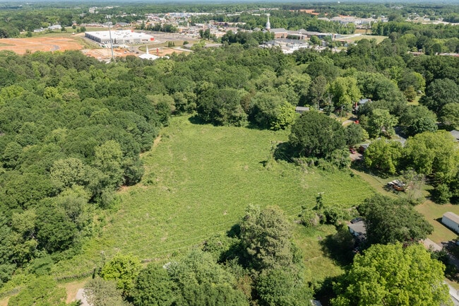

Property Detail
Caston Dr
Spartanburg, SC
S SIDE DOUBLE BRIDGE RD & E SIDE GILES HTS PB 179-850
2-44-09-031.02
SPARTANBURG
Agriculturalland
South Carolina
B and X Area of moderate flood hazard, usually the area between the limits of the 100-year and 500-year floods.
15.21 AC
2024
North Side/Rt 9 Corridor
2025
Greenville/Spartanburg
022406
NEARBY LISTINGS FOR SALE OR LEASE
DEMOGRAPHICS near Caston Dr
1 mile
3 mile
5 mile
2025 Total Population
5,111
38,982
70,720
2030 Population
5,739
43,660
79,115
Pop Growth 2025-2030
+ 12.29%
+ 12.00%
+ 11.87%
Average Age
39
38
38
2025 Total Households
2,042
14,703
26,239
HH Growth 2025-2030
+ 12.14%
+ 12.09%
+ 12.04%
Median Household Inc
$73,332
$71,242
$66,665
Avg Household Size
2.50
2.60
2.60
2025 Avg HH Vehicles
2.00
2.00
2.00
Median Home Value
$274,408
$245,314
$242,476
Median Year Built
2006
2002
1996
Nearby Places
Map Layers
Map Styles
 Street
 Aerial
Layers
 Traffic
 Biking
Places
Listings with unknown addresses are not visible on the map
- Restaurants
- Banks
- Shops
- Fitness
- Groceries
PUBLIC TRANSPORTATION
COMMUTER RAIL
Spartanburg Amtrak Station (Crescent - Amtrak)
Drive
Walk
Distance
Spartanburg Amtrak Station (Crescent - Amtrak)
16 min
7.2 mi
AIRPORT
Greenville Spartanburg International
Drive
Walk
Distance
Greenville Spartanburg International
33 min
22.0 mi
Freight Ports
North Charleston Terminal
Drive
Walk
Distance
North Charleston Terminal
230 min
202.6 mi
SALE & LEASE HISTORY
LISTING DATE
SALE/LEASE

Jul 26, 2024
For Sale
Nearby Properties
Address
Land Use
TOTAL SIZE
Lot Size
Zoning
Address
Land Use
TOTAL SIZE
Lot Size
Zoning
4,172 SF
15.98 AC
Address
Land Use
TOTAL SIZE
Lot Size
Zoning
5,547 SF
6.58 AC
Address
Land Use
TOTAL SIZE
Lot Size
Zoning
22,955 SF
5.05 AC
Address
Land Use
TOTAL SIZE
Lot Size
Zoning
3,406 SF
13.10 AC
Address
Land Use
TOTAL SIZE
Lot Size
Zoning
3,412 SF
21.60 AC
Address
Land Use
TOTAL SIZE
Lot Size
Zoning
5,034 SF
17.60 AC
Address
Land Use
TOTAL SIZE
Lot Size
Zoning
24,738 SF
34.52 AC
Address
Land Use
TOTAL SIZE
Lot Size
Zoning
20,976 SF
23.72 AC
Address
Land Use
TOTAL SIZE
Lot Size
Zoning
62,000 SF
10.17 AC
Address
Land Use
TOTAL SIZE
Lot Size
Zoning
3,112 SF
20.17 AC
Address
Land Use
TOTAL SIZE
Lot Size
Zoning
8,911 SF
23.64 AC
Address
Land Use
TOTAL SIZE
Lot Size
Zoning
6,816 SF
14.16 AC
Address
Land Use
TOTAL SIZE
Lot Size
Zoning
9,649 SF
9.67 AC
Address
Land Use
TOTAL SIZE
Lot Size
Zoning
7,000 SF
3 AC
Address
Land Use
TOTAL SIZE
Lot Size
Zoning
184,015 SF
19.23 AC
Address
Land Use
TOTAL SIZE
Lot Size
Zoning
42,657 SF
11.57 AC
Address
Land Use
TOTAL SIZE
Lot Size
Zoning
641,891 SF
16.26 AC
Address
Land Use
TOTAL SIZE
Lot Size
Zoning
2,220 SF
14.09 AC
Address
Land Use
TOTAL SIZE
Lot Size
Zoning
76,325 SF
17.28 AC
Address
Land Use
TOTAL SIZE
Lot Size
Zoning
108,060 SF
2.95 AC
Address
Land Use
TOTAL SIZE
Lot Size
Zoning
Address
Land Use
TOTAL SIZE
Lot Size
Zoning
5,236 SF
0.65 AC
Address
Land Use
TOTAL SIZE
Lot Size
Zoning
6,695 SF
0.30 AC
Address
Land Use
TOTAL SIZE
Lot Size
Zoning
25,214 SF
4.48 AC
Address
Land Use
TOTAL SIZE
Lot Size
Zoning
53,066 SF
8.39 AC
Address
Land Use
TOTAL SIZE
Lot Size
Zoning
4,426 SF
Address
Land Use
TOTAL SIZE
Lot Size
Zoning
172,332 SF
15.01 AC
Address
Land Use
TOTAL SIZE
Lot Size
Zoning
4,283 SF
0.50 AC
Address
Land Use
TOTAL SIZE
Lot Size
Zoning
5,263 SF
0.77 AC
Address
Land Use
TOTAL SIZE
Lot Size
Zoning
The World's #1 Commercial Real Estate Marketplace
Connect with us
© 2026 CoStar Group
The information above has been obtained from sources believed reliable. While we do not doubt its accuracy we have not verified it and make no guarantee, warranty or representation about it. It is your responsibility to independently confirm its accuracy and completeness. Any projections, opinions, assumptions, or estimates used are for example only and do not represent the current or future performance of the property. The value of this transaction to you depends on tax and other factors which should be evaluated by your tax, financial, and legal advisors. You and your advisors should conduct a careful, independent investigation of the property to determine to your satisfaction the suitability of the property for your needs.