Property Record
Castro Ranch Rd, El Sobrante, CA 94803


Property Detail
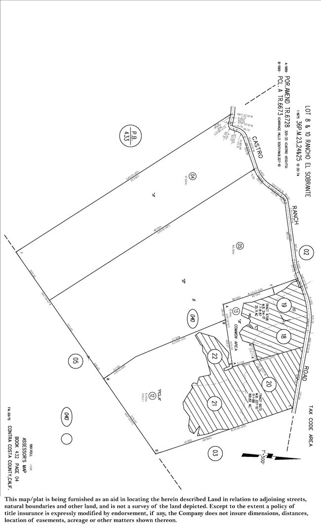
Castro Ranch Rd
432-040-004-9
PARCEL MAP 36 PG 24 PCL A
Pasture
CONTRA COSTA
A2
California
B and X Area of moderate flood hazard, usually the area between the limits of the 100-year and 500-year floods.
97.62 AC
2025
Martinez/Pacheco/Hercules
2025
East Bay/Oakland
360200
Oakland-Fremont-Berkeley, CA
NEARBY LISTINGS FOR SALE OR LEASE
-
-
View all El Sobrante listings for sale on LoopNet.com
DEMOGRAPHICS near Castro Ranch Rd
1 mile
3 mile
5 mile
2025 Total Population
3,793
33,900
211,886
2030 Population
3,785
34,024
212,802
Pop Growth 2025-2030
(0.21%)
+ 0.37%
+ 0.43%
Average Age
47
45
43
2025 Total Households
1,359
12,069
75,528
HH Growth 2025-2030
(0.29%)
+ 0.36%
+ 0.40%
Median Household Inc
$160,665
$123,636
$115,365
Avg Household Size
2.70
2.80
2.70
2025 Avg HH Vehicles
3.00
2.00
2.00
Median Home Value
$843,708
$760,780
$819,721
Median Year Built
1981
1974
1964
Nearby Places
Map Layers
Map Styles
 Street
 Aerial
Layers
 Traffic
 Biking
Places
Listings with unknown addresses are not visible on the map
- Restaurants
- Banks
- Shops
- Fitness
- Groceries
PUBLIC TRANSPORTATION
AIRPORT
Metro Oakland International
Drive
Walk
Distance
Metro Oakland International
57 min
27.1 mi
San Francisco International
Drive
Walk
Distance
San Francisco International
70 min
37.0 mi
Freight Ports
Port of Richmond
Drive
Walk
Distance
Port of Richmond
44 min
15.5 mi
SALE & LEASE HISTORY
LISTING DATE
SALE/LEASE

Mar 12, 2020
For Sale
Nearby Properties
Address
Land Use
TOTAL SIZE
Lot Size
Zoning
Address
Land Use
TOTAL SIZE
Lot Size
Zoning
40.41 AC
Address
Land Use
TOTAL SIZE
Lot Size
Zoning
6,884 SF
3.91 AC
M29
Address
Land Use
TOTAL SIZE
Lot Size
Zoning
53,439 SF
2.32 AC
Address
Land Use
TOTAL SIZE
Lot Size
Zoning
3,482 SF
1.25 AC
M17
Address
Land Use
TOTAL SIZE
Lot Size
Zoning
15,395 SF
3.66 AC
NB
Address
Land Use
TOTAL SIZE
Lot Size
Zoning
11,200 SF
1.38 AC
M29
Address
Land Use
TOTAL SIZE
Lot Size
Zoning
6,890 SF
1.32 AC
M29
Address
Land Use
TOTAL SIZE
Lot Size
Zoning
13,743 SF
1.38 AC
M29
Address
Land Use
TOTAL SIZE
Lot Size
Zoning
3,848 SF
1.19 AC
M29
Address
Land Use
TOTAL SIZE
Lot Size
Zoning
22.26 AC
Address
Land Use
TOTAL SIZE
Lot Size
Zoning
26,691 SF
127.06 AC
Address
Land Use
TOTAL SIZE
Lot Size
Zoning
5,600 SF
2.66 AC
R7
Address
Land Use
TOTAL SIZE
Lot Size
Zoning
16,950 SF
0.91 AC
M29
Address
Land Use
TOTAL SIZE
Lot Size
Zoning
4,800 SF
1.16 AC
M17
Address
Land Use
TOTAL SIZE
Lot Size
Zoning
13,620 SF
1.70 AC
NB
Address
Land Use
TOTAL SIZE
Lot Size
Zoning
8,420 SF
0.96 AC
RB
Address
Land Use
TOTAL SIZE
Lot Size
Zoning
12,480 SF
1.62 AC
M29
Address
Land Use
TOTAL SIZE
Lot Size
Zoning
3,352 SF
1.01 AC
NB
Address
Land Use
TOTAL SIZE
Lot Size
Zoning
18,417 SF
6.09 AC
Address
Land Use
TOTAL SIZE
Lot Size
Zoning
1,507 SF
0.88 AC
M29
Address
Land Use
TOTAL SIZE
Lot Size
Zoning
23,886 SF
2.53 AC
M12
Address
Land Use
TOTAL SIZE
Lot Size
Zoning
11,076 SF
0.55 AC
M29
Address
Land Use
TOTAL SIZE
Lot Size
Zoning
2,275 SF
2.72 AC
RB
Address
Land Use
TOTAL SIZE
Lot Size
Zoning
12,240 SF
0.72 AC
Address
Land Use
TOTAL SIZE
Lot Size
Zoning
88,234 SF
1.58 AC
Address
Land Use
TOTAL SIZE
Lot Size
Zoning
16,000 SF
1.98 AC
RB
Address
Land Use
TOTAL SIZE
Lot Size
Zoning
9,408 SF
0.30 AC
M29
Address
Land Use
TOTAL SIZE
Lot Size
Zoning
49,912 SF
3.04 AC
M29
Address
Land Use
TOTAL SIZE
Lot Size
Zoning
689.62 AC
Address
Land Use
TOTAL SIZE
Lot Size
Zoning
8,460 SF
0.31 AC
RB
The World's #1 Commercial Real Estate Marketplace
Connect with us
© 2026 CoStar Group
The information above has been obtained from sources believed reliable. While we do not doubt its accuracy we have not verified it and make no guarantee, warranty or representation about it. It is your responsibility to independently confirm its accuracy and completeness. Any projections, opinions, assumptions, or estimates used are for example only and do not represent the current or future performance of the property. The value of this transaction to you depends on tax and other factors which should be evaluated by your tax, financial, and legal advisors. You and your advisors should conduct a careful, independent investigation of the property to determine to your satisfaction the suitability of the property for your needs.