Property Record
Caughdenoy Rd, Syracuse, NY 13212


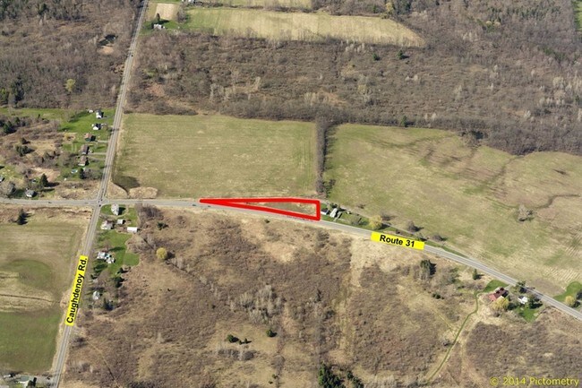
Property Detail
Caughdenoy Rd
Syracuse, NY
FL 39 1159688
312489-064-000-0001-006-003-0000
ONONDAGA
Industrialacreage
New York
02 - SINGL
6.003
B and X Area of moderate flood hazard, usually the area between the limits of the 100-year and 500-year floods.
1.32 AC
2025
NE Outer Onondaga County
2025
Syracuse
010800
NEARBY LISTINGS FOR SALE OR LEASE
-
-
-
-
-
No Photo
-
-
View all Syracuse listings for sale on LoopNet.com
DEMOGRAPHICS near Caughdenoy Rd
1 mile
3 mile
5 mile
2025 Total Population
579
16,095
85,950
2030 Population
573
15,844
84,867
Pop Growth 2025-2030
(1.04%)
(1.56%)
(1.26%)
Average Age
43
42
42
2025 Total Households
217
6,242
35,647
HH Growth 2025-2030
(0.92%)
(1.60%)
(1.35%)
Median Household Inc
$135,267
$109,152
$93,889
Avg Household Size
2.70
2.50
2.40
2025 Avg HH Vehicles
2.00
2.00
2.00
Median Home Value
$330,434
$222,930
$209,341
Median Year Built
1991
1981
1976
Nearby Places
Map Layers
Map Styles
 Street
 Aerial
Layers
 Traffic
 Biking
Places
Listings with unknown addresses are not visible on the map
- Restaurants
- Banks
- Shops
- Fitness
- Groceries
PUBLIC TRANSPORTATION
AIRPORT
Syracuse Hancock International
Drive
Walk
Distance
Syracuse Hancock International
13 min
8.9 mi
Freight Ports
Albany, NY Port
Drive
Walk
Distance
Albany, NY Port
177 min
149.3 mi
SALE & LEASE HISTORY
LISTING DATE
SALE/LEASE

Mar 24, 2017
For Sale
Nearby Properties
Address
Land Use
TOTAL SIZE
Lot Size
Zoning
Address
Land Use
TOTAL SIZE
Lot Size
Zoning
203,345 SF
18.17 AC
Address
Land Use
TOTAL SIZE
Lot Size
Zoning
8,417 SF
13.95 AC
Address
Land Use
TOTAL SIZE
Lot Size
Zoning
125,400 SF
18.11 AC
GC
Address
Land Use
TOTAL SIZE
Lot Size
Zoning
66,538 SF
18.24 AC
Address
Land Use
TOTAL SIZE
Lot Size
Zoning
57,052 SF
16.82 AC
Address
Land Use
TOTAL SIZE
Lot Size
Zoning
2,404 SF
9.73 AC
Address
Land Use
TOTAL SIZE
Lot Size
Zoning
42,698 SF
13.85 AC
Address
Land Use
TOTAL SIZE
Lot Size
Zoning
271,263 SF
77.30 AC
Address
Land Use
TOTAL SIZE
Lot Size
Zoning
17,436 SF
98.89 AC
06000
Address
Land Use
TOTAL SIZE
Lot Size
Zoning
16,630 SF
10.16 AC
Address
Land Use
TOTAL SIZE
Lot Size
Zoning
43,968 SF
1.95 AC
Address
Land Use
TOTAL SIZE
Lot Size
Zoning
3,724 SF
56.89 AC
N00
Address
Land Use
TOTAL SIZE
Lot Size
Zoning
12,220 SF
5.86 AC
Address
Land Use
TOTAL SIZE
Lot Size
Zoning
74,342 SF
8.81 AC
Address
Land Use
TOTAL SIZE
Lot Size
Zoning
26,724 SF
89.15 AC
Address
Land Use
TOTAL SIZE
Lot Size
Zoning
116,020 SF
15.72 AC
PUD
Address
Land Use
TOTAL SIZE
Lot Size
Zoning
7,416 SF
7.30 AC
Address
Land Use
TOTAL SIZE
Lot Size
Zoning
42,720 SF
3.09 AC
Address
Land Use
TOTAL SIZE
Lot Size
Zoning
8,114 SF
2.79 AC
Address
Land Use
TOTAL SIZE
Lot Size
Zoning
42,210 SF
62.23 AC
N00
Address
Land Use
TOTAL SIZE
Lot Size
Zoning
26,445 SF
3.95 AC
Address
Land Use
TOTAL SIZE
Lot Size
Zoning
952 SF
3.81 AC
Address
Land Use
TOTAL SIZE
Lot Size
Zoning
16,630 SF
2.66 AC
Address
Land Use
TOTAL SIZE
Lot Size
Zoning
16,630 SF
3.95 AC
Address
Land Use
TOTAL SIZE
Lot Size
Zoning
32,370 SF
3.16 AC
Address
Land Use
TOTAL SIZE
Lot Size
Zoning
19,200 SF
4.52 AC
Address
Land Use
TOTAL SIZE
Lot Size
Zoning
39,055 SF
28.38 AC
Address
Land Use
TOTAL SIZE
Lot Size
Zoning
11,571 SF
1.53 AC
Address
Land Use
TOTAL SIZE
Lot Size
Zoning
19,740 SF
0.01 AC
Address
Land Use
TOTAL SIZE
Lot Size
Zoning
16,422 SF
25.28 AC
The World's #1 Commercial Real Estate Marketplace
Connect with us
© 2026 CoStar Group
The information above has been obtained from sources believed reliable. While we do not doubt its accuracy we have not verified it and make no guarantee, warranty or representation about it. It is your responsibility to independently confirm its accuracy and completeness. Any projections, opinions, assumptions, or estimates used are for example only and do not represent the current or future performance of the property. The value of this transaction to you depends on tax and other factors which should be evaluated by your tax, financial, and legal advisors. You and your advisors should conduct a careful, independent investigation of the property to determine to your satisfaction the suitability of the property for your needs.