Property Record
Cedar Grove Rd, Shepherdsville, KY 40165
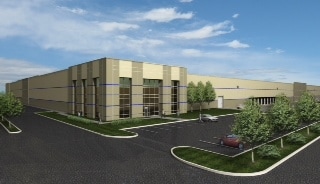


Property Detail
Cedar Grove Rd
Louisville/Jefferson County, KY-IN
PART OF TRACT 1_BLUEGRASS SAFE STORAGE_PLAT 3-136
405223
BULLITT
Commercialnec
Kentucky
AE The base floodplain where base flood elevations are provided. AE Zones are now used on new format FIRMs instead of A1-A30 Zones.
42.39 AC
2025
Bullitt County
2025
Louisville
020702
NEARBY LISTINGS FOR SALE OR LEASE
DEMOGRAPHICS near Cedar Grove Rd
1 mile
3 mile
5 mile
2025 Total Population
1,661
18,774
27,672
2030 Population
1,721
19,485
28,767
Pop Growth 2025-2030
+ 3.61%
+ 3.79%
+ 3.96%
Average Age
39
39
41
2025 Total Households
654
7,204
10,580
HH Growth 2025-2030
+ 3.52%
+ 3.73%
+ 3.94%
Median Household Inc
$33,080
$63,564
$67,710
Avg Household Size
2.50
2.60
2.60
2025 Avg HH Vehicles
2.00
2.00
2.00
Median Home Value
$198,666
$229,115
$253,126
Median Year Built
1979
1994
1992
Nearby Places
Map Layers
Map Styles
 Street
 Aerial
Layers
 Traffic
 Biking
Places
Listings with unknown addresses are not visible on the map
- Restaurants
- Banks
- Shops
- Fitness
- Groceries
PUBLIC TRANSPORTATION
AIRPORT
Louisville Muhammad Ali International
Drive
Walk
Distance
Louisville Muhammad Ali International
25 min
16.6 mi
SALE & LEASE HISTORY
LISTING DATE
SALE/LEASE

Sep 26, 2016
For Lease
Jun 18, 2021
For Lease
Nearby Properties
Address
Land Use
TOTAL SIZE
Lot Size
Zoning
Address
Land Use
TOTAL SIZE
Lot Size
Zoning
936,000 SF
51.74 AC
Address
Land Use
TOTAL SIZE
Lot Size
Zoning
Address
Land Use
TOTAL SIZE
Lot Size
Zoning
Address
Land Use
TOTAL SIZE
Lot Size
Zoning
Address
Land Use
TOTAL SIZE
Lot Size
Zoning
29.43 AC
Address
Land Use
TOTAL SIZE
Lot Size
Zoning
Address
Land Use
TOTAL SIZE
Lot Size
Zoning
38.03 AC
Address
Land Use
TOTAL SIZE
Lot Size
Zoning
52.61 AC
Address
Land Use
TOTAL SIZE
Lot Size
Zoning
Address
Land Use
TOTAL SIZE
Lot Size
Zoning
38.20 AC
Address
Land Use
TOTAL SIZE
Lot Size
Zoning
59.47 AC
Address
Land Use
TOTAL SIZE
Lot Size
Zoning
32.26 AC
Address
Land Use
TOTAL SIZE
Lot Size
Zoning
33.96 AC
Address
Land Use
TOTAL SIZE
Lot Size
Zoning
Address
Land Use
TOTAL SIZE
Lot Size
Zoning
Address
Land Use
TOTAL SIZE
Lot Size
Zoning
Address
Land Use
TOTAL SIZE
Lot Size
Zoning
29.46 AC
Address
Land Use
TOTAL SIZE
Lot Size
Zoning
Address
Land Use
TOTAL SIZE
Lot Size
Zoning
Address
Land Use
TOTAL SIZE
Lot Size
Zoning
Address
Land Use
TOTAL SIZE
Lot Size
Zoning
40.82 AC
Address
Land Use
TOTAL SIZE
Lot Size
Zoning
20.96 AC
Address
Land Use
TOTAL SIZE
Lot Size
Zoning
Address
Land Use
TOTAL SIZE
Lot Size
Zoning
Address
Land Use
TOTAL SIZE
Lot Size
Zoning
Address
Land Use
TOTAL SIZE
Lot Size
Zoning
27.78 AC
Address
Land Use
TOTAL SIZE
Lot Size
Zoning
400,260 SF
32.97 AC
Address
Land Use
TOTAL SIZE
Lot Size
Zoning
25.85 AC
Address
Land Use
TOTAL SIZE
Lot Size
Zoning
The World's #1 Commercial Real Estate Marketplace
Connect with us
© 2026 CoStar Group
The information above has been obtained from sources believed reliable. While we do not doubt its accuracy we have not verified it and make no guarantee, warranty or representation about it. It is your responsibility to independently confirm its accuracy and completeness. Any projections, opinions, assumptions, or estimates used are for example only and do not represent the current or future performance of the property. The value of this transaction to you depends on tax and other factors which should be evaluated by your tax, financial, and legal advisors. You and your advisors should conduct a careful, independent investigation of the property to determine to your satisfaction the suitability of the property for your needs.