Property Record
Cedar Ridge Dr, Burlington, NC 27217


Property Detail
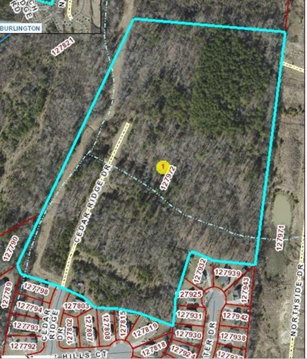
Cedar Ridge Dr
Burlington, NC
BRIDGEWATER SEC 2 PH 3 LOT 1 12-35-58
127972
ALAMANCE
Vacantlandnec
North Carolina
R 9
1
AE The base floodplain where base flood elevations are provided. AE Zones are now used on new format FIRMs instead of A1-A30 Zones.
19.07 AC
2025
NW Alamance County
2025
Greensboro/Winston-Salem
021400
NEARBY LISTINGS FOR SALE OR LEASE
DEMOGRAPHICS near Cedar Ridge Dr
1 mile
3 mile
5 mile
2025 Total Population
5,881
39,050
95,453
2030 Population
6,239
41,242
101,912
Pop Growth 2025-2030
+ 6.09%
+ 5.61%
+ 6.77%
Average Age
36
40
39
2025 Total Households
2,141
15,314
37,451
HH Growth 2025-2030
+ 6.26%
+ 5.79%
+ 7.05%
Median Household Inc
$55,038
$53,750
$60,292
Avg Household Size
2.70
2.40
2.40
2025 Avg HH Vehicles
2.00
2.00
2.00
Median Home Value
$161,278
$206,801
$242,652
Median Year Built
1988
1970
1981
Nearby Places
Map Layers
Map Styles
 Street
 Aerial
Layers
 Traffic
 Biking
Places
Listings with unknown addresses are not visible on the map
- Restaurants
- Banks
- Shops
- Fitness
- Groceries
PUBLIC TRANSPORTATION
COMMUTER RAIL
Burlington Station (Piedmont - North Carolina by Train (NC Train))
Drive
Walk
Distance
Burlington Station (Piedmont - North Carolina by Train (NC Train))
5 min
2.3 mi
AIRPORT
Piedmont Triad International
Drive
Walk
Distance
Piedmont Triad International
52 min
34.5 mi
Freight Ports
Virginia Port Authority - Richmond
Drive
Walk
Distance
Virginia Port Authority - Richmond
209 min
179.7 mi
SALE & LEASE HISTORY
LISTING DATE
SALE/LEASE

Nov 27, 2017
For Sale
Jan 23, 2020
For Sale
Nearby Properties
Address
Land Use
TOTAL SIZE
Lot Size
Zoning
Address
Land Use
TOTAL SIZE
Lot Size
Zoning
9,120 SF
83.53 AC
PI
Address
Land Use
TOTAL SIZE
Lot Size
Zoning
177,145 SF
47.79 AC
R 15
Address
Land Use
TOTAL SIZE
Lot Size
Zoning
128,458 SF
70.20 AC
IO CI
Address
Land Use
TOTAL SIZE
Lot Size
Zoning
146,080 SF
22.15 AC
X 1
Address
Land Use
TOTAL SIZE
Lot Size
Zoning
141,600 SF
18 AC
X 1
Address
Land Use
TOTAL SIZE
Lot Size
Zoning
40,220 SF
12.45 AC
MF A
Address
Land Use
TOTAL SIZE
Lot Size
Zoning
110,612 SF
1 AC
B 3
Address
Land Use
TOTAL SIZE
Lot Size
Zoning
9,672 SF
10.77 AC
MF A
Address
Land Use
TOTAL SIZE
Lot Size
Zoning
23,992 SF
25.66 AC
R 9
Address
Land Use
TOTAL SIZE
Lot Size
Zoning
40,440 SF
23.57 AC
R 9
Address
Land Use
TOTAL SIZE
Lot Size
Zoning
23,268 SF
6.11 AC
Address
Land Use
TOTAL SIZE
Lot Size
Zoning
59,897 SF
15.40 AC
Address
Land Use
TOTAL SIZE
Lot Size
Zoning
17,073 SF
7.59 AC
R 9
Address
Land Use
TOTAL SIZE
Lot Size
Zoning
32,480 SF
18.44 AC
R 9
Address
Land Use
TOTAL SIZE
Lot Size
Zoning
118,078 SF
8.81 AC
PI
Address
Land Use
TOTAL SIZE
Lot Size
Zoning
2,923 SF
10.13 AC
Address
Land Use
TOTAL SIZE
Lot Size
Zoning
77,046 SF
1.61 AC
I 3
Address
Land Use
TOTAL SIZE
Lot Size
Zoning
5,760 SF
8.34 AC
MF B
Address
Land Use
TOTAL SIZE
Lot Size
Zoning
22,301 SF
19.25 AC
OI
Address
Land Use
TOTAL SIZE
Lot Size
Zoning
27,336 SF
10.84 AC
R 6
Address
Land Use
TOTAL SIZE
Lot Size
Zoning
17,112 SF
5.25 AC
URBAN RESI
Address
Land Use
TOTAL SIZE
Lot Size
Zoning
33,045 SF
4.03 AC
R 15OFB1
Address
Land Use
TOTAL SIZE
Lot Size
Zoning
50,448 SF
37.72 AC
M1
Address
Land Use
TOTAL SIZE
Lot Size
Zoning
25,200 SF
5.30 AC
Address
Land Use
TOTAL SIZE
Lot Size
Zoning
60,713 SF
3.15 AC
O I
Address
Land Use
TOTAL SIZE
Lot Size
Zoning
41,624 SF
19.77 AC
R 9
Address
Land Use
TOTAL SIZE
Lot Size
Zoning
310,055 SF
14.23 AC
I 2
Address
Land Use
TOTAL SIZE
Lot Size
Zoning
2,016 SF
2.83 AC
B 2
Address
Land Use
TOTAL SIZE
Lot Size
Zoning
6,152 SF
14 AC
R 6
Address
Land Use
TOTAL SIZE
Lot Size
Zoning
24,108 SF
10.62 AC
The World's #1 Commercial Real Estate Marketplace
Connect with us
© 2026 CoStar Group
The information above has been obtained from sources believed reliable. While we do not doubt its accuracy we have not verified it and make no guarantee, warranty or representation about it. It is your responsibility to independently confirm its accuracy and completeness. Any projections, opinions, assumptions, or estimates used are for example only and do not represent the current or future performance of the property. The value of this transaction to you depends on tax and other factors which should be evaluated by your tax, financial, and legal advisors. You and your advisors should conduct a careful, independent investigation of the property to determine to your satisfaction the suitability of the property for your needs.