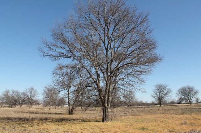
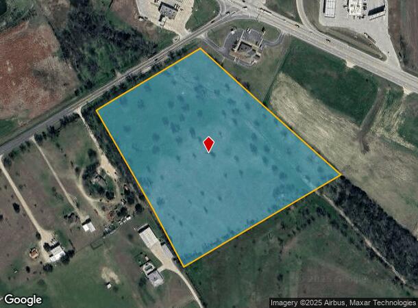
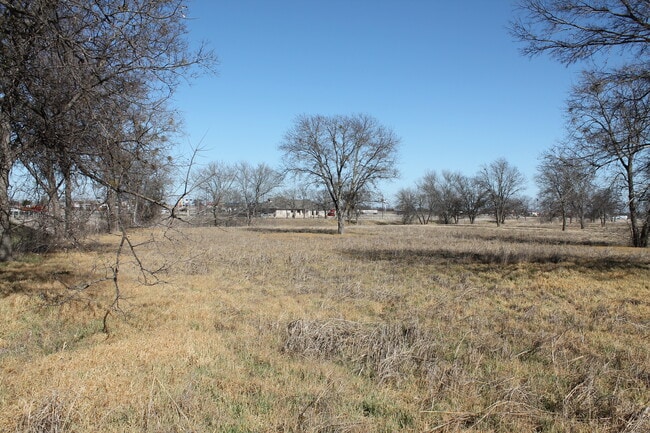
Property Record
Cedar Rock Pkwy, Woodway, TX 76712
NEARBY LISTINGS FOR SALE OR LEASE
Property Detail
Cedar Rock Pkwy
Waco, TX
Anderson Allen S
36-005700-000300-5
ANDERSON ALLEN S TRACT 2A ACRES 15.24
Agriculturalland
Mclennan
A
Texas
48309C0350C
2a
2024
15.24 AC
2025
Waco & Killeen
002504
Other Market Areas
DEMOGRAPHICS near Cedar Rock Pkwy
1 Mile
3 Mile
5 Mile
2024 Total Population
369
3,756
11,738
2029 Population
385
3,921
12,381
Pop Growth 2024-2029
+ 4.34%
+ 4.39%
+ 5.48%
Average Age
41
41
38
2024 Total Households
141
1,421
4,165
HH Growth 2024-2029
+ 4.26%
+ 4.50%
+ 5.55%
Median Household Inc
$84,091
$88,662
$102,686
Avg Household Size
2.50
2.60
2.80
2024 Avg HH Vehicles
2.00
2.00
2.00
Median Home Value
$265,789
$276,941
$279,321
Median Year Built
1985
1985
1995
Nearby Places
Map Layers
Map Styles
 Street
 Aerial
- Restaurants
- Banks
- Shops
- Fitness
- Groceries
PUBLIC TRANSPORTATION
AIRPORT
Waco Regional
DRIVE
WALK
Distance
Waco Regional
16 min
8.3 mi
Freight Ports
Port of Houston
DRIVE
WALK
Distance
Port of Houston
227 min
199.2 mi
SALE & LEASE HISTORY
LISTING DATE
SALE/LEASE

Mar 08, 2021
For Sale
Nearby Properties
Address
Land Use
TOTAL SIZE
Lot Size
Zoning
Address
Land Use
TOTAL SIZE
Lot Size
Zoning
145,656 SF
28.32 AC
Address
Land Use
TOTAL SIZE
Lot Size
Zoning
6,844 SF
4.51 AC
Address
Land Use
TOTAL SIZE
Lot Size
Zoning
50,025 SF
2.54 AC
Address
Land Use
TOTAL SIZE
Lot Size
Zoning
49,439 SF
3.75 AC
Address
Land Use
TOTAL SIZE
Lot Size
Zoning
50,412 SF
30.71 AC
C1
Address
Land Use
TOTAL SIZE
Lot Size
Zoning
40,000 SF
4.06 AC
Address
Land Use
TOTAL SIZE
Lot Size
Zoning
9,012 SF
81.54 AC
R
Address
Land Use
TOTAL SIZE
Lot Size
Zoning
27,988 SF
14.82 AC
C
Address
Land Use
TOTAL SIZE
Lot Size
Zoning
44,406 SF
6.67 AC
Address
Land Use
TOTAL SIZE
Lot Size
Zoning
923.34 AC
Address
Land Use
TOTAL SIZE
Lot Size
Zoning
3,192 SF
14.79 AC
R1
Address
Land Use
TOTAL SIZE
Lot Size
Zoning
13,179,513 SF
302.57 AC
Address
Land Use
TOTAL SIZE
Lot Size
Zoning
31,440 SF
2.90 AC
R-1
Address
Land Use
TOTAL SIZE
Lot Size
Zoning
9,820 SF
1.86 AC
R-1
Address
Land Use
TOTAL SIZE
Lot Size
Zoning
32,300 SF
1 AC
R-1
Address
Land Use
TOTAL SIZE
Lot Size
Zoning
46,000 SF
12.13 AC
Address
Land Use
TOTAL SIZE
Lot Size
Zoning
15,852 SF
1.38 AC
C
Address
Land Use
TOTAL SIZE
Lot Size
Zoning
3,200 SF
5.01 AC
R1
Address
Land Use
TOTAL SIZE
Lot Size
Zoning
10,325 SF
12.63 AC
R1
Address
Land Use
TOTAL SIZE
Lot Size
Zoning
9,360 SF
1.60 AC
Address
Land Use
TOTAL SIZE
Lot Size
Zoning
7,123 SF
14.03 AC
R
Address
Land Use
TOTAL SIZE
Lot Size
Zoning
7,035 SF
11.17 AC
R
Address
Land Use
TOTAL SIZE
Lot Size
Zoning
15,858 SF
2.18 AC
R-1
Address
Land Use
TOTAL SIZE
Lot Size
Zoning
45,000 SF
11.62 AC
R
Address
Land Use
TOTAL SIZE
Lot Size
Zoning
244.09 AC
R1
Address
Land Use
TOTAL SIZE
Lot Size
Zoning
7,637 SF
16.45 AC
R
Address
Land Use
TOTAL SIZE
Lot Size
Zoning
5,023 SF
9.97 AC
R1
Address
Land Use
TOTAL SIZE
Lot Size
Zoning
5,945 SF
6.53 AC
R
Address
Land Use
TOTAL SIZE
Lot Size
Zoning
8,950 SF
4 AC
Address
Land Use
TOTAL SIZE
Lot Size
Zoning
10,495 SF
30.90 AC
R1
The World's #1 Commercial Real Estate Marketplace
Connect with us
© 2025 CoStar Group
The information above has been obtained from sources believed reliable. While we do not doubt its accuracy we have not verified it and make no guarantee, warranty or representation about it. It is your responsibility to independently confirm its accuracy and completeness. Any projections, opinions, assumptions, or estimates used are for example only and do not represent the current or future performance of the property. The value of this transaction to you depends on tax and other factors which should be evaluated by your tax, financial, and legal advisors. You and your advisors should conduct a careful, independent investigation of the property to determine to your satisfaction the suitability of the property for your needs.