Property Record
Cedarcrest Dr, Lexington, SC 29072
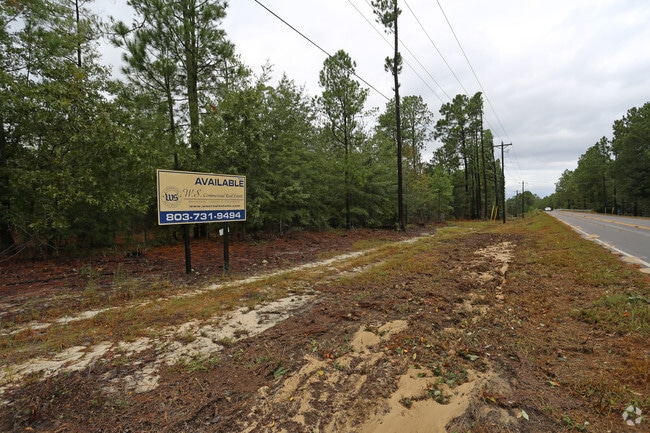
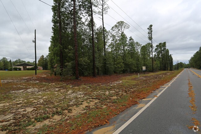
This Property Is For Sale
NEARBY LISTINGS FOR SALE OR LEASE
Property Detail
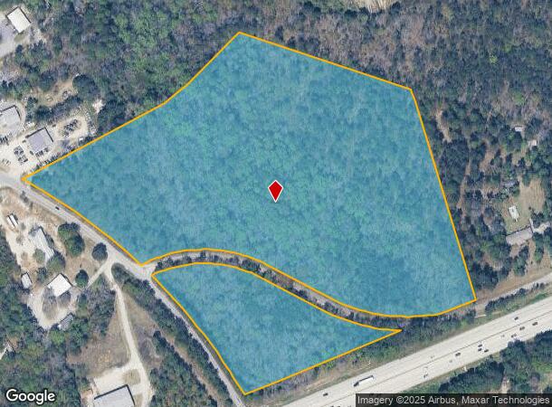
Cedarcrest Dr
005596-01-010
NS I-20
Agriculturalland
Lexington
X
South Carolina
45063C0252J
22.62 AC
2025
Lexington
2024
Columbia
021050
Columbia, SC
DEMOGRAPHICS near Cedarcrest Dr
1 Mile
3 Mile
5 Mile
2024 Total Population
3,792
38,934
87,060
2029 Population
4,109
42,321
94,853
Pop Growth 2024-2029
+ 8.36%
+ 8.70%
+ 8.95%
Average Age
41
40
39
2024 Total Households
1,603
15,680
33,899
HH Growth 2024-2029
+ 8.67%
+ 8.94%
+ 9.15%
Median Household Inc
$70,197
$71,272
$72,458
Avg Household Size
2.30
2.40
2.50
2024 Avg HH Vehicles
2.00
2.00
2.00
Median Home Value
$209,293
$178,577
$197,876
Median Year Built
1997
1996
1996
Nearby Places
Map Layers
Map Styles
 Street
 Aerial
- Restaurants
- Banks
- Shops
- Fitness
- Groceries
PUBLIC TRANSPORTATION
AIRPORT
Columbia Metro
DRIVE
WALK
Distance
Columbia Metro
23 min
7.0 mi
Freight Ports
North Charleston Terminal
DRIVE
WALK
Distance
North Charleston Terminal
126 min
108.7 mi
Nearby Properties
Address
Land Use
TOTAL SIZE
Lot Size
Zoning
Address
Land Use
TOTAL SIZE
Lot Size
Zoning
78,966 SF
10.34 AC
Address
Land Use
TOTAL SIZE
Lot Size
Zoning
37,794 SF
22.37 AC
ID
Address
Land Use
TOTAL SIZE
Lot Size
Zoning
4,198 SF
23.54 AC
Address
Land Use
TOTAL SIZE
Lot Size
Zoning
63,658 SF
17.56 AC
GC
Address
Land Use
TOTAL SIZE
Lot Size
Zoning
3,383 SF
20.65 AC
Address
Land Use
TOTAL SIZE
Lot Size
Zoning
38,496 SF
19.41 AC
HDR
Address
Land Use
TOTAL SIZE
Lot Size
Zoning
3,406 SF
19.99 AC
HDR
Address
Land Use
TOTAL SIZE
Lot Size
Zoning
204,927 SF
24.82 AC
GC
Address
Land Use
TOTAL SIZE
Lot Size
Zoning
78,131 SF
24 AC
GC
Address
Land Use
TOTAL SIZE
Lot Size
Zoning
58.81 AC
RD
Address
Land Use
TOTAL SIZE
Lot Size
Zoning
86,935 SF
9.91 AC
ID
Address
Land Use
TOTAL SIZE
Lot Size
Zoning
41,860 SF
6.54 AC
ID
Address
Land Use
TOTAL SIZE
Lot Size
Zoning
64,281 SF
11.71 AC
GC
Address
Land Use
TOTAL SIZE
Lot Size
Zoning
79,246 SF
9.04 AC
GC
Address
Land Use
TOTAL SIZE
Lot Size
Zoning
3,079 SF
15.93 AC
HDR
Address
Land Use
TOTAL SIZE
Lot Size
Zoning
2,065 SF
19.73 AC
HDR
Address
Land Use
TOTAL SIZE
Lot Size
Zoning
85,600 SF
22.08 AC
Address
Land Use
TOTAL SIZE
Lot Size
Zoning
136,940 SF
20.36 AC
GC
Address
Land Use
TOTAL SIZE
Lot Size
Zoning
59.61 AC
ID
Address
Land Use
TOTAL SIZE
Lot Size
Zoning
102,553 SF
13.30 AC
GC
Address
Land Use
TOTAL SIZE
Lot Size
Zoning
127,329 SF
10.91 AC
Address
Land Use
TOTAL SIZE
Lot Size
Zoning
85,508 SF
9.22 AC
GC
Address
Land Use
TOTAL SIZE
Lot Size
Zoning
62,141 SF
7.28 AC
GC
Address
Land Use
TOTAL SIZE
Lot Size
Zoning
8,269 SF
12.99 AC
RD
Address
Land Use
TOTAL SIZE
Lot Size
Zoning
78,665 SF
7.58 AC
GC
Address
Land Use
TOTAL SIZE
Lot Size
Zoning
51,657 SF
3.48 AC
ID
Address
Land Use
TOTAL SIZE
Lot Size
Zoning
10.52 AC
ID
Address
Land Use
TOTAL SIZE
Lot Size
Zoning
33,218 SF
4.40 AC
GC
Address
Land Use
TOTAL SIZE
Lot Size
Zoning
15,343 SF
1.30 AC
GC
Address
Land Use
TOTAL SIZE
Lot Size
Zoning
14,820 SF
2.56 AC
The World's #1 Commercial Real Estate Marketplace
Connect with us
© 2025 CoStar Group
The information above has been obtained from sources believed reliable. While we do not doubt its accuracy we have not verified it and make no guarantee, warranty or representation about it. It is your responsibility to independently confirm its accuracy and completeness. Any projections, opinions, assumptions, or estimates used are for example only and do not represent the current or future performance of the property. The value of this transaction to you depends on tax and other factors which should be evaluated by your tax, financial, and legal advisors. You and your advisors should conduct a careful, independent investigation of the property to determine to your satisfaction the suitability of the property for your needs.