Property Record
Cele Rd, Hutto, TX 78634

Save to a Folder
{{folder.Name}}
{{folder.ListingIds.length}} Properties
{{folder.ListingIds.length}} Property
Create a New Folder
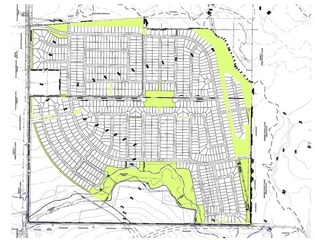
Property Detail
Cele Rd
Austin-Round Rock-San Marcos, TX
ABS 464 SUR 12 KEMPE J P 43.41 AC
780111
TRAVIS
Commercialnec
Texas
A Areas with a 1% annual chance of flooding and a 26% chance of flooding over the life of a 30-year mortgage.
43.41 AC
0
Far Northeast
2025
Austin
020813
NEARBY LISTINGS FOR SALE OR LEASE
DEMOGRAPHICS near Cele Rd
1 mile
3 mile
5 mile
2025 Total Population
8,009
38,409
105,030
2030 Population
8,498
40,494
112,916
Pop Growth 2025-2030
+ 6.11%
+ 5.43%
+ 7.51%
Average Age
35
36
37
2025 Total Households
2,528
12,141
35,299
HH Growth 2025-2030
+ 6.84%
+ 6.12%
+ 8.13%
Median Household Inc
$140,794
$150,861
$127,152
Avg Household Size
3.10
3.10
2.90
2025 Avg HH Vehicles
2.00
2.00
2.00
Median Home Value
$486,906
$482,738
$434,813
Median Year Built
2011
2011
2010
Nearby Places
Map Layers
Map Styles
 Street
 Aerial
Layers
 Traffic
 Biking
Places
Listings with unknown addresses are not visible on the map
- Restaurants
- Banks
- Shops
- Fitness
- Groceries
PUBLIC TRANSPORTATION
AIRPORT
Austin-Bergstrom International
Drive
Walk
Distance
Austin-Bergstrom International
41 min
29.6 mi
Freight Ports
Calhoun Port
Drive
Walk
Distance
Calhoun Port
201 min
172.5 mi
Nearby Properties
Address
Land Use
TOTAL SIZE
Lot Size
Zoning
Address
Land Use
TOTAL SIZE
Lot Size
Zoning
721,940 SF
140.82 AC
Address
Land Use
TOTAL SIZE
Lot Size
Zoning
475,624 SF
64.73 AC
Address
Land Use
TOTAL SIZE
Lot Size
Zoning
393,550 SF
29.76 AC
Address
Land Use
TOTAL SIZE
Lot Size
Zoning
307,910 SF
20 AC
Address
Land Use
TOTAL SIZE
Lot Size
Zoning
247,500 SF
14.64 AC
Address
Land Use
TOTAL SIZE
Lot Size
Zoning
194,532 SF
133.87 AC
Address
Land Use
TOTAL SIZE
Lot Size
Zoning
154,420 SF
26.39 AC
Address
Land Use
TOTAL SIZE
Lot Size
Zoning
183,074 SF
21.48 AC
Address
Land Use
TOTAL SIZE
Lot Size
Zoning
130,906 SF
14.08 AC
Address
Land Use
TOTAL SIZE
Lot Size
Zoning
134,434 SF
19.53 AC
Address
Land Use
TOTAL SIZE
Lot Size
Zoning
170,100 SF
11.95 AC
Address
Land Use
TOTAL SIZE
Lot Size
Zoning
170,100 SF
9.32 AC
Address
Land Use
TOTAL SIZE
Lot Size
Zoning
170,100 SF
9.53 AC
Address
Land Use
TOTAL SIZE
Lot Size
Zoning
129,360 SF
7.95 AC
Address
Land Use
TOTAL SIZE
Lot Size
Zoning
170,100 SF
10.19 AC
Address
Land Use
TOTAL SIZE
Lot Size
Zoning
170,100 SF
8.87 AC
Address
Land Use
TOTAL SIZE
Lot Size
Zoning
127,127 SF
22.09 AC
Address
Land Use
TOTAL SIZE
Lot Size
Zoning
120,100 SF
7.12 AC
Address
Land Use
TOTAL SIZE
Lot Size
Zoning
28,162 SF
23 AC
Address
Land Use
TOTAL SIZE
Lot Size
Zoning
159,127 SF
18.18 AC
Address
Land Use
TOTAL SIZE
Lot Size
Zoning
100,200 SF
2.26 AC
Address
Land Use
TOTAL SIZE
Lot Size
Zoning
50,725 SF
11.89 AC
Address
Land Use
TOTAL SIZE
Lot Size
Zoning
74,266 SF
11.26 AC
Address
Land Use
TOTAL SIZE
Lot Size
Zoning
1,102 SF
97.50 AC
Address
Land Use
TOTAL SIZE
Lot Size
Zoning
88,839 SF
3.44 AC
Address
Land Use
TOTAL SIZE
Lot Size
Zoning
101.25 AC
Address
Land Use
TOTAL SIZE
Lot Size
Zoning
55,000 SF
6.30 AC
Address
Land Use
TOTAL SIZE
Lot Size
Zoning
16,868 SF
13.21 AC
Address
Land Use
TOTAL SIZE
Lot Size
Zoning
14,711 SF
1.83 AC
Address
Land Use
TOTAL SIZE
Lot Size
Zoning
17,760 SF
2.05 AC
The World's #1 Commercial Real Estate Marketplace
Connect with us
© 2026 CoStar Group
The information above has been obtained from sources believed reliable. While we do not doubt its accuracy we have not verified it and make no guarantee, warranty or representation about it. It is your responsibility to independently confirm its accuracy and completeness. Any projections, opinions, assumptions, or estimates used are for example only and do not represent the current or future performance of the property. The value of this transaction to you depends on tax and other factors which should be evaluated by your tax, financial, and legal advisors. You and your advisors should conduct a careful, independent investigation of the property to determine to your satisfaction the suitability of the property for your needs.