Property Record
Central Ave, Cincinnati, OH 45202
Property Detail
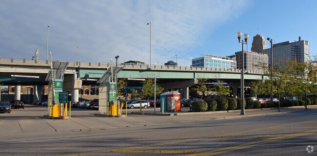
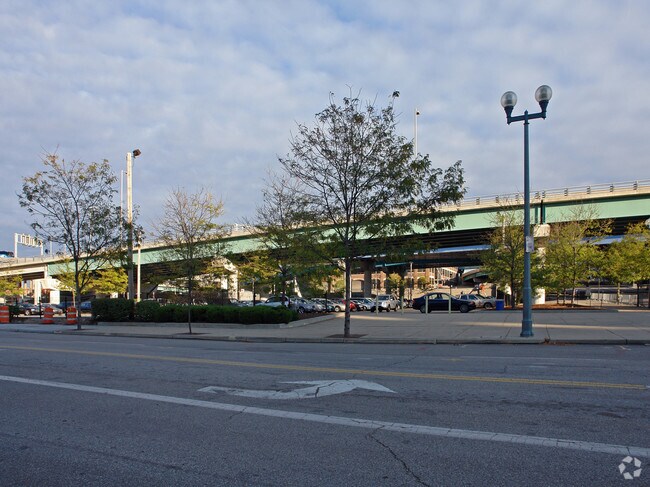
Central Ave
082-0001-0055
SS CENTRAL AV FT IR PRS 40-41 CONS
Parkingstructure
HAMILTON
MG
Ohio
AE The base floodplain where base flood elevations are provided. AE Zones are now used on new format FIRMs instead of A1-A30 Zones.
0.36 AC
2025
Cincinnati CBD
2025
Cincinnati/Dayton
000700
Cincinnati, OH-KY-IN
NEARBY LISTINGS FOR SALE OR LEASE
DEMOGRAPHICS near Central Ave
1 mile
3 mile
5 mile
2025 Total Population
16,601
149,484
322,191
2030 Population
17,424
154,777
331,145
Pop Growth 2025-2030
+ 4.96%
+ 3.54%
+ 2.78%
Average Age
40
36
37
2025 Total Households
9,573
67,406
140,414
HH Growth 2025-2030
+ 5.19%
+ 3.81%
+ 2.95%
Median Household Inc
$80,846
$57,438
$59,314
Avg Household Size
1.60
2.00
2.10
2025 Avg HH Vehicles
1.00
1.00
1.00
Median Home Value
$385,629
$251,121
$254,180
Median Year Built
1959
1949
1952
Nearby Places
Map Layers
Map Styles
 Street
 Aerial
Transit
 Traffic
 Biking
Places
Listings with unknown addresses are not visible on the map
- Restaurants
- Banks
- Shops
- Fitness
- Groceries
PUBLIC TRANSPORTATION
TRANSIT/SUBWAY
The Banks Station - 2Nd & Main (Streetcar - OTR - Banks - Southwest Ohio Regional Transit Authority)
Drive
Walk
Distance
The Banks Station - 2Nd & Main (Streetcar - OTR - Banks - Southwest Ohio Regional Transit Authority)
5 min
14 min
0.8 mi
Fountain Square Station - 5Th & Walnut (Streetcar - OTR - Banks - Southwest Ohio Regional Transit Authority)
Drive
Walk
Distance
Fountain Square Station - 5Th & Walnut (Streetcar - OTR - Banks - Southwest Ohio Regional Transit Authority)
5 min
15 min
0.8 mi
247 Telemarketing Station - 4Th & Main (Streetcar - OTR - Banks - Southwest Ohio Regional Transit Authority)
Drive
Walk
Distance
247 Telemarketing Station - 4Th & Main (Streetcar - OTR - Banks - Southwest Ohio Regional Transit Authority)
4 min
16 min
0.8 mi
Richter & Phillips Station - 6Th & Main (Streetcar - OTR - Banks - Southwest Ohio Regional Transit Authority)
Drive
Walk
Distance
Richter & Phillips Station - 6Th & Main (Streetcar - OTR - Banks - Southwest Ohio Regional Transit Authority)
5 min
20 min
1.0 mi
Aronoff Center Station - 7Th & Walnut (Streetcar - OTR - Banks - Southwest Ohio Regional Transit Authority)
Drive
Walk
Distance
Aronoff Center Station - 7Th & Walnut (Streetcar - OTR - Banks - Southwest Ohio Regional Transit Authority)
6 min
20 min
1.0 mi
COMMUTER RAIL
Cincinnati Union Terminal (Cardinal - Amtrak)
Drive
Walk
Distance
Cincinnati Union Terminal (Cardinal - Amtrak)
9 min
4.8 mi
AIRPORT
Cincinnati/Northern Kentucky International
Drive
Walk
Distance
Cincinnati/Northern Kentucky International
30 min
16.8 mi
Freight Ports
Port of Toledo
Drive
Walk
Distance
Port of Toledo
245 min
205.6 mi
Nearby Properties
Address
Land Use
TOTAL SIZE
Lot Size
Zoning
Address
Land Use
TOTAL SIZE
Lot Size
Zoning
77.73 AC
IR
Address
Land Use
TOTAL SIZE
Lot Size
Zoning
39.99 AC
MG
Address
Land Use
TOTAL SIZE
Lot Size
Zoning
11.82 AC
Address
Land Use
TOTAL SIZE
Lot Size
Zoning
11.62 AC
Address
Land Use
TOTAL SIZE
Lot Size
Zoning
19.36 AC
Address
Land Use
TOTAL SIZE
Lot Size
Zoning
17.10 AC
DD
Address
Land Use
TOTAL SIZE
Lot Size
Zoning
1.97 AC
DD
Address
Land Use
TOTAL SIZE
Lot Size
Zoning
11.41 AC
IR
Address
Land Use
TOTAL SIZE
Lot Size
Zoning
22.45 AC
Address
Land Use
TOTAL SIZE
Lot Size
Zoning
60,750 SF
1.52 AC
Address
Land Use
TOTAL SIZE
Lot Size
Zoning
2.60 AC
Address
Land Use
TOTAL SIZE
Lot Size
Zoning
9.55 AC
Address
Land Use
TOTAL SIZE
Lot Size
Zoning
19.43 AC
Address
Land Use
TOTAL SIZE
Lot Size
Zoning
3.09 AC
Address
Land Use
TOTAL SIZE
Lot Size
Zoning
3.40 AC
IR
Address
Land Use
TOTAL SIZE
Lot Size
Zoning
89,500 SF
0.58 AC
Address
Land Use
TOTAL SIZE
Lot Size
Zoning
290,233 SF
Address
Land Use
TOTAL SIZE
Lot Size
Zoning
3.51 AC
DD
Address
Land Use
TOTAL SIZE
Lot Size
Zoning
9,962 SF
712 AC
Address
Land Use
TOTAL SIZE
Lot Size
Zoning
Address
Land Use
TOTAL SIZE
Lot Size
Zoning
153,312 SF
4 AC
Address
Land Use
TOTAL SIZE
Lot Size
Zoning
9.14 AC
Address
Land Use
TOTAL SIZE
Lot Size
Zoning
21.55 AC
Address
Land Use
TOTAL SIZE
Lot Size
Zoning
298,611 SF
Address
Land Use
TOTAL SIZE
Lot Size
Zoning
20.02 AC
Address
Land Use
TOTAL SIZE
Lot Size
Zoning
12.13 AC
Address
Land Use
TOTAL SIZE
Lot Size
Zoning
2.46 AC
Address
Land Use
TOTAL SIZE
Lot Size
Zoning
165,016 SF
15.23 AC
Address
Land Use
TOTAL SIZE
Lot Size
Zoning
20.49 AC
Address
Land Use
TOTAL SIZE
Lot Size
Zoning
256,000 SF
The World's #1 Commercial Real Estate Marketplace
Connect with us
© 2026 CoStar Group
The information above has been obtained from sources believed reliable. While we do not doubt its accuracy we have not verified it and make no guarantee, warranty or representation about it. It is your responsibility to independently confirm its accuracy and completeness. Any projections, opinions, assumptions, or estimates used are for example only and do not represent the current or future performance of the property. The value of this transaction to you depends on tax and other factors which should be evaluated by your tax, financial, and legal advisors. You and your advisors should conduct a careful, independent investigation of the property to determine to your satisfaction the suitability of the property for your needs.