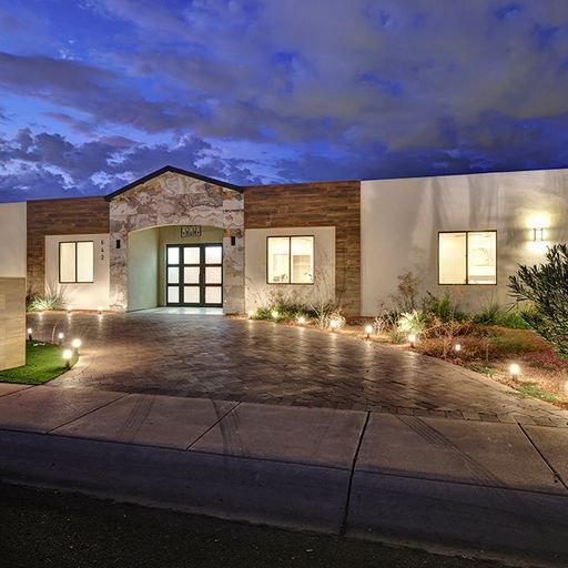
Property Record
631 W Linger Ln, Phoenix, AZ 85021


NEARBY LISTINGS FOR SALE OR LEASE
Property Detail
631 W Linger Ln
Phoenix-Mesa-Scottsdale, AZ
Modern Groves
160-42-067
Maricopa
Sfr
Arizona
X
0.32 AC
04013C1740L
Northwest Phoenix
2,630 SF
Phoenix
DEMOGRAPHICS near 631 W Linger Ln
1 Mile
3 Mile
5 Mile
2024 Total Population
13,369
155,947
434,689
2029 Population
14,407
168,868
470,299
Pop Growth 2024-2029
+ 7.76%
+ 8.29%
+ 8.19%
Average Age
42
38
37
2024 Total Households
5,259
64,584
171,449
HH Growth 2024-2029
+ 7.87%
+ 8.44%
+ 8.57%
Median Household Inc
$121,319
$59,699
$59,393
Avg Household Size
2.50
2.30
2.40
2024 Avg HH Vehicles
2.00
2.00
2.00
Median Home Value
$677,244
$418,909
$355,610
Median Year Built
1965
1973
1974
Nearby Places
Map Layers
Map Styles
 Street
 Aerial
- Restaurants
- Banks
- Shops
- Fitness
- Groceries
PUBLIC TRANSPORTATION
AIRPORT
Phoenix Sky Harbor International
DRIVE
WALK
Distance
Phoenix Sky Harbor International
22 min
12.8 mi
Phoenix-Mesa Gateway
DRIVE
WALK
Distance
Phoenix-Mesa Gateway
54 min
39.6 mi
Freight Ports
Port of San Diego
DRIVE
WALK
Distance
Port of San Diego
404 min
360.7 mi
SALE & LEASE HISTORY
LISTING DATE
SALE/LEASE

Sep 26, 2022
For Sale
Jun 30, 2021
For Sale
Nearby Properties
Address
Land Use
TOTAL SIZE
Lot Size
Zoning
Address
Land Use
TOTAL SIZE
Lot Size
Zoning
98,760 SF
6.76 AC
A-1
Address
Land Use
TOTAL SIZE
Lot Size
Zoning
96,183 SF
11.04 AC
R-6
Address
Land Use
TOTAL SIZE
Lot Size
Zoning
63,018 SF
4.77 AC
C-T
Address
Land Use
TOTAL SIZE
Lot Size
Zoning
3.58 AC
Address
Land Use
TOTAL SIZE
Lot Size
Zoning
19,474 SF
8.43 AC
C-3
Address
Land Use
TOTAL SIZE
Lot Size
Zoning
21,587 SF
3.66 AC
R-10
Address
Land Use
TOTAL SIZE
Lot Size
Zoning
558,361 SF
14.61 AC
C-2
Address
Land Use
TOTAL SIZE
Lot Size
Zoning
367,399 SF
14.88 AC
C-1
Address
Land Use
TOTAL SIZE
Lot Size
Zoning
496,222 SF
29.53 AC
C-R
Address
Land Use
TOTAL SIZE
Lot Size
Zoning
515,418 SF
19.72 AC
R-3
Address
Land Use
TOTAL SIZE
Lot Size
Zoning
474,952 SF
13.68 AC
C-C
Address
Land Use
TOTAL SIZE
Lot Size
Zoning
215,150 SF
13.24 AC
R-3
Address
Land Use
TOTAL SIZE
Lot Size
Zoning
16,284 SF
3.77 AC
M-H
Address
Land Use
TOTAL SIZE
Lot Size
Zoning
7,665 SF
1.29 AC
C-T
Address
Land Use
TOTAL SIZE
Lot Size
Zoning
4.43 AC
Address
Land Use
TOTAL SIZE
Lot Size
Zoning
146,867 SF
12.95 AC
CPGCP
Address
Land Use
TOTAL SIZE
Lot Size
Zoning
194,523 SF
37.27 AC
R-6
Address
Land Use
TOTAL SIZE
Lot Size
Zoning
212,227 SF
27.71 AC
R-6
Address
Land Use
TOTAL SIZE
Lot Size
Zoning
394,793 SF
3.60 AC
PUD
Address
Land Use
TOTAL SIZE
Lot Size
Zoning
584,674 SF
27.83 AC
R-3A
Address
Land Use
TOTAL SIZE
Lot Size
Zoning
349,252 SF
15.11 AC
Address
Land Use
TOTAL SIZE
Lot Size
Zoning
348,766 SF
37.16 AC
R-10
Address
Land Use
TOTAL SIZE
Lot Size
Zoning
362,729 SF
21.85 AC
Address
Land Use
TOTAL SIZE
Lot Size
Zoning
398,829 SF
11.66 AC
M-H
Address
Land Use
TOTAL SIZE
Lot Size
Zoning
99,714 SF
11.72 AC
R-6
Address
Land Use
TOTAL SIZE
Lot Size
Zoning
533,505 SF
27.69 AC
Address
Land Use
TOTAL SIZE
Lot Size
Zoning
123,370 SF
0.82 AC
C-C
Address
Land Use
TOTAL SIZE
Lot Size
Zoning
154,128 SF
9.32 AC
I-1
Address
Land Use
TOTAL SIZE
Lot Size
Zoning
453,660 SF
2.62 AC
C-C
Address
Land Use
TOTAL SIZE
Lot Size
Zoning
302,016 SF
28.06 AC
The World's #1 Commercial Real Estate Marketplace
Connect with us
© 2025 CoStar Group
The information above has been obtained from sources believed reliable. While we do not doubt its accuracy we have not verified it and make no guarantee, warranty or representation about it. It is your responsibility to independently confirm its accuracy and completeness. Any projections, opinions, assumptions, or estimates used are for example only and do not represent the current or future performance of the property. The value of this transaction to you depends on tax and other factors which should be evaluated by your tax, financial, and legal advisors. You and your advisors should conduct a careful, independent investigation of the property to determine to your satisfaction the suitability of the property for your needs.