Property Record
Central Rd, Apple Valley, CA 92307


Property Detail
Central Rd
Riverside-San Bernardino-Ontario, CA
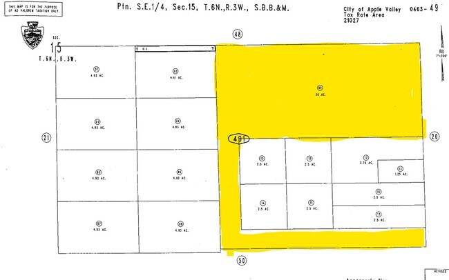
NE 50 AC SQUARE IN SE 1/4 SEC 15 TP 6N R 3W EX S 1/2 NE 1/4 SE 1/4 SD SEC 30 AC
0463-491-09
SAN BERNARDINO
Vacantlandnec
California
D Areas with possible but undetermined flood hazards.
30 AC
2025
Mojave River Valley
2025
Inland Empire (California)
009714
NEARBY LISTINGS FOR SALE OR LEASE
DEMOGRAPHICS near Central Rd
1 mile
3 mile
5 mile
2025 Total Population
8
677
7,286
2030 Population
8
696
7,553
Pop Growth 2025-2030
0.00%
+ 2.81%
+ 3.66%
Average Age
40
43
39
2025 Total Households
3
232
2,454
HH Growth 2025-2030
0.00%
+ 2.59%
+ 3.79%
Median Household Inc
$87,500
$89,389
$77,546
Avg Household Size
1.50
2.90
2.90
2025 Avg HH Vehicles
2.00
3.00
2.00
Median Home Value
$750,000
$522,152
$438,243
Median Year Built
1994
1987
1989
Nearby Places
Map Layers
Map Styles
 Street
 Aerial
Layers
 Traffic
 Biking
Places
Listings with unknown addresses are not visible on the map
- Restaurants
- Banks
- Shops
- Fitness
- Groceries
SALE & LEASE HISTORY
LISTING DATE
SALE/LEASE

Mar 25, 2022
For Sale
Nearby Properties
Address
Land Use
TOTAL SIZE
Lot Size
Zoning
Address
Land Use
TOTAL SIZE
Lot Size
Zoning
1,345,009 SF
106.46 AC
Address
Land Use
TOTAL SIZE
Lot Size
Zoning
1,096,308 SF
225.42 AC
Address
Land Use
TOTAL SIZE
Lot Size
Zoning
145,600 SF
10.43 AC
Address
Land Use
TOTAL SIZE
Lot Size
Zoning
67.89 AC
Address
Land Use
TOTAL SIZE
Lot Size
Zoning
Address
Land Use
TOTAL SIZE
Lot Size
Zoning
39.10 AC
Address
Land Use
TOTAL SIZE
Lot Size
Zoning
143.55 AC
IR
Address
Land Use
TOTAL SIZE
Lot Size
Zoning
120 AC
RL
Address
Land Use
TOTAL SIZE
Lot Size
Zoning
40 AC
RL
Address
Land Use
TOTAL SIZE
Lot Size
Zoning
40 AC
RL
Address
Land Use
TOTAL SIZE
Lot Size
Zoning
35.63 AC
Address
Land Use
TOTAL SIZE
Lot Size
Zoning
35.60 AC
Address
Land Use
TOTAL SIZE
Lot Size
Zoning
35.11 AC
Address
Land Use
TOTAL SIZE
Lot Size
Zoning
35.08 AC
Address
Land Use
TOTAL SIZE
Lot Size
Zoning
47.68 AC
Address
Land Use
TOTAL SIZE
Lot Size
Zoning
Address
Land Use
TOTAL SIZE
Lot Size
Zoning
Address
Land Use
TOTAL SIZE
Lot Size
Zoning
20.42 AC
Address
Land Use
TOTAL SIZE
Lot Size
Zoning
79.13 AC
RL
Address
Land Use
TOTAL SIZE
Lot Size
Zoning
72.06 AC
Address
Land Use
TOTAL SIZE
Lot Size
Zoning
29,615 SF
3.27 AC
Address
Land Use
TOTAL SIZE
Lot Size
Zoning
Address
Land Use
TOTAL SIZE
Lot Size
Zoning
8.89 AC
Address
Land Use
TOTAL SIZE
Lot Size
Zoning
40.15 AC
Address
Land Use
TOTAL SIZE
Lot Size
Zoning
Address
Land Use
TOTAL SIZE
Lot Size
Zoning
40.20 AC
Address
Land Use
TOTAL SIZE
Lot Size
Zoning
18.77 AC
The World's #1 Commercial Real Estate Marketplace
Connect with us
© 2026 CoStar Group
The information above has been obtained from sources believed reliable. While we do not doubt its accuracy we have not verified it and make no guarantee, warranty or representation about it. It is your responsibility to independently confirm its accuracy and completeness. Any projections, opinions, assumptions, or estimates used are for example only and do not represent the current or future performance of the property. The value of this transaction to you depends on tax and other factors which should be evaluated by your tax, financial, and legal advisors. You and your advisors should conduct a careful, independent investigation of the property to determine to your satisfaction the suitability of the property for your needs.