Property Record
Central Rd, Apple Valley, CA 92307

NEARBY LISTINGS FOR SALE OR LEASE
Property Detail
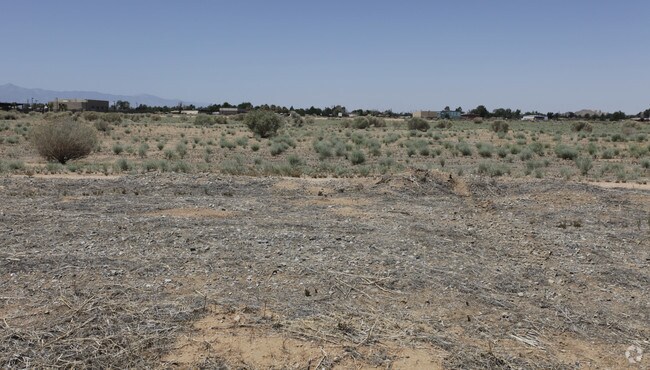
Central Rd
Riverside-San Bernardino-Ontario, CA
Parcel Map No 15518
3112-721-29
PARCEL MAP 15518 PARCEL 2 BOOK 191 PAGE 81
Vacantlandnec
San Bernardino
D
California
06071C5845H
16.26 AC
2025
Mojave River Valley
2025
Inland Empire (California)
009714
DEMOGRAPHICS near Central Rd
1 Mile
3 Mile
5 Mile
2024 Total Population
4,194
32,604
68,612
2029 Population
4,256
33,132
69,761
Pop Growth 2024-2029
+ 1.48%
+ 1.62%
+ 1.67%
Average Age
37
37
38
2024 Total Households
1,365
10,319
22,455
HH Growth 2024-2029
+ 1.47%
+ 1.61%
+ 1.67%
Median Household Inc
$49,955
$59,240
$66,903
Avg Household Size
3.00
3.10
3.00
2024 Avg HH Vehicles
2.00
2.00
2.00
Median Home Value
$248,470
$301,716
$354,290
Median Year Built
1985
1984
1985
Nearby Places
Map Layers
Map Styles
 Street
 Aerial
- Restaurants
- Banks
- Shops
- Fitness
- Groceries
PUBLIC TRANSPORTATION
COMMUTER RAIL
Victorville Amtrak (Southwest Chief - Amtrak)
DRIVE
WALK
Distance
Victorville Amtrak (Southwest Chief - Amtrak)
13 min
8.2 mi
Freight Ports
Port of Long Beach
DRIVE
WALK
Distance
Port of Long Beach
129 min
107.1 mi
Nearby Properties
Address
Land Use
TOTAL SIZE
Lot Size
Zoning
Address
Land Use
TOTAL SIZE
Lot Size
Zoning
172,153 SF
13.13 AC
Address
Land Use
TOTAL SIZE
Lot Size
Zoning
57,365 SF
5.61 AC
Address
Land Use
TOTAL SIZE
Lot Size
Zoning
75,280 SF
4.07 AC
Address
Land Use
TOTAL SIZE
Lot Size
Zoning
Address
Land Use
TOTAL SIZE
Lot Size
Zoning
29,042 SF
2.62 AC
Address
Land Use
TOTAL SIZE
Lot Size
Zoning
14,739 SF
1.38 AC
Address
Land Use
TOTAL SIZE
Lot Size
Zoning
16,804 SF
1.80 AC
Address
Land Use
TOTAL SIZE
Lot Size
Zoning
5,394 SF
1.88 AC
Address
Land Use
TOTAL SIZE
Lot Size
Zoning
35,178 SF
3.44 AC
Address
Land Use
TOTAL SIZE
Lot Size
Zoning
22,488 SF
3.05 AC
Address
Land Use
TOTAL SIZE
Lot Size
Zoning
14,235 SF
1.15 AC
Address
Land Use
TOTAL SIZE
Lot Size
Zoning
4,998 SF
2.76 AC
Address
Land Use
TOTAL SIZE
Lot Size
Zoning
2,618 SF
6.77 AC
Address
Land Use
TOTAL SIZE
Lot Size
Zoning
27,661 SF
2.36 AC
Address
Land Use
TOTAL SIZE
Lot Size
Zoning
138,827 SF
12.53 AC
Address
Land Use
TOTAL SIZE
Lot Size
Zoning
55,415 SF
2.91 AC
Address
Land Use
TOTAL SIZE
Lot Size
Zoning
3,500 SF
0.51 AC
Address
Land Use
TOTAL SIZE
Lot Size
Zoning
64,784 SF
28.73 AC
Address
Land Use
TOTAL SIZE
Lot Size
Zoning
22,700 SF
6.19 AC
Address
Land Use
TOTAL SIZE
Lot Size
Zoning
60.38 AC
Address
Land Use
TOTAL SIZE
Lot Size
Zoning
37,521 SF
24.52 AC
Address
Land Use
TOTAL SIZE
Lot Size
Zoning
Address
Land Use
TOTAL SIZE
Lot Size
Zoning
10,296 SF
1.77 AC
Address
Land Use
TOTAL SIZE
Lot Size
Zoning
9.78 AC
Address
Land Use
TOTAL SIZE
Lot Size
Zoning
5,182 SF
1.13 AC
Address
Land Use
TOTAL SIZE
Lot Size
Zoning
2,856 SF
0.68 AC
Address
Land Use
TOTAL SIZE
Lot Size
Zoning
Address
Land Use
TOTAL SIZE
Lot Size
Zoning
Address
Land Use
TOTAL SIZE
Lot Size
Zoning
9,545 SF
0.52 AC
Address
Land Use
TOTAL SIZE
Lot Size
Zoning
8,970 SF
0.78 AC
The World's #1 Commercial Real Estate Marketplace
Connect with us
© 2026 CoStar Group
The information above has been obtained from sources believed reliable. While we do not doubt its accuracy we have not verified it and make no guarantee, warranty or representation about it. It is your responsibility to independently confirm its accuracy and completeness. Any projections, opinions, assumptions, or estimates used are for example only and do not represent the current or future performance of the property. The value of this transaction to you depends on tax and other factors which should be evaluated by your tax, financial, and legal advisors. You and your advisors should conduct a careful, independent investigation of the property to determine to your satisfaction the suitability of the property for your needs.