Property Record
Chapel Rd, , SC


Save to a Folder
{{folder.Name}}
{{folder.ListingIds.length}} Properties
{{folder.ListingIds.length}} Property
Create a New Folder
Property Detail
Chapel Rd
007896-04-026
TRACT A
Mobilehomepark
LEXINGTON
C1
South Carolina
B and X Area of moderate flood hazard, usually the area between the limits of the 100-year and 500-year floods.
5.95 AC
2025
Cayce/West Columbia
2024
Columbia
020703
Columbia, SC
924 SF
NEARBY LISTINGS FOR SALE OR LEASE
-
-
View all listings for sale on LoopNet.com
DEMOGRAPHICS near Chapel Rd
1 mile
3 mile
5 mile
2025 Total Population
3,285
16,638
53,132
2030 Population
3,472
17,547
56,018
Pop Growth 2025-2030
+ 5.69%
+ 5.46%
+ 5.43%
Average Age
41
41
40
2025 Total Households
1,322
6,593
21,073
HH Growth 2025-2030
+ 5.82%
+ 5.63%
+ 5.59%
Median Household Inc
$51,575
$64,582
$67,365
Avg Household Size
2.40
2.50
2.50
2025 Avg HH Vehicles
2.00
2.00
2.00
Median Home Value
$180,293
$211,445
$196,169
Median Year Built
1984
1988
1992
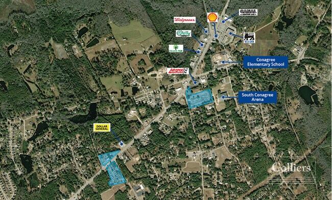
Nearby Places
Map Layers
Map Styles
 Street
 Aerial
Layers
 Traffic
 Biking
Places
Listings with unknown addresses are not visible on the map
- Restaurants
- Banks
- Shops
- Fitness
- Groceries
PUBLIC TRANSPORTATION
AIRPORT
Columbia Metro
Drive
Walk
Distance
Columbia Metro
11 min
3.5 mi
Freight Ports
North Charleston Terminal
Drive
Walk
Distance
North Charleston Terminal
120 min
105.3 mi
SALE & LEASE HISTORY
LISTING DATE
SALE/LEASE

Feb 29, 2024
For Sale
Nearby Properties
Address
Land Use
TOTAL SIZE
Lot Size
Zoning
Address
Land Use
TOTAL SIZE
Lot Size
Zoning
430.11 AC
ID
Address
Land Use
TOTAL SIZE
Lot Size
Zoning
254,399 SF
49.79 AC
ID
Address
Land Use
TOTAL SIZE
Lot Size
Zoning
8,030 SF
1.66 AC
C1
Address
Land Use
TOTAL SIZE
Lot Size
Zoning
47,126 SF
4.53 AC
Address
Land Use
TOTAL SIZE
Lot Size
Zoning
78.48 AC
ID
Address
Land Use
TOTAL SIZE
Lot Size
Zoning
218.28 AC
RD
Address
Land Use
TOTAL SIZE
Lot Size
Zoning
10,168 SF
0.32 AC
R1
Address
Land Use
TOTAL SIZE
Lot Size
Zoning
7,396 SF
17.37 AC
R1
Address
Land Use
TOTAL SIZE
Lot Size
Zoning
3,000 SF
2.75 AC
ID
Address
Land Use
TOTAL SIZE
Lot Size
Zoning
9,100 SF
1.82 AC
R1
Address
Land Use
TOTAL SIZE
Lot Size
Zoning
1,670 SF
0.38 AC
ID
Address
Land Use
TOTAL SIZE
Lot Size
Zoning
47,456 SF
4.08 AC
ID
Address
Land Use
TOTAL SIZE
Lot Size
Zoning
6,747 SF
1.80 AC
Address
Land Use
TOTAL SIZE
Lot Size
Zoning
43.83 AC
ID
Address
Land Use
TOTAL SIZE
Lot Size
Zoning
40,000 SF
5.05 AC
ID
Address
Land Use
TOTAL SIZE
Lot Size
Zoning
32,895 SF
8.82 AC
ID
Address
Land Use
TOTAL SIZE
Lot Size
Zoning
29,400 SF
1.70 AC
RD
Address
Land Use
TOTAL SIZE
Lot Size
Zoning
1,600 SF
9.17 AC
R1
Address
Land Use
TOTAL SIZE
Lot Size
Zoning
244.66 AC
RD
Address
Land Use
TOTAL SIZE
Lot Size
Zoning
122,398 SF
11.25 AC
ID
Address
Land Use
TOTAL SIZE
Lot Size
Zoning
33.49 AC
ID
Address
Land Use
TOTAL SIZE
Lot Size
Zoning
12,000 SF
2.58 AC
Address
Land Use
TOTAL SIZE
Lot Size
Zoning
295.44 AC
RD
Address
Land Use
TOTAL SIZE
Lot Size
Zoning
50.07 AC
Address
Land Use
TOTAL SIZE
Lot Size
Zoning
238.17 AC
RD
Address
Land Use
TOTAL SIZE
Lot Size
Zoning
4,684 SF
0.50 AC
ID
Address
Land Use
TOTAL SIZE
Lot Size
Zoning
2,200 SF
4.31 AC
ID
Address
Land Use
TOTAL SIZE
Lot Size
Zoning
30,610 SF
0.75 AC
ID
Address
Land Use
TOTAL SIZE
Lot Size
Zoning
1,216 SF
8.96 AC
RD
Address
Land Use
TOTAL SIZE
Lot Size
Zoning
10,750 SF
3.99 AC
ID
The World's #1 Commercial Real Estate Marketplace
Connect with us
© 2026 CoStar Group
The information above has been obtained from sources believed reliable. While we do not doubt its accuracy we have not verified it and make no guarantee, warranty or representation about it. It is your responsibility to independently confirm its accuracy and completeness. Any projections, opinions, assumptions, or estimates used are for example only and do not represent the current or future performance of the property. The value of this transaction to you depends on tax and other factors which should be evaluated by your tax, financial, and legal advisors. You and your advisors should conduct a careful, independent investigation of the property to determine to your satisfaction the suitability of the property for your needs.