Property Record
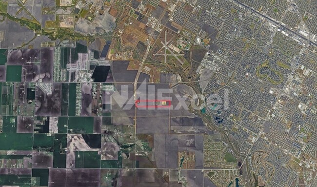
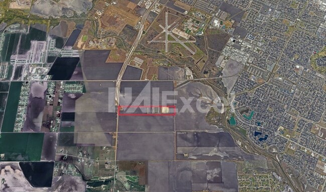
Chapman Ranch Rd, Corpus Christi, TX 78415

Property Detail
Chapman Ranch Rd
Corpus Christi, TX
LAURELES FARM TRACTS 119 ACS OUT S/2 SEC 5
256833
NUECES
Farms
Texas
B and X Area of moderate flood hazard, usually the area between the limits of the 100-year and 500-year floods.
119 AC
2024
Southwest
2025
Corpus Christi
001905
NEARBY LISTINGS FOR SALE OR LEASE
DEMOGRAPHICS near Chapman Ranch Rd
1 mile
3 mile
5 mile
2025 Total Population
61
16,120
95,570
2030 Population
63
16,027
94,447
Pop Growth 2025-2030
+ 3.28%
(0.58%)
(1.18%)
Average Age
36
39
38
2025 Total Households
20
5,541
34,613
HH Growth 2025-2030
0.00%
(0.96%)
(1.33%)
Median Household Inc
$109,375
$94,108
$71,202
Avg Household Size
3.30
2.80
2.70
2025 Avg HH Vehicles
2.00
2.00
2.00
Median Home Value
$700,000
$251,010
$225,453
Median Year Built
2005
1989
1984
Nearby Places
Map Layers
Map Styles
 Street
 Aerial
Transit
 Traffic
 Biking
Places
Listings with unknown addresses are not visible on the map
- Restaurants
- Banks
- Shops
- Fitness
- Groceries
PUBLIC TRANSPORTATION
AIRPORT
Corpus Christi International
Drive
Walk
Distance
Corpus Christi International
17 min
11.4 mi
Freight Ports
Port of Corpus Christi
Drive
Walk
Distance
Port of Corpus Christi
12 min
10.0 mi
SALE & LEASE HISTORY
LISTING DATE
SALE/LEASE

Apr 22, 2025
For Sale
Nearby Properties
Address
Land Use
TOTAL SIZE
Lot Size
Zoning
Address
Land Use
TOTAL SIZE
Lot Size
Zoning
419,479 SF
32.65 AC
Address
Land Use
TOTAL SIZE
Lot Size
Zoning
296,470 SF
81.22 AC
Address
Land Use
TOTAL SIZE
Lot Size
Zoning
111,464 SF
18.63 AC
R1C
Address
Land Use
TOTAL SIZE
Lot Size
Zoning
124,257 SF
7.63 AC
Address
Land Use
TOTAL SIZE
Lot Size
Zoning
86,224 SF
33.89 AC
Address
Land Use
TOTAL SIZE
Lot Size
Zoning
81,798 SF
23.13 AC
A2
Address
Land Use
TOTAL SIZE
Lot Size
Zoning
25,998 SF
31.72 AC
R1B
Address
Land Use
TOTAL SIZE
Lot Size
Zoning
3,292 SF
352.15 AC
Address
Land Use
TOTAL SIZE
Lot Size
Zoning
89,100 SF
11.45 AC
R1B
Address
Land Use
TOTAL SIZE
Lot Size
Zoning
150,137 SF
22.82 AC
R1B
Address
Land Use
TOTAL SIZE
Lot Size
Zoning
644 SF
320.25 AC
FR
Address
Land Use
TOTAL SIZE
Lot Size
Zoning
56,100 SF
9.24 AC
R1B
Address
Land Use
TOTAL SIZE
Lot Size
Zoning
20.31 AC
I2
Address
Land Use
TOTAL SIZE
Lot Size
Zoning
2,200 SF
4.60 AC
B-4
Address
Land Use
TOTAL SIZE
Lot Size
Zoning
70,096 SF
10.17 AC
R1B
Address
Land Use
TOTAL SIZE
Lot Size
Zoning
89.64 AC
OCL
Address
Land Use
TOTAL SIZE
Lot Size
Zoning
221.94 AC
FR
Address
Land Use
TOTAL SIZE
Lot Size
Zoning
2,160 SF
4.13 AC
B4
Address
Land Use
TOTAL SIZE
Lot Size
Zoning
16,008 SF
13.59 AC
B4
Address
Land Use
TOTAL SIZE
Lot Size
Zoning
308.99 AC
OCL
Address
Land Use
TOTAL SIZE
Lot Size
Zoning
25,225 SF
3.21 AC
B-4
Address
Land Use
TOTAL SIZE
Lot Size
Zoning
144.97 AC
R1B
Address
Land Use
TOTAL SIZE
Lot Size
Zoning
27,808 SF
6.45 AC
Address
Land Use
TOTAL SIZE
Lot Size
Zoning
2,075 SF
22.06 AC
I2
Address
Land Use
TOTAL SIZE
Lot Size
Zoning
24,560 SF
2 AC
OCL
Address
Land Use
TOTAL SIZE
Lot Size
Zoning
3,705 SF
29.03 AC
Address
Land Use
TOTAL SIZE
Lot Size
Zoning
25,978 SF
8.24 AC
A-2
Address
Land Use
TOTAL SIZE
Lot Size
Zoning
3,200 SF
35.04 AC
Address
Land Use
TOTAL SIZE
Lot Size
Zoning
66,735 SF
12.24 AC
I2
Address
Land Use
TOTAL SIZE
Lot Size
Zoning
66,342 SF
5.82 AC
B-4
The World's #1 Commercial Real Estate Marketplace
Connect with us
© 2026 CoStar Group
The information above has been obtained from sources believed reliable. While we do not doubt its accuracy we have not verified it and make no guarantee, warranty or representation about it. It is your responsibility to independently confirm its accuracy and completeness. Any projections, opinions, assumptions, or estimates used are for example only and do not represent the current or future performance of the property. The value of this transaction to you depends on tax and other factors which should be evaluated by your tax, financial, and legal advisors. You and your advisors should conduct a careful, independent investigation of the property to determine to your satisfaction the suitability of the property for your needs.