Property Record
Cherry St, Conshohocken, PA 19428

Save to a Folder
{{folder.Name}}
{{folder.ListingIds.length}} Properties
{{folder.ListingIds.length}} Property
Create a New Folder
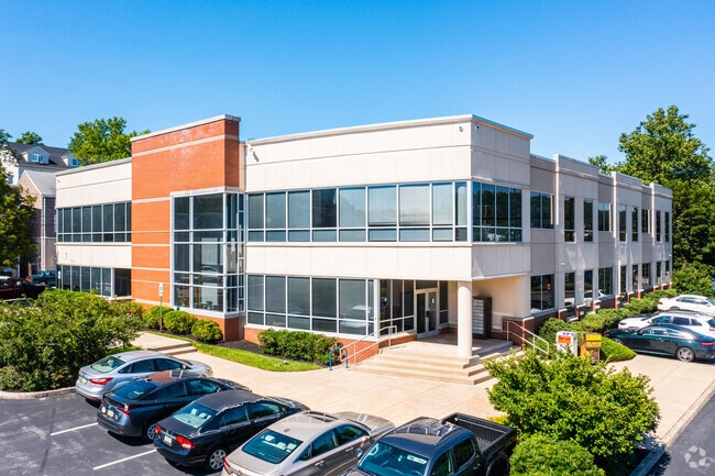
Property Detail
Cherry St
Philadelphia-Camden-Wilmington, PA-NJ-DE-MD
ASSD W/ 05 00 02280 00 1 B 24 U 18 .635 AC
05-00-00072-004
MONTGOMERY
Miscellaneous
Pennsylvania
LI
19
AE The base floodplain where base flood elevations are provided. AE Zones are now used on new format FIRMs instead of A1-A30 Zones.
1.33 AC
0
Conshohocken
2026
Philadelphia
204104
NEARBY LISTINGS FOR SALE OR LEASE
DEMOGRAPHICS near Cherry St
1 mile
3 mile
5 mile
2025 Total Population
14,083
55,972
227,411
2030 Population
14,345
57,524
232,181
Pop Growth 2025-2030
+ 1.86%
+ 2.77%
+ 2.10%
Average Age
37
41
40
2025 Total Households
6,891
23,315
88,430
HH Growth 2025-2030
+ 2.06%
+ 2.91%
+ 2.15%
Median Household Inc
$120,056
$126,924
$107,789
Avg Household Size
2.00
2.30
2.40
2025 Avg HH Vehicles
2.00
2.00
2.00
Median Home Value
$486,338
$609,125
$485,445
Median Year Built
1962
1970
1962
Nearby Places
Map Layers
Map Styles
 Street
 Aerial
Layers
 Traffic
 Biking
Places
Listings with unknown addresses are not visible on the map
- Restaurants
- Banks
- Shops
- Fitness
- Groceries
PUBLIC TRANSPORTATION
COMMUTER RAIL
Conshohocken (Manayunk/Norristown Line - SEPTA)
Drive
Walk
Distance
Conshohocken (Manayunk/Norristown Line - SEPTA)
2 min
14 min
0.6 mi
Spring Mill (Manayunk/Norristown Line - SEPTA)
Drive
Walk
Distance
Spring Mill (Manayunk/Norristown Line - SEPTA)
3 min
16 min
0.8 mi
AIRPORT
Philadelphia International
Drive
Walk
Distance
Philadelphia International
38 min
23.9 mi
Trenton Mercer
Drive
Walk
Distance
Trenton Mercer
54 min
39.6 mi
Freight Ports
Port of Philadelphia
Drive
Walk
Distance
Port of Philadelphia
31 min
19.5 mi
SALE & LEASE HISTORY
LISTING DATE
SALE/LEASE

Oct 17, 2019
For Sale
Nearby Properties
Address
Land Use
TOTAL SIZE
Lot Size
Zoning
Address
Land Use
TOTAL SIZE
Lot Size
Zoning
350,807 SF
50 AC
R1
Address
Land Use
TOTAL SIZE
Lot Size
Zoning
520,066 SF
1.02 AC
HB
Address
Land Use
TOTAL SIZE
Lot Size
Zoning
702,393 SF
61.81 AC
RA
Address
Land Use
TOTAL SIZE
Lot Size
Zoning
723,623 SF
6.69 AC
HVY
Address
Land Use
TOTAL SIZE
Lot Size
Zoning
510,312 SF
51.75 AC
IA
Address
Land Use
TOTAL SIZE
Lot Size
Zoning
469,066 SF
47 AC
MU
Address
Land Use
TOTAL SIZE
Lot Size
Zoning
527,618 SF
7.89 AC
SP2
Address
Land Use
TOTAL SIZE
Lot Size
Zoning
452,486 SF
10.44 AC
HI
Address
Land Use
TOTAL SIZE
Lot Size
Zoning
676,867 SF
2.98 AC
SP2
Address
Land Use
TOTAL SIZE
Lot Size
Zoning
519,822 SF
19.53 AC
AR
Address
Land Use
TOTAL SIZE
Lot Size
Zoning
470,032 SF
2.98 AC
SP2
Address
Land Use
TOTAL SIZE
Lot Size
Zoning
434,229 SF
3.24 AC
HI
Address
Land Use
TOTAL SIZE
Lot Size
Zoning
561,359 SF
48.06 AC
R1
Address
Land Use
TOTAL SIZE
Lot Size
Zoning
426,711 SF
6.04 AC
HI
Address
Land Use
TOTAL SIZE
Lot Size
Zoning
843,567 SF
50.79 AC
HI
Address
Land Use
TOTAL SIZE
Lot Size
Zoning
214,714 SF
22.23 AC
R1
Address
Land Use
TOTAL SIZE
Lot Size
Zoning
531,656 SF
19.51 AC
HVY
Address
Land Use
TOTAL SIZE
Lot Size
Zoning
660,582 SF
5.43 AC
O
Address
Land Use
TOTAL SIZE
Lot Size
Zoning
622,736 SF
2.06 AC
O
Address
Land Use
TOTAL SIZE
Lot Size
Zoning
370,404 SF
15.55 AC
SM1
Address
Land Use
TOTAL SIZE
Lot Size
Zoning
961,106 SF
5.47 AC
LI
Address
Land Use
TOTAL SIZE
Lot Size
Zoning
452,740 SF
11.03 AC
C
Address
Land Use
TOTAL SIZE
Lot Size
Zoning
610,819 SF
3.17 AC
O1
Address
Land Use
TOTAL SIZE
Lot Size
Zoning
310,900 SF
55.48 AC
HI
Address
Land Use
TOTAL SIZE
Lot Size
Zoning
320,804 SF
30.85 AC
CR
Address
Land Use
TOTAL SIZE
Lot Size
Zoning
368,147 SF
3.70 AC
O1
Address
Land Use
TOTAL SIZE
Lot Size
Zoning
312,710 SF
30.07 AC
APTLR
Address
Land Use
TOTAL SIZE
Lot Size
Zoning
346,163 SF
16.53 AC
SC
Address
Land Use
TOTAL SIZE
Lot Size
Zoning
197,630 SF
1.73 AC
SP2
Address
Land Use
TOTAL SIZE
Lot Size
Zoning
333,974 SF
18.56 AC
HR
The World's #1 Commercial Real Estate Marketplace
Connect with us
© 2026 CoStar Group
The information above has been obtained from sources believed reliable. While we do not doubt its accuracy we have not verified it and make no guarantee, warranty or representation about it. It is your responsibility to independently confirm its accuracy and completeness. Any projections, opinions, assumptions, or estimates used are for example only and do not represent the current or future performance of the property. The value of this transaction to you depends on tax and other factors which should be evaluated by your tax, financial, and legal advisors. You and your advisors should conduct a careful, independent investigation of the property to determine to your satisfaction the suitability of the property for your needs.