Property Record
Chester Ave, Baltimore, MD 21220
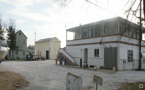
Property Detail
Chester Ave
Baltimore-Columbia-Towson, MD
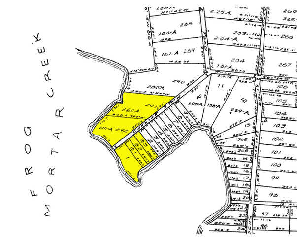
LONG BEACH ESTATES
15-1505880141
BALTIMORE
Commercialacreage
Maryland
BMB
83
AE The base floodplain where base flood elevations are provided. AE Zones are now used on new format FIRMs instead of A1-A30 Zones.
0.69 AC
2024
Baltimore County East
2025
Baltimore
451802
NEARBY LISTINGS FOR SALE OR LEASE
-
-
View all Baltimore listings for sale on LoopNet.com
DEMOGRAPHICS near Chester Ave
1 mile
3 mile
5 mile
2025 Total Population
2,994
45,429
100,281
2030 Population
3,066
45,890
100,879
Pop Growth 2025-2030
+ 2.40%
+ 1.01%
+ 0.60%
Average Age
45
40
40
2025 Total Households
1,267
18,545
39,590
HH Growth 2025-2030
+ 2.37%
+ 1.15%
+ 0.67%
Median Household Inc
$110,702
$73,462
$73,364
Avg Household Size
2.30
2.40
2.50
2025 Avg HH Vehicles
2.00
2.00
2.00
Median Home Value
$412,892
$315,376
$300,027
Median Year Built
1987
1977
1975
Nearby Places
Map Layers
Map Styles
 Street
 Aerial
Transit
 Traffic
 Biking
Places
Listings with unknown addresses are not visible on the map
- Restaurants
- Banks
- Shops
- Fitness
- Groceries
PUBLIC TRANSPORTATION
COMMUTER RAIL
Martin Airport Marc Nb (PENN - WASHINGTON - Maryland Transit Administration)
Drive
Walk
Distance
Martin Airport Marc Nb (PENN - WASHINGTON - Maryland Transit Administration)
9 min
3.3 mi
AIRPORT
Baltimore/Washington International Thurgood Marshall
Drive
Walk
Distance
Baltimore/Washington International Thurgood Marshall
46 min
26.7 mi
Freight Ports
Port of Baltimore
Drive
Walk
Distance
Port of Baltimore
32 min
17.2 mi
Nearby Properties
Address
Land Use
TOTAL SIZE
Lot Size
Zoning
Address
Land Use
TOTAL SIZE
Lot Size
Zoning
159,728 SF
0.02 AC
MH
Address
Land Use
TOTAL SIZE
Lot Size
Zoning
504,086 SF
7.48 AC
MH
Address
Land Use
TOTAL SIZE
Lot Size
Zoning
553,984 SF
7.42 AC
Address
Land Use
TOTAL SIZE
Lot Size
Zoning
83.12 AC
ML
Address
Land Use
TOTAL SIZE
Lot Size
Zoning
1,062,672 SF
70.27 AC
MHIM
Address
Land Use
TOTAL SIZE
Lot Size
Zoning
423,200 SF
22.60 AC
MH-1M
Address
Land Use
TOTAL SIZE
Lot Size
Zoning
14.19 AC
DR16
Address
Land Use
TOTAL SIZE
Lot Size
Zoning
21.83 AC
DR16
Address
Land Use
TOTAL SIZE
Lot Size
Zoning
440,340 SF
128.19 AC
Address
Land Use
TOTAL SIZE
Lot Size
Zoning
23.40 AC
DR16
Address
Land Use
TOTAL SIZE
Lot Size
Zoning
20.13 AC
DR16
Address
Land Use
TOTAL SIZE
Lot Size
Zoning
19 AC
DR16
Address
Land Use
TOTAL SIZE
Lot Size
Zoning
24.95 AC
DR16
Address
Land Use
TOTAL SIZE
Lot Size
Zoning
11.69 AC
DR16
Address
Land Use
TOTAL SIZE
Lot Size
Zoning
18 AC
DR16
Address
Land Use
TOTAL SIZE
Lot Size
Zoning
1,914,359 SF
24.44 AC
MHIM
Address
Land Use
TOTAL SIZE
Lot Size
Zoning
300,000 SF
85.04 AC
MH
Address
Land Use
TOTAL SIZE
Lot Size
Zoning
14.14 AC
DR16
Address
Land Use
TOTAL SIZE
Lot Size
Zoning
3,844 SF
35.84 AC
Address
Land Use
TOTAL SIZE
Lot Size
Zoning
21.53 AC
DR16
Address
Land Use
TOTAL SIZE
Lot Size
Zoning
136,978 SF
12.06 AC
MH-IM
Address
Land Use
TOTAL SIZE
Lot Size
Zoning
14.13 AC
DR16
Address
Land Use
TOTAL SIZE
Lot Size
Zoning
124,751 SF
9.24 AC
BM
Address
Land Use
TOTAL SIZE
Lot Size
Zoning
16.15 AC
DR16
Address
Land Use
TOTAL SIZE
Lot Size
Zoning
50,400 SF
7.13 AC
MH
Address
Land Use
TOTAL SIZE
Lot Size
Zoning
72,118 SF
10.10 AC
DR5.5
Address
Land Use
TOTAL SIZE
Lot Size
Zoning
196,204 SF
49 AC
DR5.5
Address
Land Use
TOTAL SIZE
Lot Size
Zoning
59,400 SF
4.98 AC
MH
Address
Land Use
TOTAL SIZE
Lot Size
Zoning
7.81 AC
DR16
Address
Land Use
TOTAL SIZE
Lot Size
Zoning
6.06 AC
DR16
The World's #1 Commercial Real Estate Marketplace
Connect with us
© 2026 CoStar Group
The information above has been obtained from sources believed reliable. While we do not doubt its accuracy we have not verified it and make no guarantee, warranty or representation about it. It is your responsibility to independently confirm its accuracy and completeness. Any projections, opinions, assumptions, or estimates used are for example only and do not represent the current or future performance of the property. The value of this transaction to you depends on tax and other factors which should be evaluated by your tax, financial, and legal advisors. You and your advisors should conduct a careful, independent investigation of the property to determine to your satisfaction the suitability of the property for your needs.