Property Record
Chestnut St, Henderson, WV 25106


NEARBY LISTINGS FOR SALE OR LEASE
-
-
View all Henderson listings for sale on LoopNet.com
Property Detail
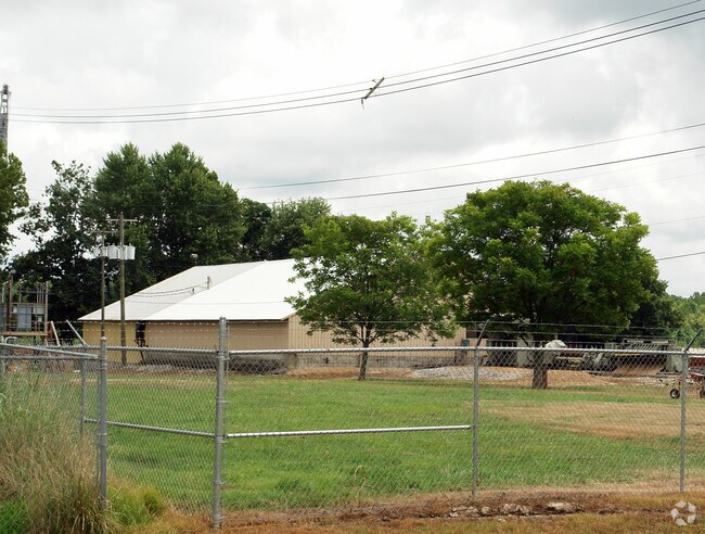
Chestnut St
08 300020001
3.13 ACRES K B (TRUCK STOP)
Commercialacreage
Mason
AE
West Virginia
54053C0135C
3.13 AC
2025
West Virginia South Area
2025
Other Market Areas
955101
Point Pleasant, WV-OH
DEMOGRAPHICS near Chestnut St
1 Mile
3 Mile
5 Mile
2024 Total Population
633
5,800
13,441
2029 Population
634
5,786
13,416
Pop Growth 2024-2029
+ 0.16%
(0.24%)
(0.19%)
Average Age
47
43
43
2024 Total Households
352
2,633
5,964
HH Growth 2024-2029
+ 0.28%
(0.15%)
(0.13%)
Median Household Inc
$13,420
$40,013
$44,047
Avg Household Size
1.70
2.10
2.20
2024 Avg HH Vehicles
1.00
1.00
2.00
Median Home Value
$52,884
$87,977
$116,645
Median Year Built
1972
1968
1969
Nearby Places
Map Layers
Map Styles
 Street
 Aerial
- Restaurants
- Banks
- Shops
- Fitness
- Groceries
Nearby Properties
Address
Land Use
TOTAL SIZE
Lot Size
Zoning
Address
Land Use
TOTAL SIZE
Lot Size
Zoning
1,072 SF
247.90 AC
Address
Land Use
TOTAL SIZE
Lot Size
Zoning
Address
Land Use
TOTAL SIZE
Lot Size
Zoning
7.52 AC
Address
Land Use
TOTAL SIZE
Lot Size
Zoning
0.77 AC
Address
Land Use
TOTAL SIZE
Lot Size
Zoning
179,444 SF
23.37 AC
Address
Land Use
TOTAL SIZE
Lot Size
Zoning
4.37 AC
Address
Land Use
TOTAL SIZE
Lot Size
Zoning
83.70 AC
Address
Land Use
TOTAL SIZE
Lot Size
Zoning
76,268 SF
14.43 AC
Address
Land Use
TOTAL SIZE
Lot Size
Zoning
Address
Land Use
TOTAL SIZE
Lot Size
Zoning
Address
Land Use
TOTAL SIZE
Lot Size
Zoning
4,000 SF
17.70 AC
Address
Land Use
TOTAL SIZE
Lot Size
Zoning
25,516 SF
4.08 AC
Address
Land Use
TOTAL SIZE
Lot Size
Zoning
180,646 SF
22.34 AC
Address
Land Use
TOTAL SIZE
Lot Size
Zoning
5.03 AC
Address
Land Use
TOTAL SIZE
Lot Size
Zoning
12.54 AC
Address
Land Use
TOTAL SIZE
Lot Size
Zoning
54,471 SF
3.81 AC
Address
Land Use
TOTAL SIZE
Lot Size
Zoning
158,000 SF
21.45 AC
Address
Land Use
TOTAL SIZE
Lot Size
Zoning
22,995 SF
6.79 AC
Address
Land Use
TOTAL SIZE
Lot Size
Zoning
47.27 AC
Address
Land Use
TOTAL SIZE
Lot Size
Zoning
22,200 SF
3.41 AC
Address
Land Use
TOTAL SIZE
Lot Size
Zoning
0.72 AC
Address
Land Use
TOTAL SIZE
Lot Size
Zoning
85,022 SF
9.74 AC
Address
Land Use
TOTAL SIZE
Lot Size
Zoning
3,572 SF
65.41 AC
Address
Land Use
TOTAL SIZE
Lot Size
Zoning
1.96 AC
Address
Land Use
TOTAL SIZE
Lot Size
Zoning
Address
Land Use
TOTAL SIZE
Lot Size
Zoning
7.01 AC
Address
Land Use
TOTAL SIZE
Lot Size
Zoning
Address
Land Use
TOTAL SIZE
Lot Size
Zoning
41,328 SF
1.88 AC
Address
Land Use
TOTAL SIZE
Lot Size
Zoning
7.16 AC
Address
Land Use
TOTAL SIZE
Lot Size
Zoning
3.69 AC
The World's #1 Commercial Real Estate Marketplace
Connect with us
© 2026 CoStar Group
The information above has been obtained from sources believed reliable. While we do not doubt its accuracy we have not verified it and make no guarantee, warranty or representation about it. It is your responsibility to independently confirm its accuracy and completeness. Any projections, opinions, assumptions, or estimates used are for example only and do not represent the current or future performance of the property. The value of this transaction to you depends on tax and other factors which should be evaluated by your tax, financial, and legal advisors. You and your advisors should conduct a careful, independent investigation of the property to determine to your satisfaction the suitability of the property for your needs.