Property Record
Chestnut St, Orangeburg, SC 29115
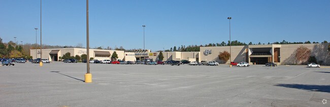

Property Detail
Chestnut St
0151-15-01-002.000
HWY 178 NORTH A-2 51 00181201
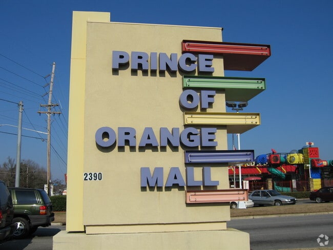
Commercialnec
ORANGEBURG
AE The base floodplain where base flood elevations are provided. AE Zones are now used on new format FIRMs instead of A1-A30 Zones.
South Carolina
2024
31.40 AC
2024
Orangeburg/Sumter
011400
Other Market Areas
62,817 SF
Orangeburg, SC
NEARBY LISTINGS FOR SALE OR LEASE
DEMOGRAPHICS near Chestnut St
1 mile
3 mile
5 mile
2025 Total Population
2,438
22,753
35,098
2030 Population
2,370
22,788
35,162
Pop Growth 2025-2030
(2.79%)
+ 0.15%
+ 0.18%
Average Age
45
39
39
2025 Total Households
1,075
8,370
13,341
HH Growth 2025-2030
(2.79%)
+ 0.01%
+ 0.07%
Median Household Inc
$82,849
$47,990
$46,478
Avg Household Size
2.20
2.20
2.30
2025 Avg HH Vehicles
2.00
2.00
2.00
Median Home Value
$172,647
$163,502
$149,837
Median Year Built
1974
1976
1978
Nearby Places
Map Layers
Map Styles
 Street
 Aerial
Transit
 Traffic
 Biking
Places
Listings with unknown addresses are not visible on the map
- Restaurants
- Banks
- Shops
- Fitness
- Groceries
PUBLIC TRANSPORTATION
AIRPORT
Columbia Metro
Drive
Walk
Distance
Columbia Metro
59 min
43.1 mi
SALE & LEASE HISTORY
LISTING DATE
SALE/LEASE

Sep 25, 2016
For Lease
Apr 20, 2017
For Lease
Nearby Properties
Address
Land Use
TOTAL SIZE
Lot Size
Zoning
Address
Land Use
TOTAL SIZE
Lot Size
Zoning
534,738 SF
53.78 AC
Address
Land Use
TOTAL SIZE
Lot Size
Zoning
24,351 SF
1.23 AC
Address
Land Use
TOTAL SIZE
Lot Size
Zoning
195,536 SF
22.90 AC
Address
Land Use
TOTAL SIZE
Lot Size
Zoning
41,412 SF
7.40 AC
Address
Land Use
TOTAL SIZE
Lot Size
Zoning
206,224 SF
42.20 AC
Address
Land Use
TOTAL SIZE
Lot Size
Zoning
320,700 SF
35.10 AC
Address
Land Use
TOTAL SIZE
Lot Size
Zoning
130,175 SF
14.58 AC
Address
Land Use
TOTAL SIZE
Lot Size
Zoning
100,693 SF
6.61 AC
Address
Land Use
TOTAL SIZE
Lot Size
Zoning
20,160 SF
3.35 AC
Address
Land Use
TOTAL SIZE
Lot Size
Zoning
5,059 SF
3.60 AC
Address
Land Use
TOTAL SIZE
Lot Size
Zoning
29,977 SF
9.57 AC
Address
Land Use
TOTAL SIZE
Lot Size
Zoning
4,794 SF
5 AC
Address
Land Use
TOTAL SIZE
Lot Size
Zoning
179,500 SF
83 AC
Address
Land Use
TOTAL SIZE
Lot Size
Zoning
24,186 SF
2.15 AC
Address
Land Use
TOTAL SIZE
Lot Size
Zoning
102,557 SF
10.30 AC
Address
Land Use
TOTAL SIZE
Lot Size
Zoning
35,928 SF
1.80 AC
Address
Land Use
TOTAL SIZE
Lot Size
Zoning
2,500 SF
14.76 AC
Address
Land Use
TOTAL SIZE
Lot Size
Zoning
29,275 SF
8.50 AC
Address
Land Use
TOTAL SIZE
Lot Size
Zoning
14,606 SF
1.80 AC
Address
Land Use
TOTAL SIZE
Lot Size
Zoning
41,838 SF
2.40 AC
Address
Land Use
TOTAL SIZE
Lot Size
Zoning
159,852 SF
27 AC
Address
Land Use
TOTAL SIZE
Lot Size
Zoning
26,640 SF
5.40 AC
Address
Land Use
TOTAL SIZE
Lot Size
Zoning
25,775 SF
15.80 AC
Address
Land Use
TOTAL SIZE
Lot Size
Zoning
3,876 SF
5 AC
Address
Land Use
TOTAL SIZE
Lot Size
Zoning
63,120 SF
3.55 AC
Address
Land Use
TOTAL SIZE
Lot Size
Zoning
28,414 SF
10.20 AC
Address
Land Use
TOTAL SIZE
Lot Size
Zoning
13,868 SF
7.70 AC
The World's #1 Commercial Real Estate Marketplace
Connect with us
© 2026 CoStar Group
The information above has been obtained from sources believed reliable. While we do not doubt its accuracy we have not verified it and make no guarantee, warranty or representation about it. It is your responsibility to independently confirm its accuracy and completeness. Any projections, opinions, assumptions, or estimates used are for example only and do not represent the current or future performance of the property. The value of this transaction to you depends on tax and other factors which should be evaluated by your tax, financial, and legal advisors. You and your advisors should conduct a careful, independent investigation of the property to determine to your satisfaction the suitability of the property for your needs.