Property Record
Chillicothe Rd, Novelty, OH 44072


Property Detail
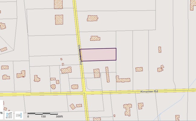
Chillicothe Rd
Cleveland-Elyria, OH
LOT 4 MIDDLE SURVEY TR 2
26-213200
GEAUGA
Commercialacreage
Ohio
CS
4
B and X Area of moderate flood hazard, usually the area between the limits of the 100-year and 500-year floods.
0.99 AC
2025
Geauga County
2024
Cleveland
311500
NEARBY LISTINGS FOR SALE OR LEASE
-
-
View all Novelty listings for sale on LoopNet.com
DEMOGRAPHICS near Chillicothe Rd
1 mile
3 mile
5 mile
2025 Total Population
1,147
11,448
31,926
2030 Population
1,145
11,401
31,872
Pop Growth 2025-2030
(0.17%)
(0.41%)
(0.17%)
Average Age
47
46
46
2025 Total Households
456
4,446
12,462
HH Growth 2025-2030
(0.22%)
(0.47%)
(0.22%)
Median Household Inc
$99,999
$109,483
$117,676
Avg Household Size
2.50
2.50
2.50
2025 Avg HH Vehicles
2.00
2.00
2.00
Median Home Value
$358,415
$385,789
$394,637
Median Year Built
1963
1966
1967
Nearby Places
Map Layers
Map Styles
 Street
 Aerial
Transit
 Traffic
 Biking
Places
Listings with unknown addresses are not visible on the map
- Restaurants
- Banks
- Shops
- Fitness
- Groceries
PUBLIC TRANSPORTATION
AIRPORT
Cleveland-Hopkins International
Drive
Walk
Distance
Cleveland-Hopkins International
48 min
30.0 mi
SALE & LEASE HISTORY
LISTING DATE
SALE/LEASE

Sep 24, 2016
For Sale
Mar 14, 2023
For Sale
Nearby Properties
Address
Land Use
TOTAL SIZE
Lot Size
Zoning
Address
Land Use
TOTAL SIZE
Lot Size
Zoning
165,544 SF
15 AC
R
Address
Land Use
TOTAL SIZE
Lot Size
Zoning
2,620 SF
15.81 AC
R5A
Address
Land Use
TOTAL SIZE
Lot Size
Zoning
114,017 SF
30 AC
R
Address
Land Use
TOTAL SIZE
Lot Size
Zoning
67,861 SF
24.84 AC
R1A
Address
Land Use
TOTAL SIZE
Lot Size
Zoning
20,192 SF
363.31 AC
PPD
Address
Land Use
TOTAL SIZE
Lot Size
Zoning
36,827 SF
6.54 AC
R5A
Address
Land Use
TOTAL SIZE
Lot Size
Zoning
60,714 SF
14.53 AC
R5
Address
Land Use
TOTAL SIZE
Lot Size
Zoning
56,518 SF
5.86 AC
RMF-10
Address
Land Use
TOTAL SIZE
Lot Size
Zoning
73.85 AC
C
Address
Land Use
TOTAL SIZE
Lot Size
Zoning
20,114 SF
4.50 AC
R
Address
Land Use
TOTAL SIZE
Lot Size
Zoning
35,646 SF
4.79 AC
RMF-10
Address
Land Use
TOTAL SIZE
Lot Size
Zoning
20,234 SF
30 AC
R5A
Address
Land Use
TOTAL SIZE
Lot Size
Zoning
15,687 SF
3 AC
Address
Land Use
TOTAL SIZE
Lot Size
Zoning
2,787 SF
1.60 AC
R1-100
Address
Land Use
TOTAL SIZE
Lot Size
Zoning
12,914 SF
10 AC
R3A
Address
Land Use
TOTAL SIZE
Lot Size
Zoning
19,708 SF
14.02 AC
R5
Address
Land Use
TOTAL SIZE
Lot Size
Zoning
4,739 SF
16.91 AC
R5
Address
Land Use
TOTAL SIZE
Lot Size
Zoning
100,617 SF
1.60 AC
B1
Address
Land Use
TOTAL SIZE
Lot Size
Zoning
5,358 SF
24.13 AC
R5
Address
Land Use
TOTAL SIZE
Lot Size
Zoning
39,196 SF
3 AC
RL
Address
Land Use
TOTAL SIZE
Lot Size
Zoning
28,802 SF
3.27 AC
R3
Address
Land Use
TOTAL SIZE
Lot Size
Zoning
2,740 SF
55.69 AC
R3
Address
Land Use
TOTAL SIZE
Lot Size
Zoning
6,835 SF
2.95 AC
R5
Address
Land Use
TOTAL SIZE
Lot Size
Zoning
20,592 SF
50.47 AC
R5
Address
Land Use
TOTAL SIZE
Lot Size
Zoning
4,784 SF
29.54 AC
R5
Address
Land Use
TOTAL SIZE
Lot Size
Zoning
122.90 AC
PPD
Address
Land Use
TOTAL SIZE
Lot Size
Zoning
6,442 SF
52.07 AC
R3
Address
Land Use
TOTAL SIZE
Lot Size
Zoning
4,700 SF
17.21 AC
R1A
Address
Land Use
TOTAL SIZE
Lot Size
Zoning
33,271 SF
3.01 AC
RL
Address
Land Use
TOTAL SIZE
Lot Size
Zoning
151.94 AC
PP
The World's #1 Commercial Real Estate Marketplace
Connect with us
© 2026 CoStar Group
The information above has been obtained from sources believed reliable. While we do not doubt its accuracy we have not verified it and make no guarantee, warranty or representation about it. It is your responsibility to independently confirm its accuracy and completeness. Any projections, opinions, assumptions, or estimates used are for example only and do not represent the current or future performance of the property. The value of this transaction to you depends on tax and other factors which should be evaluated by your tax, financial, and legal advisors. You and your advisors should conduct a careful, independent investigation of the property to determine to your satisfaction the suitability of the property for your needs.