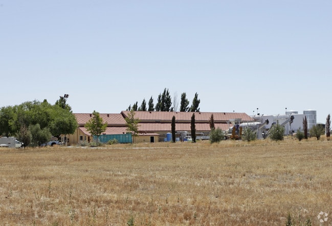
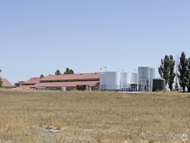
Property Record
Circle B Rd, Paso Robles, CA 93446

Property Detail
Circle B Rd
San Luis Obispo-Paso Robles, CA
PTN RHO STA YSABEL
020-011-035
SAN LUIS OBISPO
Agriculturalland
California
B and X Area of moderate flood hazard, usually the area between the limits of the 100-year and 500-year floods.
b,3
2024
10 AC
2025
San Luis Obispo/Paso Robles
010207
San Luis Obispo/Paso Robles
NEARBY LISTINGS FOR SALE OR LEASE
DEMOGRAPHICS near Circle B Rd
1 mile
3 mile
5 mile
2024 Total Population
439
15,925
35,372
2029 Population
439
15,851
35,016
Pop Growth 2024-2029
0.00%
(0.46%)
(1.01%)
Average Age
44
40
40
2024 Total Households
179
5,874
12,948
HH Growth 2024-2029
0.00%
(0.65%)
(1.18%)
Median Household Inc
$102,016
$89,537
$92,228
Avg Household Size
2.50
2.70
2.70
2024 Avg HH Vehicles
2.00
2.00
2.00
Median Home Value
$713,888
$742,603
$727,951
Median Year Built
2004
1987
1987
Nearby Places
Map Layers
Map Styles
 Street
 Aerial
Transit
 Traffic
 Biking
Places
Listings with unknown addresses are not visible on the map
- Restaurants
- Banks
- Shops
- Fitness
- Groceries
PUBLIC TRANSPORTATION
COMMUTER RAIL
Paso Robles Amtrak Station (Coast Starlight - Amtrak)
Drive
Walk
Distance
Paso Robles Amtrak Station (Coast Starlight - Amtrak)
9 min
4.1 mi
AIRPORT
San Luis County Regional
Drive
Walk
Distance
San Luis County Regional
52 min
37.1 mi
Freight Ports
The Port of Hueneme
Drive
Walk
Distance
The Port of Hueneme
209 min
164.1 mi
Nearby Properties
Address
Land Use
TOTAL SIZE
Lot Size
Zoning
Address
Land Use
TOTAL SIZE
Lot Size
Zoning
197,140 SF
11.87 AC
R3
Address
Land Use
TOTAL SIZE
Lot Size
Zoning
115,054 SF
18.78 AC
PM
Address
Land Use
TOTAL SIZE
Lot Size
Zoning
282,906 SF
10 AC
R4
Address
Land Use
TOTAL SIZE
Lot Size
Zoning
127,770 SF
27.72 AC
AG
Address
Land Use
TOTAL SIZE
Lot Size
Zoning
129,241 SF
18.91 AC
POS
Address
Land Use
TOTAL SIZE
Lot Size
Zoning
18,400 SF
2.42 AC
TC1
Address
Land Use
TOTAL SIZE
Lot Size
Zoning
77,710 SF
44 AC
AG
Address
Land Use
TOTAL SIZE
Lot Size
Zoning
63.59 AC
POS
Address
Land Use
TOTAL SIZE
Lot Size
Zoning
4.27 AC
PM
Address
Land Use
TOTAL SIZE
Lot Size
Zoning
152,938 SF
13.60 AC
M
Address
Land Use
TOTAL SIZE
Lot Size
Zoning
42,617 SF
4.79 AC
PM
Address
Land Use
TOTAL SIZE
Lot Size
Zoning
34.76 AC
Address
Land Use
TOTAL SIZE
Lot Size
Zoning
91,903 SF
5.10 AC
POS
Address
Land Use
TOTAL SIZE
Lot Size
Zoning
4.25 AC
Address
Land Use
TOTAL SIZE
Lot Size
Zoning
48.88 AC
R1
Address
Land Use
TOTAL SIZE
Lot Size
Zoning
2,557 SF
9.70 AC
M
Address
Land Use
TOTAL SIZE
Lot Size
Zoning
11.53 AC
C3
Address
Land Use
TOTAL SIZE
Lot Size
Zoning
73,236 SF
2.45 AC
TC2
Address
Land Use
TOTAL SIZE
Lot Size
Zoning
82,249 SF
6.67 AC
Address
Land Use
TOTAL SIZE
Lot Size
Zoning
Address
Land Use
TOTAL SIZE
Lot Size
Zoning
58,884 SF
2.34 AC
T4N
Address
Land Use
TOTAL SIZE
Lot Size
Zoning
65,931 SF
3.16 AC
PM
Address
Land Use
TOTAL SIZE
Lot Size
Zoning
89,417 SF
3.13 AC
T4N
Address
Land Use
TOTAL SIZE
Lot Size
Zoning
1.59 AC
C3
Address
Land Use
TOTAL SIZE
Lot Size
Zoning
14,995 SF
10.74 AC
Address
Land Use
TOTAL SIZE
Lot Size
Zoning
5.94 AC
R2
Address
Land Use
TOTAL SIZE
Lot Size
Zoning
14.75 AC
Address
Land Use
TOTAL SIZE
Lot Size
Zoning
Address
Land Use
TOTAL SIZE
Lot Size
Zoning
64,323 SF
2.56 AC
T4N
Address
Land Use
TOTAL SIZE
Lot Size
Zoning
28,050 SF
2.01 AC
PM
The World's #1 Commercial Real Estate Marketplace
Connect with us
© 2026 CoStar Group
The information above has been obtained from sources believed reliable. While we do not doubt its accuracy we have not verified it and make no guarantee, warranty or representation about it. It is your responsibility to independently confirm its accuracy and completeness. Any projections, opinions, assumptions, or estimates used are for example only and do not represent the current or future performance of the property. The value of this transaction to you depends on tax and other factors which should be evaluated by your tax, financial, and legal advisors. You and your advisors should conduct a careful, independent investigation of the property to determine to your satisfaction the suitability of the property for your needs.