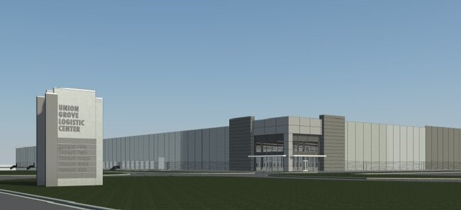
Property Record
Clarence King Dr, Calhoun, GA 30701

Property Detail
Clarence King Dr
Calhoun, GA
ON CLARENCE KING DR
C47A - -001A
GORDON
Industrialacreage
Georgia
IND-G
45.62 AC
2025
Georgia Northwest
2025
Other Market Areas
970500
NEARBY LISTINGS FOR SALE OR LEASE
DEMOGRAPHICS near Clarence King Dr
1 mile
3 mile
5 mile
2025 Total Population
206
6,668
29,226
2030 Population
219
7,025
30,897
Pop Growth 2025-2030
+ 6.31%
+ 5.35%
+ 5.72%
Average Age
41
40
39
2025 Total Households
80
2,531
10,870
HH Growth 2025-2030
+ 6.25%
+ 5.29%
+ 5.64%
Median Household Inc
$79,687
$54,651
$60,176
Avg Household Size
2.60
2.60
2.60
2025 Avg HH Vehicles
3.00
2.00
2.00
Median Home Value
$253,846
$231,332
$253,520
Median Year Built
1992
1986
1990
Nearby Places
Map Layers
Map Styles
 Street
 Aerial
Layers
 Traffic
 Biking
Places
Listings with unknown addresses are not visible on the map
- Restaurants
- Banks
- Shops
- Fitness
- Groceries
SALE & LEASE HISTORY
LISTING DATE
SALE/LEASE

Jul 07, 2020
For Lease
Nearby Properties
Address
Land Use
TOTAL SIZE
Lot Size
Zoning
Address
Land Use
TOTAL SIZE
Lot Size
Zoning
1,038,487 SF
80.91 AC
I-2
Address
Land Use
TOTAL SIZE
Lot Size
Zoning
738,719 SF
55.39 AC
IND-G
Address
Land Use
TOTAL SIZE
Lot Size
Zoning
483,077 SF
63.15 AC
I-2
Address
Land Use
TOTAL SIZE
Lot Size
Zoning
63.15 AC
I-2
Address
Land Use
TOTAL SIZE
Lot Size
Zoning
445,290 SF
35.97 AC
I-2
Address
Land Use
TOTAL SIZE
Lot Size
Zoning
403,152 SF
8.33 AC
Address
Land Use
TOTAL SIZE
Lot Size
Zoning
390,600 SF
32.57 AC
I-2
Address
Land Use
TOTAL SIZE
Lot Size
Zoning
403,200 SF
38.92 AC
I-2
Address
Land Use
TOTAL SIZE
Lot Size
Zoning
740,750 SF
30.22 AC
IND-G
Address
Land Use
TOTAL SIZE
Lot Size
Zoning
474,912 SF
54.83 AC
IND-G
Address
Land Use
TOTAL SIZE
Lot Size
Zoning
675,935 SF
63.15 AC
I-2
Address
Land Use
TOTAL SIZE
Lot Size
Zoning
675,935 SF
I-2
Address
Land Use
TOTAL SIZE
Lot Size
Zoning
675,935 SF
I-2
Address
Land Use
TOTAL SIZE
Lot Size
Zoning
549,997 SF
138.47 AC
IND-G
Address
Land Use
TOTAL SIZE
Lot Size
Zoning
453,600 SF
5.23 AC
IND-G
Address
Land Use
TOTAL SIZE
Lot Size
Zoning
89,298 SF
25.68 AC
I-2
Address
Land Use
TOTAL SIZE
Lot Size
Zoning
96,647 SF
35.06 AC
I-2
Address
Land Use
TOTAL SIZE
Lot Size
Zoning
2,870 SF
11.02 AC
PRD
Address
Land Use
TOTAL SIZE
Lot Size
Zoning
860,400 SF
19.85 AC
IND-G
Address
Land Use
TOTAL SIZE
Lot Size
Zoning
2,899 SF
12 AC
Address
Land Use
TOTAL SIZE
Lot Size
Zoning
50,676 SF
19.74 AC
C-2
Address
Land Use
TOTAL SIZE
Lot Size
Zoning
3,360 SF
25.27 AC
RC-1
Address
Land Use
TOTAL SIZE
Lot Size
Zoning
88,000 SF
8.87 AC
IND-G
Address
Land Use
TOTAL SIZE
Lot Size
Zoning
128,740 SF
42.95 AC
IND-G
Address
Land Use
TOTAL SIZE
Lot Size
Zoning
69,000 SF
22.11 AC
I-1
Address
Land Use
TOTAL SIZE
Lot Size
Zoning
6,956 SF
7 AC
R-2
Address
Land Use
TOTAL SIZE
Lot Size
Zoning
281,810 SF
22.74 AC
IND-G
Address
Land Use
TOTAL SIZE
Lot Size
Zoning
207,900 SF
13.43 AC
IND-G
Address
Land Use
TOTAL SIZE
Lot Size
Zoning
244,684 SF
41.03 AC
IND-G
Address
Land Use
TOTAL SIZE
Lot Size
Zoning
225,000 SF
14.68 AC
IND-G
The World's #1 Commercial Real Estate Marketplace
Connect with us
© 2026 CoStar Group
The information above has been obtained from sources believed reliable. While we do not doubt its accuracy we have not verified it and make no guarantee, warranty or representation about it. It is your responsibility to independently confirm its accuracy and completeness. Any projections, opinions, assumptions, or estimates used are for example only and do not represent the current or future performance of the property. The value of this transaction to you depends on tax and other factors which should be evaluated by your tax, financial, and legal advisors. You and your advisors should conduct a careful, independent investigation of the property to determine to your satisfaction the suitability of the property for your needs.