No Photo
Property Record
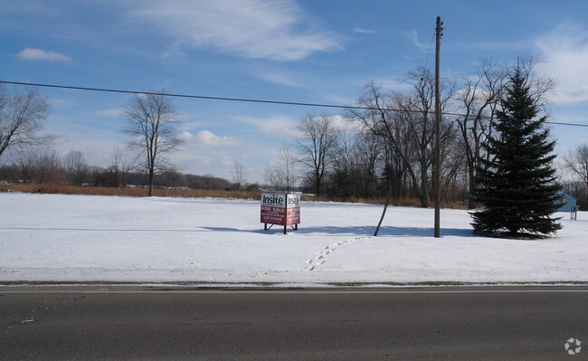
Clark Rd, Davison, MI 48423

Property Detail
Clark Rd
16-22-300-023
A PARCEL OF LAND BEG N 88 DEG 25 MIN 57 SEC E 382 FT FROM SW COR OF SEC 22 TH N 0 DEG 24 MIN 56 SEC W 1337.91 FT TH N 88 DEG
Residentialacreage
GENESEE
SRA
Michigan
A Areas with a 1% annual chance of flooding and a 26% chance of flooding over the life of a 30-year mortgage.
158 AC
2024
Flint
2025
Detroit
011713
Flint, MI
NEARBY LISTINGS FOR SALE OR LEASE
-
-
View all Davison listings for sale on LoopNet.com
DEMOGRAPHICS near Clark Rd
1 mile
3 mile
5 mile
2025 Total Population
2,071
8,832
33,658
2030 Population
2,063
8,758
33,424
Pop Growth 2025-2030
(0.39%)
(0.84%)
(0.70%)
Average Age
36
41
43
2025 Total Households
720
3,408
14,311
HH Growth 2025-2030
(0.42%)
(0.91%)
(0.73%)
Median Household Inc
$76,603
$73,238
$65,661
Avg Household Size
2.80
2.60
2.30
2025 Avg HH Vehicles
2.00
2.00
2.00
Median Home Value
$218,604
$221,818
$198,123
Median Year Built
1997
1984
1978
Nearby Places
Map Layers
Map Styles
 Street
 Aerial
Transit
 Traffic
 Biking
Places
Listings with unknown addresses are not visible on the map
- Restaurants
- Banks
- Shops
- Fitness
- Groceries
PUBLIC TRANSPORTATION
AIRPORT
Bishop International
Drive
Walk
Distance
Bishop International
38 min
22.6 mi
Freight Ports
Port of Toledo
Drive
Walk
Distance
Port of Toledo
153 min
112.3 mi
SALE & LEASE HISTORY
LISTING DATE
SALE/LEASE

Sep 24, 2016
For Sale
Nearby Properties
Address
Land Use
TOTAL SIZE
Lot Size
Zoning
Address
Land Use
TOTAL SIZE
Lot Size
Zoning
34,652 SF
208.43 AC
SRA
Address
Land Use
TOTAL SIZE
Lot Size
Zoning
6,449 SF
90.81 AC
MH
Address
Land Use
TOTAL SIZE
Lot Size
Zoning
44,280 SF
5.48 AC
C-3
Address
Land Use
TOTAL SIZE
Lot Size
Zoning
79,677 SF
13.79 AC
B-1
Address
Land Use
TOTAL SIZE
Lot Size
Zoning
101,648 SF
18.65 AC
I
Address
Land Use
TOTAL SIZE
Lot Size
Zoning
28.20 AC
Address
Land Use
TOTAL SIZE
Lot Size
Zoning
2,328 SF
79 AC
RRA
Address
Land Use
TOTAL SIZE
Lot Size
Zoning
1,850 SF
32.92 AC
B-2
Address
Land Use
TOTAL SIZE
Lot Size
Zoning
36,620 SF
47.81 AC
CB
Address
Land Use
TOTAL SIZE
Lot Size
Zoning
8.37 AC
CB
Address
Land Use
TOTAL SIZE
Lot Size
Zoning
2,008 SF
C-3
Address
Land Use
TOTAL SIZE
Lot Size
Zoning
40,393 SF
10.05 AC
I
Address
Land Use
TOTAL SIZE
Lot Size
Zoning
10,472 SF
12.89 AC
CB
Address
Land Use
TOTAL SIZE
Lot Size
Zoning
112.60 AC
SRA
Address
Land Use
TOTAL SIZE
Lot Size
Zoning
312.60 AC
SRM
Address
Land Use
TOTAL SIZE
Lot Size
Zoning
10,200 SF
2.72 AC
CB
Address
Land Use
TOTAL SIZE
Lot Size
Zoning
1,452 SF
5.01 AC
CB
Address
Land Use
TOTAL SIZE
Lot Size
Zoning
6,896 SF
5.53 AC
NOT AVAILA
Address
Land Use
TOTAL SIZE
Lot Size
Zoning
8,612 SF
10.34 AC
CB
Address
Land Use
TOTAL SIZE
Lot Size
Zoning
7,434 SF
22 AC
CB
Address
Land Use
TOTAL SIZE
Lot Size
Zoning
1,514 SF
8.43 AC
CB
Address
Land Use
TOTAL SIZE
Lot Size
Zoning
2,926 SF
146.83 AC
RRA
Address
Land Use
TOTAL SIZE
Lot Size
Zoning
12,026 SF
28.60 AC
I
Address
Land Use
TOTAL SIZE
Lot Size
Zoning
3,251 SF
1.79 AC
CB
Address
Land Use
TOTAL SIZE
Lot Size
Zoning
32.51 AC
NOT AVAILA
Address
Land Use
TOTAL SIZE
Lot Size
Zoning
1,920 SF
155.77 AC
SRA
Address
Land Use
TOTAL SIZE
Lot Size
Zoning
1,984 SF
85.18 AC
RRA
Address
Land Use
TOTAL SIZE
Lot Size
Zoning
1,608 SF
111.51 AC
RRA
Address
Land Use
TOTAL SIZE
Lot Size
Zoning
22.48 AC
C-3
Address
Land Use
TOTAL SIZE
Lot Size
Zoning
12,000 SF
10.11 AC
CB
The World's #1 Commercial Real Estate Marketplace
Connect with us
© 2026 CoStar Group
The information above has been obtained from sources believed reliable. While we do not doubt its accuracy we have not verified it and make no guarantee, warranty or representation about it. It is your responsibility to independently confirm its accuracy and completeness. Any projections, opinions, assumptions, or estimates used are for example only and do not represent the current or future performance of the property. The value of this transaction to you depends on tax and other factors which should be evaluated by your tax, financial, and legal advisors. You and your advisors should conduct a careful, independent investigation of the property to determine to your satisfaction the suitability of the property for your needs.