Property Record
Clinton Rd, Brooklyn, OH 44144
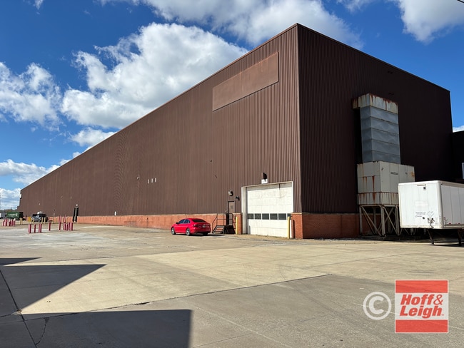

Current Lease Availabilities
Property Detail
Clinton Rd
Cleveland-Elyria, OH
16
431-03-003
CUYAHOGA
Lightindustrial
Ohio
G-I
16
B and X Area of moderate flood hazard, usually the area between the limits of the 100-year and 500-year floods.
0.87 AC
2025
Linndale/Westpark
2025
Cleveland
137101
NEARBY LISTINGS FOR SALE OR LEASE
DEMOGRAPHICS near Clinton Rd
1 mile
3 mile
5 mile
2024 Total Population
15,501
161,272
320,504
2029 Population
15,040
158,523
316,129
Pop Growth 2024-2029
(2.97%)
(1.70%)
(1.37%)
Average Age
37
39
39
2024 Total Households
6,027
72,892
147,226
HH Growth 2024-2029
(3.15%)
(1.70%)
(1.30%)
Median Household Inc
$41,195
$49,998
$57,640
Avg Household Size
2.40
2.10
2.10
2024 Avg HH Vehicles
1.00
1.00
1.00
Median Home Value
$99,025
$142,338
$163,291
Median Year Built
1946
1947
1949
Nearby Places
Map Layers
Map Styles
 Street
 Aerial
Transit
 Traffic
 Biking
Places
Listings with unknown addresses are not visible on the map
- Restaurants
- Banks
- Shops
- Fitness
- Groceries
PUBLIC TRANSPORTATION
COMMUTER RAIL
Cleveland Lakefront Station (Blue Line - Greater Cleveland Regional Transit Authority Rapid Transit (The Rapid), Green Line - Greater Cleveland Regional Transit Authority Rapid Transit (The Rapid))
Drive
Walk
Distance
Cleveland Lakefront Station (Blue Line - Greater Cleveland Regional Transit Authority Rapid Transit (The Rapid), Green Line - Greater Cleveland Regional Transit Authority Rapid Transit (The Rapid))
17 min
6.3 mi
AIRPORT
Cleveland-Hopkins International
Drive
Walk
Distance
Cleveland-Hopkins International
18 min
8.1 mi
Freight Ports
Port of Toledo
Drive
Walk
Distance
Port of Toledo
131 min
108.5 mi
Nearby Properties
Address
Land Use
TOTAL SIZE
Lot Size
Zoning
Address
Land Use
TOTAL SIZE
Lot Size
Zoning
3,491,901 SF
34.32 AC
Address
Land Use
TOTAL SIZE
Lot Size
Zoning
5,100 SF
9.41 AC
GI
Address
Land Use
TOTAL SIZE
Lot Size
Zoning
3.23 AC
LLR
Address
Land Use
TOTAL SIZE
Lot Size
Zoning
70.02 AC
GI
Address
Land Use
TOTAL SIZE
Lot Size
Zoning
257,857 SF
8.03 AC
GR
Address
Land Use
TOTAL SIZE
Lot Size
Zoning
2.83 AC
LLR
Address
Land Use
TOTAL SIZE
Lot Size
Zoning
299,507 SF
2.14 AC
LR
Address
Land Use
TOTAL SIZE
Lot Size
Zoning
208,209 SF
12.10 AC
1F
Address
Land Use
TOTAL SIZE
Lot Size
Zoning
164,294 SF
13.81 AC
GI
Address
Land Use
TOTAL SIZE
Lot Size
Zoning
320,334 SF
4 AC
GR
Address
Land Use
TOTAL SIZE
Lot Size
Zoning
200,874 SF
3.30 AC
LR
Address
Land Use
TOTAL SIZE
Lot Size
Zoning
809,240 SF
36.27 AC
L-I
Address
Land Use
TOTAL SIZE
Lot Size
Zoning
308,339 SF
9.78 AC
2F
Address
Land Use
TOTAL SIZE
Lot Size
Zoning
242,515 SF
1.01 AC
Address
Land Use
TOTAL SIZE
Lot Size
Zoning
168,750 SF
18.55 AC
GI
Address
Land Use
TOTAL SIZE
Lot Size
Zoning
519,592 SF
69.70 AC
L-I
Address
Land Use
TOTAL SIZE
Lot Size
Zoning
28,852 SF
8.17 AC
Address
Land Use
TOTAL SIZE
Lot Size
Zoning
372,486 SF
3.98 AC
GR
Address
Land Use
TOTAL SIZE
Lot Size
Zoning
3.96 AC
Address
Land Use
TOTAL SIZE
Lot Size
Zoning
361,287 SF
86.50 AC
2F
Address
Land Use
TOTAL SIZE
Lot Size
Zoning
258,852 SF
5.20 AC
MF2
Address
Land Use
TOTAL SIZE
Lot Size
Zoning
167,376 SF
0.70 AC
LR
Address
Land Use
TOTAL SIZE
Lot Size
Zoning
143,795 SF
0.92 AC
LR
Address
Land Use
TOTAL SIZE
Lot Size
Zoning
78,622 SF
11.78 AC
CB
Address
Land Use
TOTAL SIZE
Lot Size
Zoning
22,928 SF
2.17 AC
LR
Address
Land Use
TOTAL SIZE
Lot Size
Zoning
142,935 SF
1.02 AC
LR
Address
Land Use
TOTAL SIZE
Lot Size
Zoning
104,170 SF
2.70 AC
2F
Address
Land Use
TOTAL SIZE
Lot Size
Zoning
389,067 SF
12.05 AC
A-H
Address
Land Use
TOTAL SIZE
Lot Size
Zoning
372,786 SF
4.79 AC
MF3+
Address
Land Use
TOTAL SIZE
Lot Size
Zoning
155,896 SF
5.03 AC
The World's #1 Commercial Real Estate Marketplace
Connect with us
© 2026 CoStar Group
The information above has been obtained from sources believed reliable. While we do not doubt its accuracy we have not verified it and make no guarantee, warranty or representation about it. It is your responsibility to independently confirm its accuracy and completeness. Any projections, opinions, assumptions, or estimates used are for example only and do not represent the current or future performance of the property. The value of this transaction to you depends on tax and other factors which should be evaluated by your tax, financial, and legal advisors. You and your advisors should conduct a careful, independent investigation of the property to determine to your satisfaction the suitability of the property for your needs.