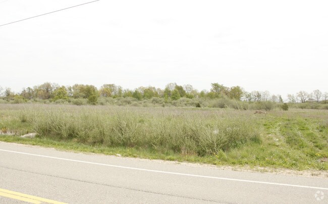
Property Record
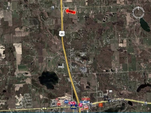
Clyde Rd, Fenton, MI 48430
Property Detail
Clyde Rd
08-09-100-016
SEC 9 T3N R6E COM NW COR, TH S86*02'50"E 841.55 FT, TH S2*04'40"W 493 FT TO POB, TH S2*04'40"W 442 FT, TH N86*02'50"W 529.70
Commercialacreage
LIVINGSTON
GC
Michigan
B and X Area of moderate flood hazard, usually the area between the limits of the 100-year and 500-year floods.
8.41 AC
2025
Livingston County
2025
Detroit
013206
Detroit-Warren-Dearborn, MI
NEARBY LISTINGS FOR SALE OR LEASE
DEMOGRAPHICS near Clyde Rd
1 mile
3 mile
5 mile
2024 Total Population
501
7,955
25,271
2029 Population
505
8,028
25,546
Pop Growth 2024-2029
+ 0.80%
+ 0.92%
+ 1.09%
Average Age
43
43
42
2024 Total Households
184
2,880
9,025
HH Growth 2024-2029
+ 0.54%
+ 0.94%
+ 1.12%
Median Household Inc
$120,689
$116,688
$109,794
Avg Household Size
2.70
2.70
2.80
2024 Avg HH Vehicles
2.00
2.00
2.00
Median Home Value
$388,888
$397,618
$391,622
Median Year Built
1991
1991
1992
Nearby Places
Map Layers
Map Styles
 Street
 Aerial
Transit
 Traffic
 Biking
Places
Listings with unknown addresses are not visible on the map
- Restaurants
- Banks
- Shops
- Fitness
- Groceries
PUBLIC TRANSPORTATION
AIRPORT
Bishop International
Drive
Walk
Distance
Bishop International
34 min
22.7 mi
Freight Ports
Port of Toledo
Drive
Walk
Distance
Port of Toledo
106 min
88.6 mi
Nearby Properties
Address
Land Use
TOTAL SIZE
Lot Size
Zoning
Address
Land Use
TOTAL SIZE
Lot Size
Zoning
139,245 SF
11.54 AC
PD
Address
Land Use
TOTAL SIZE
Lot Size
Zoning
7,662 SF
150 AC
MHP
Address
Land Use
TOTAL SIZE
Lot Size
Zoning
55,117 SF
7.50 AC
PD
Address
Land Use
TOTAL SIZE
Lot Size
Zoning
188,508 SF
18.32 AC
PD
Address
Land Use
TOTAL SIZE
Lot Size
Zoning
42,134 SF
6.80 AC
CA
Address
Land Use
TOTAL SIZE
Lot Size
Zoning
78,200 SF
12.09 AC
PDGC
Address
Land Use
TOTAL SIZE
Lot Size
Zoning
55,626 SF
18.16 AC
PD
Address
Land Use
TOTAL SIZE
Lot Size
Zoning
123,800 SF
11.36 AC
GC
Address
Land Use
TOTAL SIZE
Lot Size
Zoning
18.68 AC
PD
Address
Land Use
TOTAL SIZE
Lot Size
Zoning
93,084 SF
9.11 AC
GC
Address
Land Use
TOTAL SIZE
Lot Size
Zoning
5,628 SF
3.64 AC
GC
Address
Land Use
TOTAL SIZE
Lot Size
Zoning
23.69 AC
PD
Address
Land Use
TOTAL SIZE
Lot Size
Zoning
2.48 AC
GC
Address
Land Use
TOTAL SIZE
Lot Size
Zoning
94.50 AC
LI
Address
Land Use
TOTAL SIZE
Lot Size
Zoning
9,257 SF
79.69 AC
CA
Address
Land Use
TOTAL SIZE
Lot Size
Zoning
7,360 SF
4.95 AC
GC
Address
Land Use
TOTAL SIZE
Lot Size
Zoning
8,045 SF
1.73 AC
PD
Address
Land Use
TOTAL SIZE
Lot Size
Zoning
16.51 AC
GC
Address
Land Use
TOTAL SIZE
Lot Size
Zoning
25,540 SF
2.73 AC
GC
Address
Land Use
TOTAL SIZE
Lot Size
Zoning
48.61 AC
OS
Address
Land Use
TOTAL SIZE
Lot Size
Zoning
14,424 SF
2.92 AC
PD
Address
Land Use
TOTAL SIZE
Lot Size
Zoning
845 SF
29.60 AC
PDRR
Address
Land Use
TOTAL SIZE
Lot Size
Zoning
1.40 AC
PD
Address
Land Use
TOTAL SIZE
Lot Size
Zoning
2,628 SF
117.30 AC
PDRR
Address
Land Use
TOTAL SIZE
Lot Size
Zoning
1,344 SF
341.70 AC
PDRR
Address
Land Use
TOTAL SIZE
Lot Size
Zoning
14,271 SF
3.20 AC
GC
Address
Land Use
TOTAL SIZE
Lot Size
Zoning
6,209 SF
1.71 AC
GC
Address
Land Use
TOTAL SIZE
Lot Size
Zoning
7.20 AC
GC
Address
Land Use
TOTAL SIZE
Lot Size
Zoning
19,220 SF
38.65 AC
RE
Address
Land Use
TOTAL SIZE
Lot Size
Zoning
10,065 SF
1.28 AC
PD
The World's #1 Commercial Real Estate Marketplace
Connect with us
© 2026 CoStar Group
The information above has been obtained from sources believed reliable. While we do not doubt its accuracy we have not verified it and make no guarantee, warranty or representation about it. It is your responsibility to independently confirm its accuracy and completeness. Any projections, opinions, assumptions, or estimates used are for example only and do not represent the current or future performance of the property. The value of this transaction to you depends on tax and other factors which should be evaluated by your tax, financial, and legal advisors. You and your advisors should conduct a careful, independent investigation of the property to determine to your satisfaction the suitability of the property for your needs.