Property Record
Coco Rd, Geismar, LA 70734


Property Detail
Coco Rd
Baton Rouge, LA
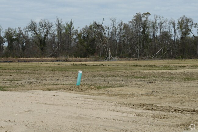
7.52 AC. M/L BEING A POR. WATER-LOO PLT. (SECS. 29 & 63-9-2) BK.
02104-000
ASCENSION
Agriculturalland
Louisiana
BP
7.52 AC
2025
Ascension Parish
2025
Baton Rouge
030304
NEARBY LISTINGS FOR SALE OR LEASE
DEMOGRAPHICS near Coco Rd
1 mile
3 mile
5 mile
2025 Total Population
335
10,533
32,418
2030 Population
353
11,007
33,890
Pop Growth 2025-2030
+ 5.37%
+ 4.50%
+ 4.54%
Average Age
37
37
37
2025 Total Households
116
3,545
11,503
HH Growth 2025-2030
+ 5.17%
+ 4.49%
+ 4.68%
Median Household Inc
$142,999
$129,214
$89,551
Avg Household Size
2.90
3.00
2.80
2025 Avg HH Vehicles
2.00
2.00
2.00
Median Home Value
$460,869
$355,757
$303,871
Median Year Built
2004
2006
2005
Nearby Places
Map Layers
Map Styles
 Street
 Aerial
Transit
 Traffic
 Biking
Places
Listings with unknown addresses are not visible on the map
- Restaurants
- Banks
- Shops
- Fitness
- Groceries
PUBLIC TRANSPORTATION
AIRPORT
Baton Rouge Metro Ryan Field
Drive
Walk
Distance
Baton Rouge Metro Ryan Field
39 min
30.0 mi
Freight Ports
Port of Greater Baton Rouge
Drive
Walk
Distance
Port of Greater Baton Rouge
35 min
25.2 mi
Nearby Properties
Address
Land Use
TOTAL SIZE
Lot Size
Zoning
Address
Land Use
TOTAL SIZE
Lot Size
Zoning
691.78 AC
IND
Address
Land Use
TOTAL SIZE
Lot Size
Zoning
1,564.08 AC
IND
Address
Land Use
TOTAL SIZE
Lot Size
Zoning
1,313.56 AC
IND
Address
Land Use
TOTAL SIZE
Lot Size
Zoning
53.35 AC
Address
Land Use
TOTAL SIZE
Lot Size
Zoning
49.67 AC
RM
Address
Land Use
TOTAL SIZE
Lot Size
Zoning
230.67 AC
IND
Address
Land Use
TOTAL SIZE
Lot Size
Zoning
10.89 AC
Address
Land Use
TOTAL SIZE
Lot Size
Zoning
76.72 AC
IND
Address
Land Use
TOTAL SIZE
Lot Size
Zoning
13.17 AC
RM
Address
Land Use
TOTAL SIZE
Lot Size
Zoning
22.60 AC
RM
Address
Land Use
TOTAL SIZE
Lot Size
Zoning
14.66 AC
IND
Address
Land Use
TOTAL SIZE
Lot Size
Zoning
172.07 AC
IND
Address
Land Use
TOTAL SIZE
Lot Size
Zoning
170.02 AC
IND
Address
Land Use
TOTAL SIZE
Lot Size
Zoning
34 AC
C
Address
Land Use
TOTAL SIZE
Lot Size
Zoning
159.44 AC
Address
Land Use
TOTAL SIZE
Lot Size
Zoning
158.55 AC
IND
Address
Land Use
TOTAL SIZE
Lot Size
Zoning
25.01 AC
IND
Address
Land Use
TOTAL SIZE
Lot Size
Zoning
7.10 AC
IND
Address
Land Use
TOTAL SIZE
Lot Size
Zoning
7.91 AC
IND
Address
Land Use
TOTAL SIZE
Lot Size
Zoning
14.25 AC
Address
Land Use
TOTAL SIZE
Lot Size
Zoning
12.19 AC
Address
Land Use
TOTAL SIZE
Lot Size
Zoning
635.80 AC
IND
Address
Land Use
TOTAL SIZE
Lot Size
Zoning
47.29 AC
IND
Address
Land Use
TOTAL SIZE
Lot Size
Zoning
60.66 AC
IND
Address
Land Use
TOTAL SIZE
Lot Size
Zoning
81.37 AC
IND
Address
Land Use
TOTAL SIZE
Lot Size
Zoning
8.63 AC
Address
Land Use
TOTAL SIZE
Lot Size
Zoning
124.04 AC
IND
Address
Land Use
TOTAL SIZE
Lot Size
Zoning
61.29 AC
IND
Address
Land Use
TOTAL SIZE
Lot Size
Zoning
8.35 AC
IND
Address
Land Use
TOTAL SIZE
Lot Size
Zoning
18.61 AC
BP
The World's #1 Commercial Real Estate Marketplace
Connect with us
© 2026 CoStar Group
The information above has been obtained from sources believed reliable. While we do not doubt its accuracy we have not verified it and make no guarantee, warranty or representation about it. It is your responsibility to independently confirm its accuracy and completeness. Any projections, opinions, assumptions, or estimates used are for example only and do not represent the current or future performance of the property. The value of this transaction to you depends on tax and other factors which should be evaluated by your tax, financial, and legal advisors. You and your advisors should conduct a careful, independent investigation of the property to determine to your satisfaction the suitability of the property for your needs.